 Made it to Poland! First day cycling through Poland was an interesting contrast with Germany. I hadn’t prepared much for Poland nor thought much about the country other than as a large unknown space separating Germany and Russia/Belarus – guide books would be a bit heavy to carry.
Had a nice breakfast at hotel in Angermunde before setting off. Both sides of the Oder River had some hills so there was some climbing and descent today. Fairly busy on the road but otherwise good travels as I went through last few Germany villages before reaching Schwedt at 24km. I half walked and cycled through town and then found road heading east to the Polish border. The river area itself was several kilometers wide with a shipping channel and some broad river areas. As I came close, looked like this would be a real passport control rather than just a sign as I had seen at the Dutch/German border. They stamped my passport twice, once to leave Germany and once to arrive in Poland.
Krajnik Doiny was the town just at the border. Apparently cigarettes and gasoline were cheaper in Poland as there were prominent signs advertising both. Also a lot of open markets with fruit and such. I got my bearings and headed north on the small road along the river. A few climbs and descents. A little rougher road but hard to tell. After 11km, came to a larger road heading north to Gryfino. The road signs were now green after yellow (Germany) and blue (Netherlands). The roads had a few more rough spots than Germany but otherwise good.
After 40km, I came to gas station at upper right. Stopped in to get something to drink and some chocolate. The attendant told me the amount in Polish. I went to pay with a five euro bill. The attendant looked at me funny. So I asked to see the register of how much…6.80. Wow, seemed a bit expensive so I got out a 10 euro bill. He then explained they didn’t take euros only the Polish currency, zloty. Now I felt foolish. I knew Poland was part of the EU, and thought I had heard something about them joining the euro, but that must be in the future and I hadn’t learned enough about the country to even know their currency. I really had treated this like a blank space (though in my defense, I had been confused when gasoline stations at the border advertised prices in euros…but that was just to convince the Germany tourists what a good deal it all was).

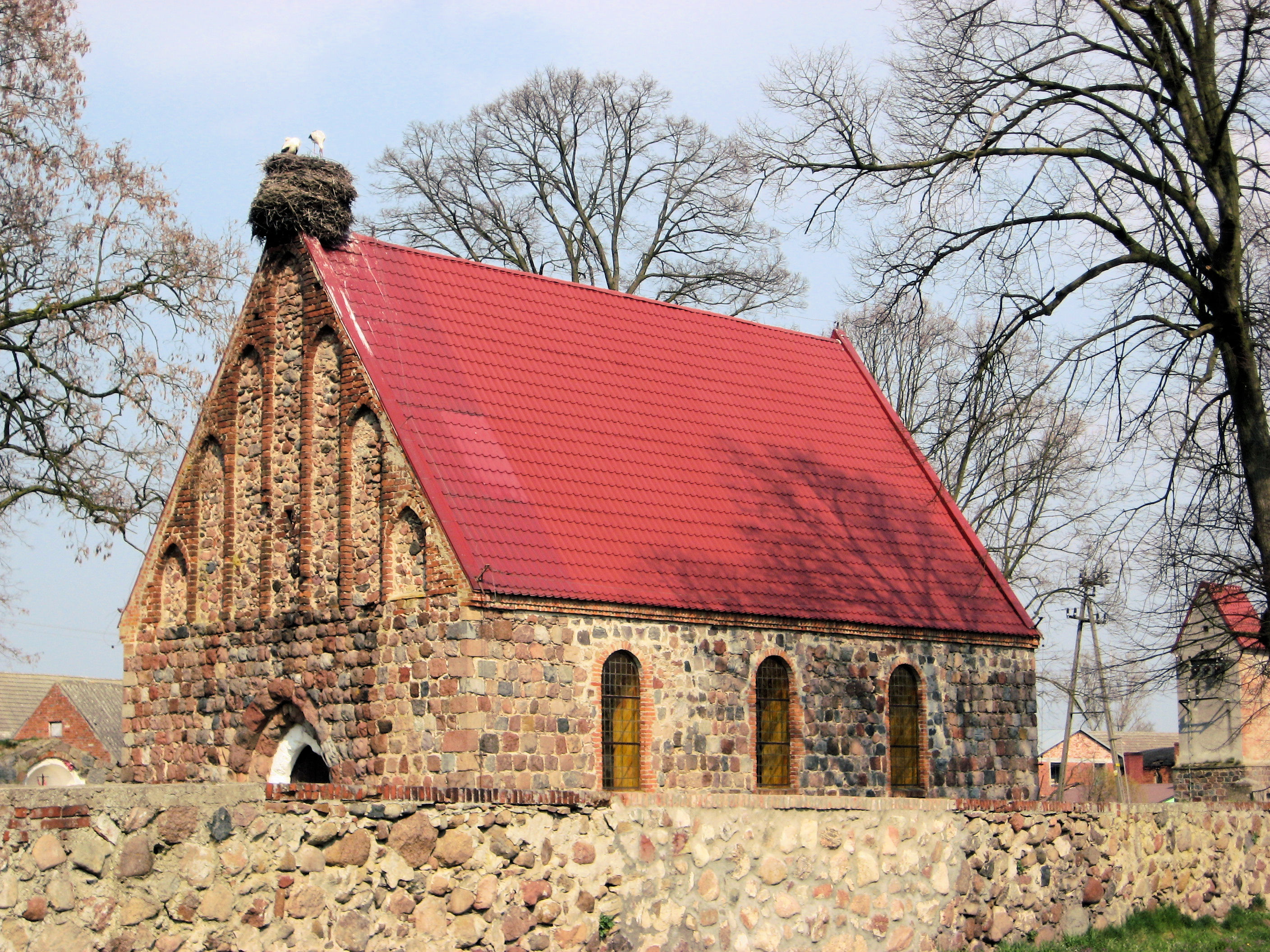 Photo at left was the big church in Gryfino which I reached after 58km. Lots of people out on the streets. I stopped at an ATM to get some Polish currency and then headed east on smaller roads. A little climb out of the river valley and then some gentle hills to climb. This road was nice traveling. One of the small towns had the church shown at right. Look carefully, instead of a steeple, there are two storks building a nest.
Went through small towns and bought some in a shop, eventually coming to a major road at 80km. This one even had shoulders, though I noticed the traffic was using them to get out of the way of passing traffic. Followed this for 4km before eight more kilometers of small road.
The last 10km or so were into the town of Stargard Szczecin, a mid sized Polish town. These towns really aren’t made for bicycles. The sidewalks become narrow and bumpy and prohibit bicycles, the roads are quite busy. I walked some through town and sometimes was on the road. As I came into the center I looked for a hotel. This was tougher than I thought. I got mixed reactions asking people. One or two helpful suggestions. One or two complete cold shoulders as they realized I couldn’t speak Polish. In the end, I didn’t quite find a hotel and was suddenly heading outbound past city limits. Oh well, as necessary I could try me tent I had been carrying along. However, just past 2km from town I saw a small bed symbol at the gas station. A small hotel! It was tough to translate the language – but we figured it out. The hotel itself had seen much better days but was also about a quarter of the price of night before. I was just happy to have a place. I walked back to town for dinner and then turned in after an eventful day cycling in Poland. I also picked up a Polish auto map that seems to give some hints about sizes of shoulders, so may backtrack just a bit to take another road tomorrow.
108 km today. 887km across Europe. 2525 km total.
]]>
 Mostly quiet roads on a Sunday cycle through the German countryside. So far I don’t see much difference between eastern and western parts of Germany. There are fewer bike paths here, but then also fewer towns to go through. I see several other cyclists out on the roads, particularly today. Left the hotel in the quiet morning and half biked and half walked to outskirts of Neuruppin. There do seem to be more cobblestones here.
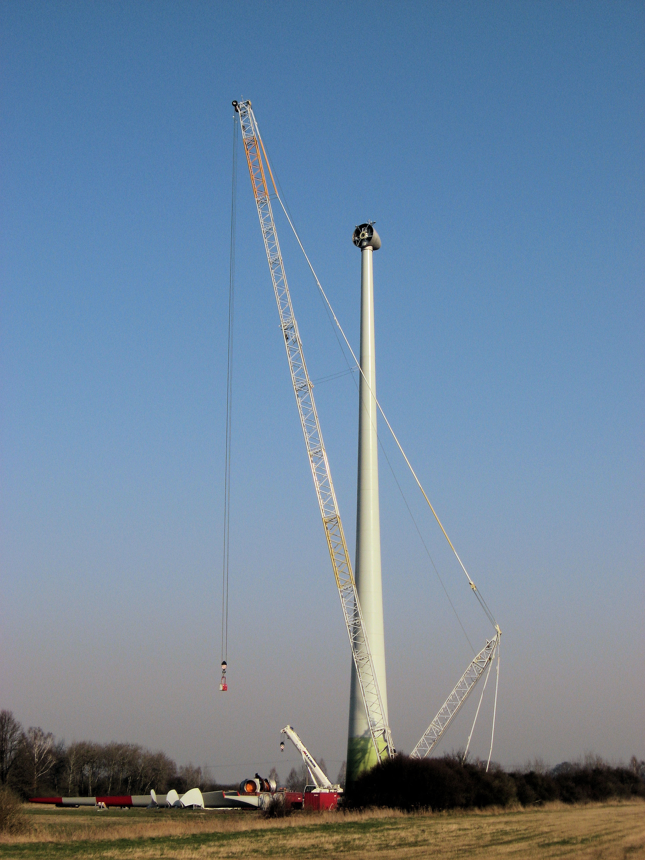
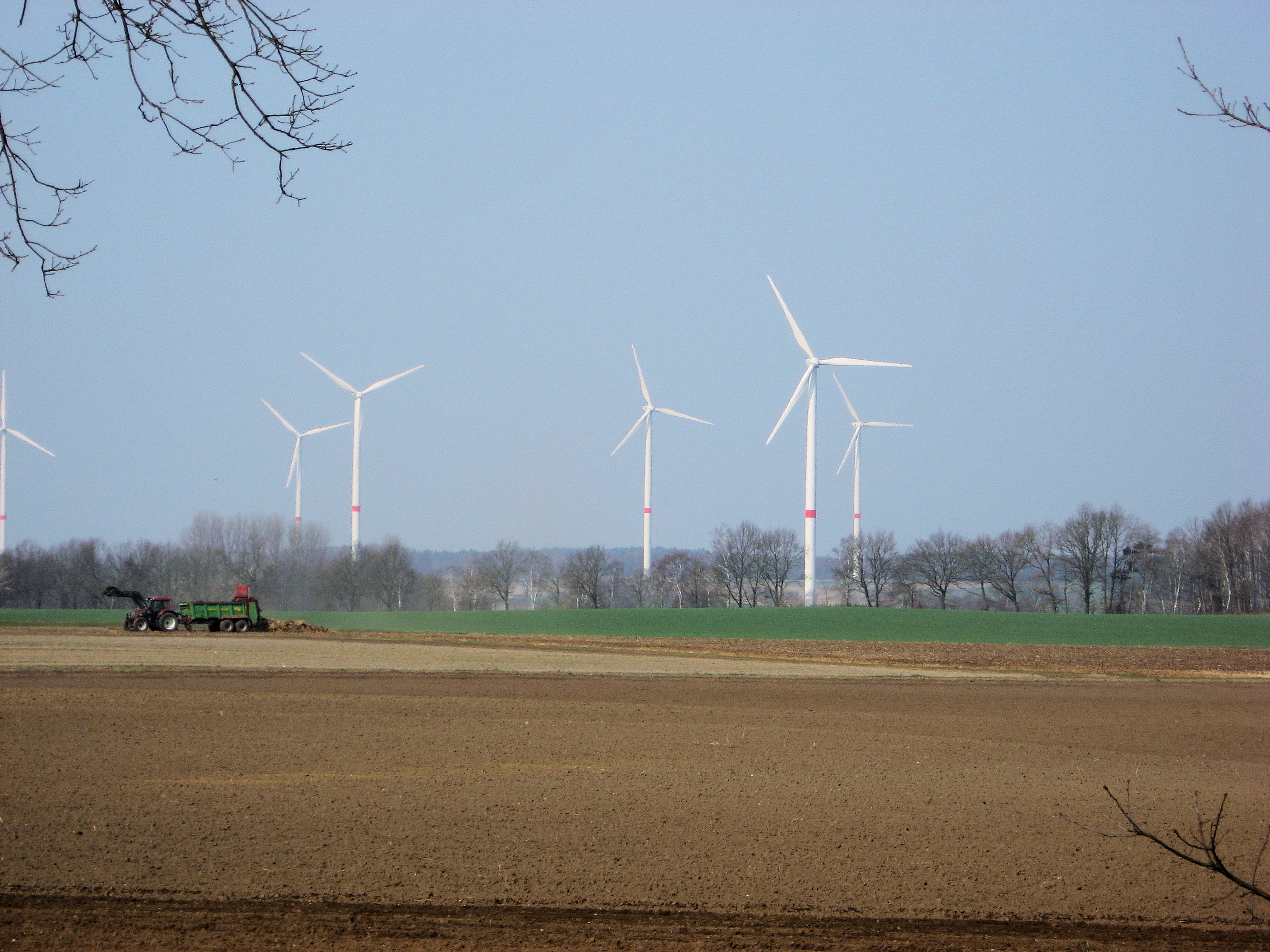
The weather forecast had said winds from east, but overall I was pleasantly surprised. Winds were lighter and I also crossed several forests. Neuruppin and Alt Ruppin were towns to go through but then it was back to country roads. Not much traffic on a Sunday morning. I had adopted a habit of stopping fairly often, so wasn’t making fast time but was enjoying the ride. Welkow seemed to have a big prison. From here mostly forested for a while with train tracks right alongside. Below left shows one of those big wind turbines they were assembling. Fortunately the windmills weren’t turning as quickly today as yesterday.
Lowenberg was a nice little town and first longer stop at 28km. I had a more complete stop at Liebenwalde at 46 km. This town had a historic old church under restoration. At each of these points, roads went due south to Berlin. Only 40km or so to the outskirts. There were a lot of motorcycles out today, and as motorcyclists do – they would occasionally pass at quick rates of speed.
 From Liebenwalde, another 20km to pass over the Stettin/Berlin autobahn. In contrast to these autobahn crossings further west, no businesses right next to the junction. After this came more populated areas of Finowfurt and then a long drawn out town of Eberswalde. What I saw of Eberswalde was a little disappointing. Lots of nice old buildings painted in pastel, but a drawn out city where I didn’t cross a nice old core. I stopped briefly for a late lunch and then headed northbound on highway #2.
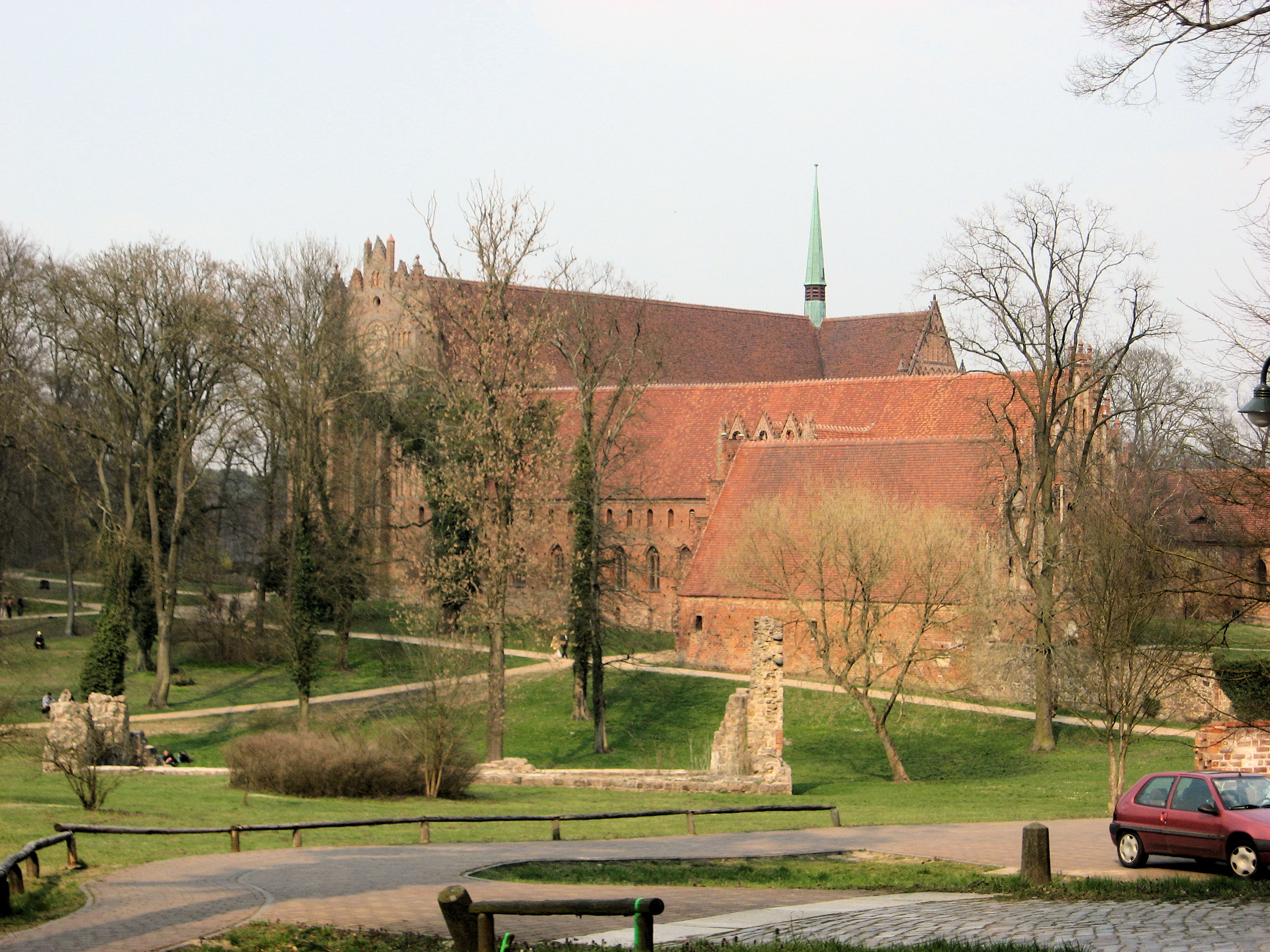
At 80km, a bike path joined again and the next 20km of forest was a tourist zone. Several small lakes and then a large old monastery at Chorin. Signs explained this area were edges of the terminal moraines from the glaciers (I think signs were in German). There were several small hills to climb over but didn’t take much effort. Also several small lakes on either side and looked like some camping and some vacation houses. I kept going to Angermunde. I haven’t yet visited but the town has a historic center dating to 1233. Definitely several old and historic towns around here.
101 km today. 779km across Europe. 2417 km total.
]]>
 I decided to relax some today, since in my enthusiasm to get underway I found myself too concerned about things I couldn’t change. Instead, just take it a little slower and stop occasionally to check the map or just because. However, still turned out to be a tough day because of some consistent headwinds most of the afternoon.
The day began like many others with continental breakfast. A surprisingly filling amount of bread, yogurt, egg, tea and everything else. The evening before I had negotiated the time. The exchange went similar to several others. I’ll ideally want to get on the road earlier because of less wind. So in half-German I’ll suggest a time. This goes back and forth with the innskeeper suggesting a bit later and a good amount of facial expressions. Today we had settled on 8am.
Nice and cool starting out without too much wind. I decided to try one of the small yellow roads marked on the map as I went to Karstadt. Excellent choice as the road was very smooth and had a slight ride coming from the Elbe basin. At 11km, a brief stop in a village of Mellen until reaching the main road at 20km. This main road like those I mostly followed today didn’t have a bike lane, so on the shoulder and without too much traffic. Every 5-10km or so one would come across a village. I decided those plants I am seeing everywhere are potatoes. Relatively flat areas, though also somewhat open so good chance to give the large windmills some wind. I slowly followed this main road inbound to Perleberg where once again I followed small streets into town.
On far side of town, I stopped at local supermarket. I’ve found these to be good snack/lunch spots and went in for mixture of fruit juice, yogurt, pastry and other things for the hungry cyclist. Interestingly, I noticed that the product code for golden delicious apples is the same in US as Germany (4021). There weren’t many bananas but those they had came from Ecuador. At 36km, it was already 11:30, my slowest day so far. From here the next 40km would be along the main highway to Kyritz. The wind had started to pick up, so it was a slow ride into the wind past the open fields and occasional small town. Fortunately, once I reached Kyritz they had another supermarket. I stocked up on a few extra things since stores will be closed tomorrow.
Kyritz was one of those nice small towns with a cobblestone street. That is even bumpier on a bike than the tiles or bricks. Fortunately, the bike paths were frequently brick. I took a nice relaxing break before finding my way out of Kyritz. The signs were starting to say Berlin and less than 100km now on this road. However, after another 10km, I turned northeast again into a stronger wind and last little bits.
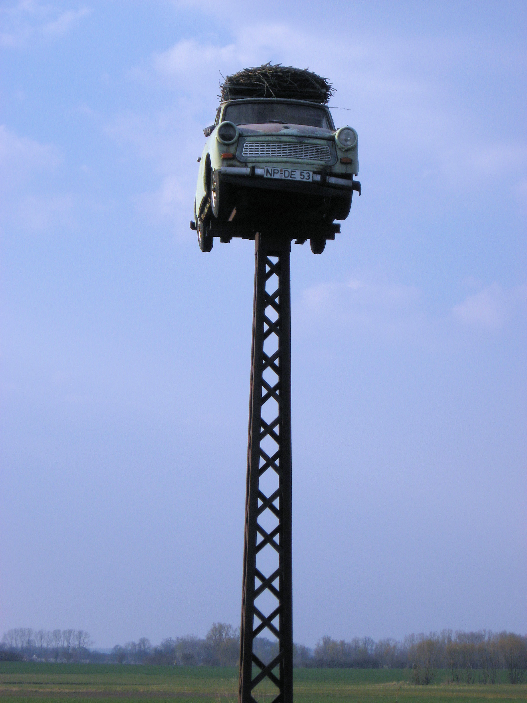 It was another 18km, against the silly wind until I reached the main Hamburg/Berlin autobahn. In several of the small towns I took a bit of a break by walking the bike for a bit to get a break from the wind between towns. As I crossed the autobahn, I saw the car on pedestal at left. The storks sure found an nice place for a nest. The last few km went into town. I found the town center ok, but it took a question or two before I found a local hotel. A very nice little place on the water and cost was even reasonable. What had started as a bit of a relaxing day turned out to be a tough ride this afternoon.
By the way, I added some geographic coordinates to these last few posts so if you click on “Map” above you can see a rough progression across Germany.
111 km today. 678 km across Europe. 2316 km total.
]]>
 Today a little tougher than yesterday. A few more hills as I made it across the Elbe River and into the area that used to be East Germany. Last night I was one of few guests at the hotel as they had a party with 130 guests. Overnight it rained lightly and there was very light drizzle as I got up. That stopped and rest of the day was clear. I got back onto the bike path at Escede. The path was smooth but there were occasional ups and downs as I crossed some slight hills. Enough to try some different gears. There was a lot of forest here with occasional signs for forest paths. This part of Germany seems to have some forest bike paths, though the distances to towns always seem larger than the more direct routes.
At 20km, the road joined with a larger road and time for a quick break at the gasoline station. I followed this road until it got close to Uelzen, and once again was directed onto smaller paths through town. This town had better signs and wasn’t too difficult to find my way through. Before I knew it, at 38km I was already on other side of town. From here the bike path discontinued at Stocken (45km) and onto the main road. Seemed like there was a bit of a headwind again. More significantly, were some gentle hills. I shifted into lower gears and slowly lumbered over these hills. Could definitely tell the extra weight of everything. Several small towns, one even with a cafe. Enough open spaces to catch some wind, and see some of the windmills such as those above right. There are multiple country signs for potatoes, honey and even some apples for sale.
Once I got to Ziernen, it looked like the largest of the hills were behind me. I was even surprised at a fair descent of several kilometers. Guess I must have climbed some and not just been slow. A few kilometers further, around km 65 or so, the bike path started again and came into Dannenberg at kilometer 77. A nice small city, where the main road went just past city center. More importantly it was flat here. I stopped for a late lunch before continuing on towards the Elbe River.
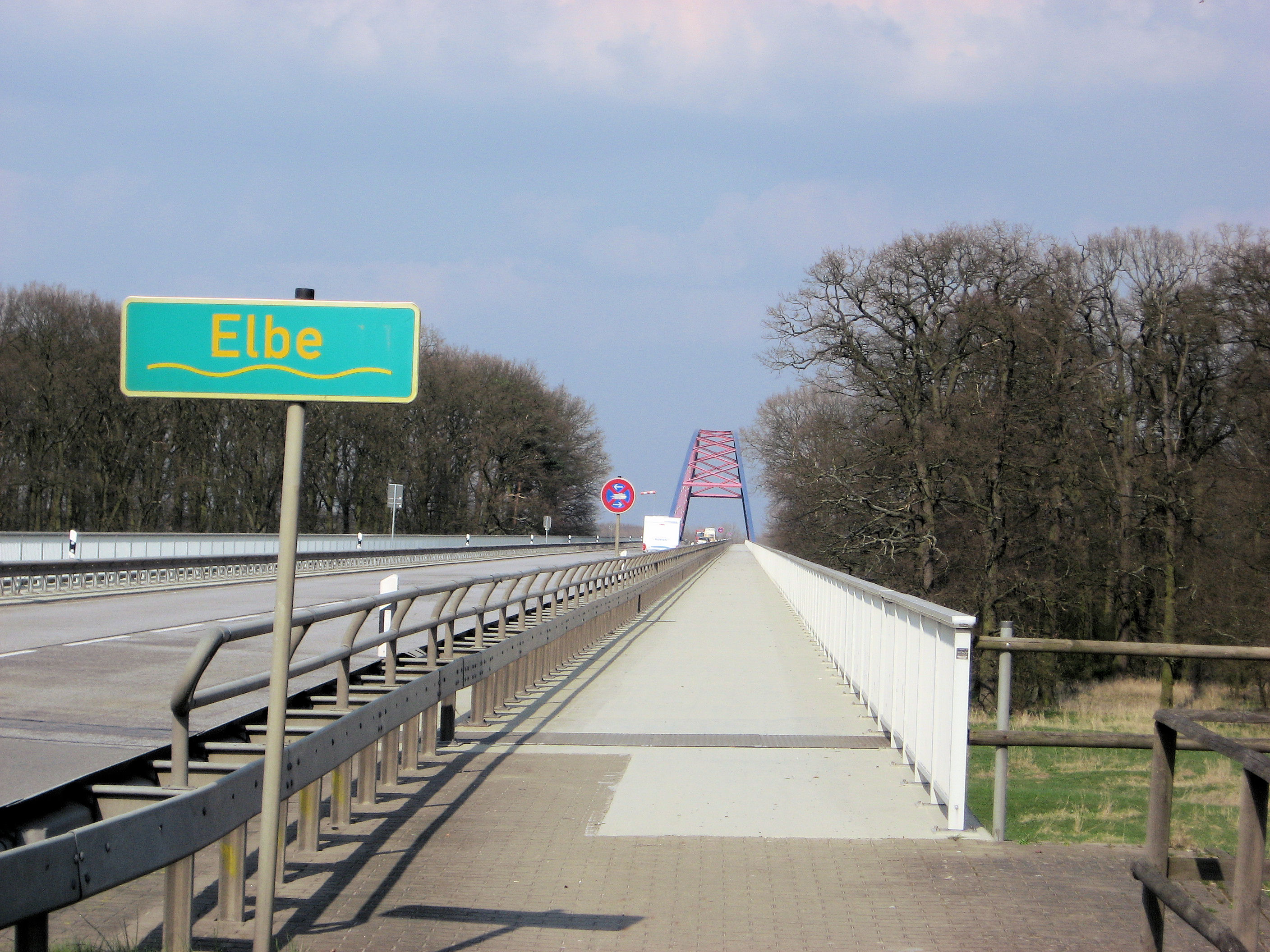
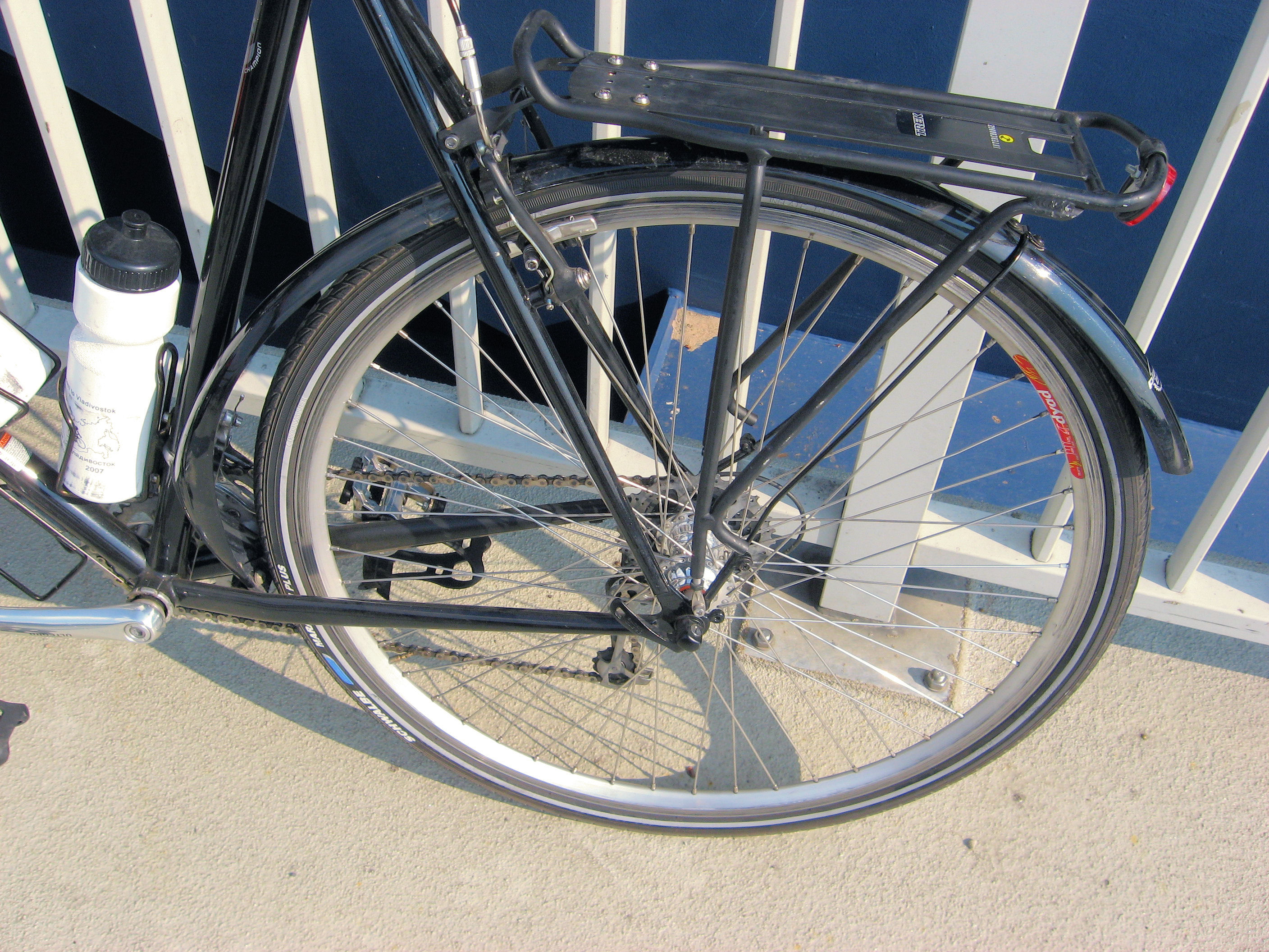 At kilometer 89, I came upon the bridge crossing the Elbe. This point had formerly been a border between East and West Germany. I stopped to take a photo and then cycled the long approach to the bridge itself. Just as I got onto bridge itself, pow! My bike was instantly stopped. As I crossed the bump onto start of the bridge, my right rear pannier had fallen into the spokes. This pushed the fender forward and stopped the wheel. Wow! I took luggage off and assessed the situation. My big worry was the rear wheel and particularly the rim. Best I could tell, the fender had stopped the wheel quickly and spokes looked ok. This type of thing always makes me queasy until I have another 100km behind me…so hopefully all will be ok. I bent the fender back, got things back to looking ok and decided to walk across the rest of the bridge.
From here, I turned east (into the wind) and slowly cycled into Domitz. A very quaint old town with several hotels and lots of old looking buildings. I wanted to get a few more kilometers on the wheel so continued out of town. Here I took the back road via Polz since it was 3 km shorter than the main road. That old road did have some very bumpy sections though so I took it slow. I was ready for a stop as I came into Lenzen. Looks like the wheel is doing ok so far. Weather turned out nicer than expected, so perhaps this was all of the quick system that was coming through.
109 km today. 567 km across Europe. 2205 km total.
]]>
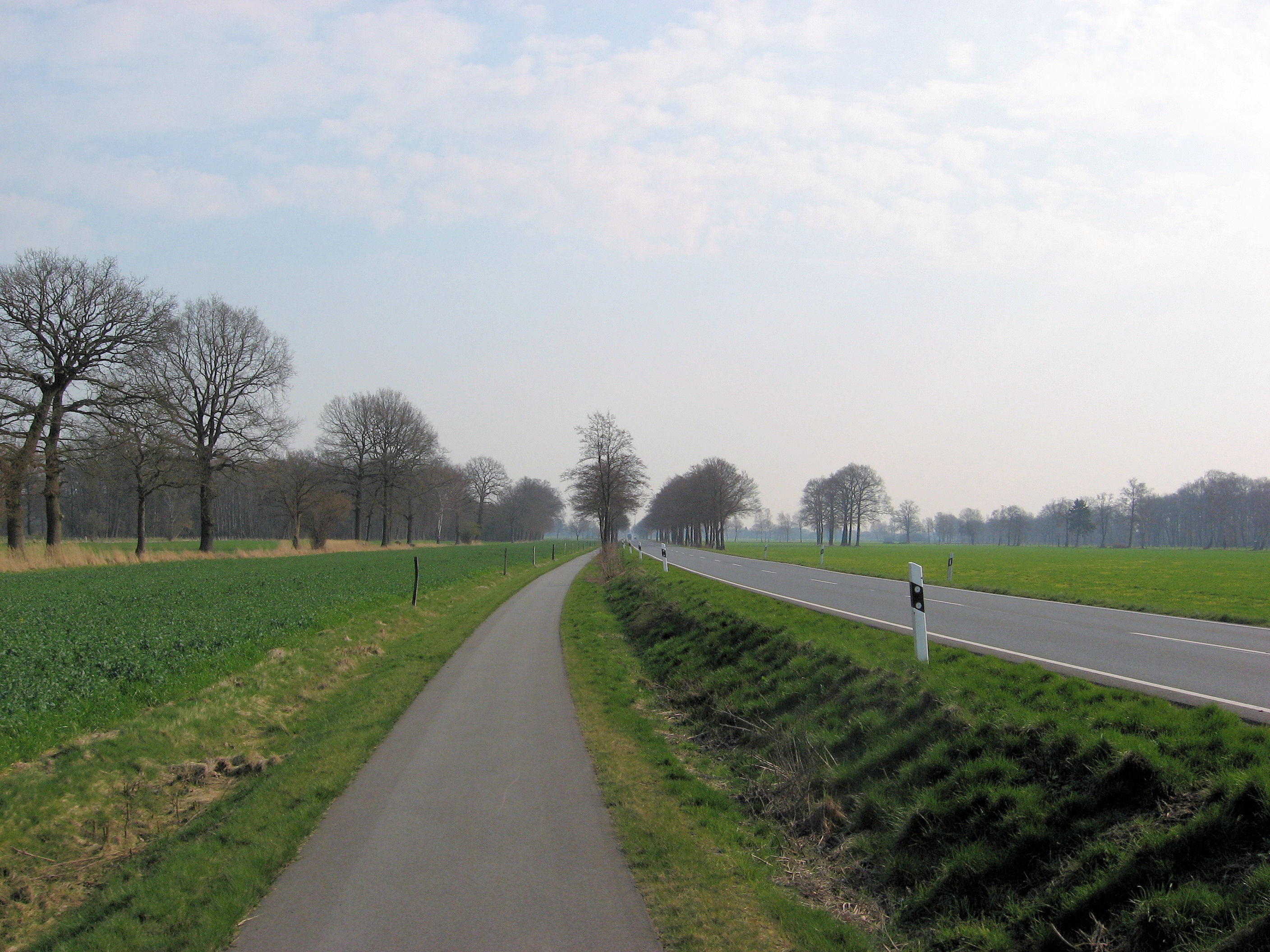 Another beautiful day cycling through Germany. More trees, so noticed the winds a bit less. Many places had bike paths such as those at left or right, and other roads were reasonable. I found it a little tricky to cross the two small cities on my way today: Nienburg and Celle. There seemed to be fewer signs than before.
Had a nice continental breakfast and was on the road before 8am. They let me know I was the first cyclist they had. I wasn’t quite sure if this was for the season or ever. In these places, I’ve been parking the bike out back in the garage. I’d prefer the room, but locking things in the garage seems ok as well. Centers of these towns have bricks and so are rougher than roads outside. Left Sulingen and was soon on some nice smooth roads and paths such as those shown here. Seemed to be making some nice progress in cool morning air. At 24km, the road started to become larger and now the exercise was to cross Nienburg. I first followed bike paths through town of Lemke, and then followed signs to center of Neinburg. A bridge crossed the broad Weser river. From here one or two signs outbound before finding signs to the right suburbs. My detailed German map definitely helped here. After that back in the countryside with easy riding again. Steimbke looked like a nice quaint touristy town.

 Anyone have a good idea what the sign at left means? (Reply with a comment). I see these signs occasionally. Coming through Schwarmstedt, I also saw a number of military trucks on a field exercise. Soldiers were up manning their guns. Several of the trucks had large blue flags as in “blue team”. Just a little past that, I came underneath the main Hannover/Hamburgh autobahn, and several rest area businesses including a McDonalds. Decided on a McDonalds meal here and saw a number of different soldiers here as well. I wonder if the army exercises include McDonalds?
After lunch, just 28 km on to Celle. Most of this was a flat forest path, but last few kilometers through a few small towns. Outside Celle was a large map. Ok, plan was to go underneath railroad tracks and then eventually northbound across the city. Celle was at 94km and considered stopping here if I found a nice looking hotel. My route didn’t take me past anything too interesting and soon I was north of the city again. From here I decided to go to Eschede, 16km away. My map had the town underlined so I hoped there might be a guest house or hotel. More nice forest path as I came into Eschede. Earlier than previous days by 3:30pm or so.
I found the first guest house. Nobody was there. I waited for a bit and someone came. In a mixture of German and pantomime, I learned they were full. There might be room just down the road. “How far”? “Not very, just around the bend, 5 minutes”. So I started cycling around the bend, up the hill and out of town. Hmmm… I didn’t see anything that looked like a guest house. Decided to turn around. Came into town and next hotel. Sign said something like hotel and restaurant guests, wait until 6pm. I was sitting there weighing my options (cycle to next town 37km away or wait and hope they had something), when I noticed a button for hotel reception. Yeah, they had a room and I was just as happy finding a place for the night.
110 km today. 458 km across Europe. 2096 km total.
]]>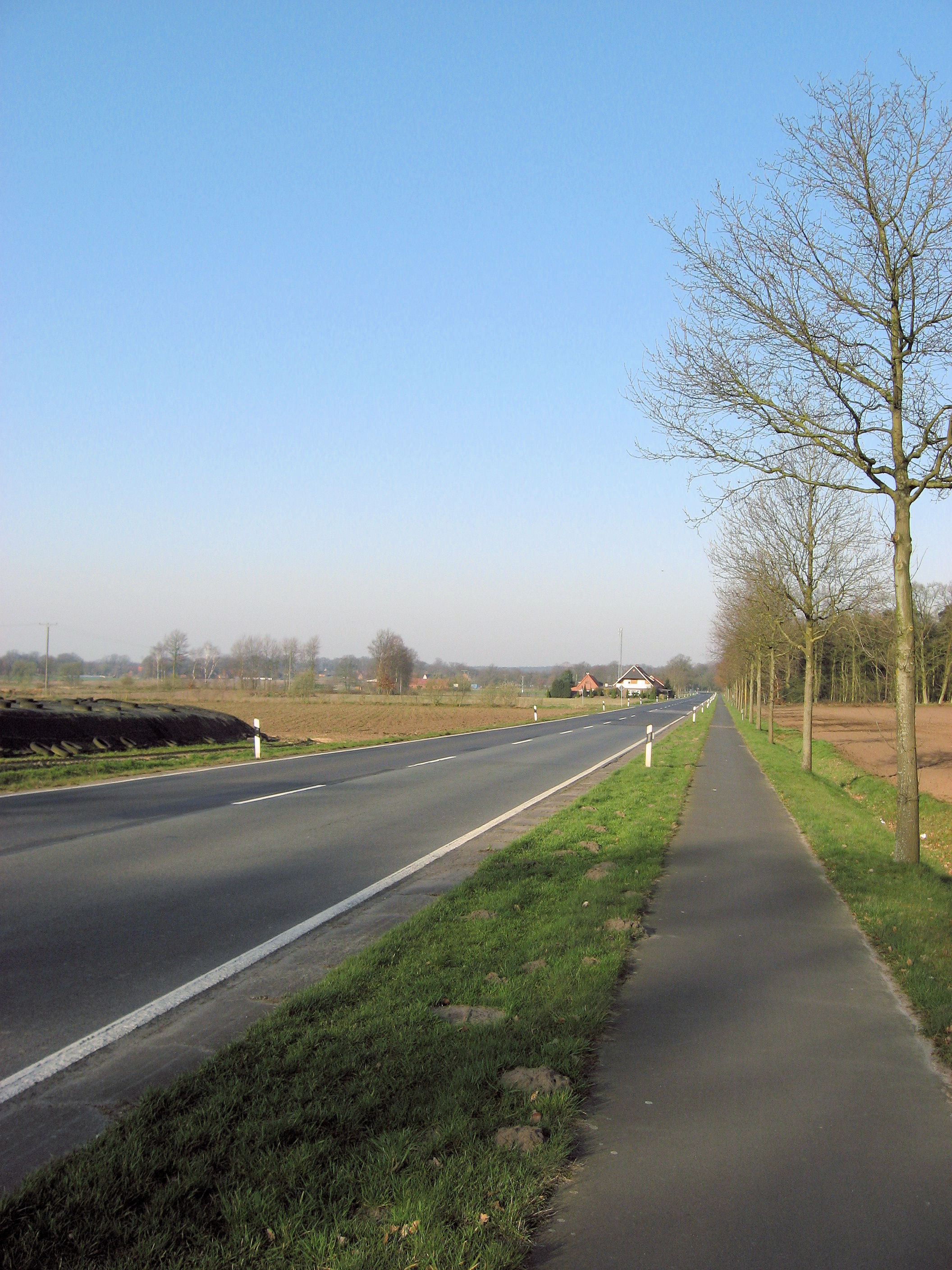
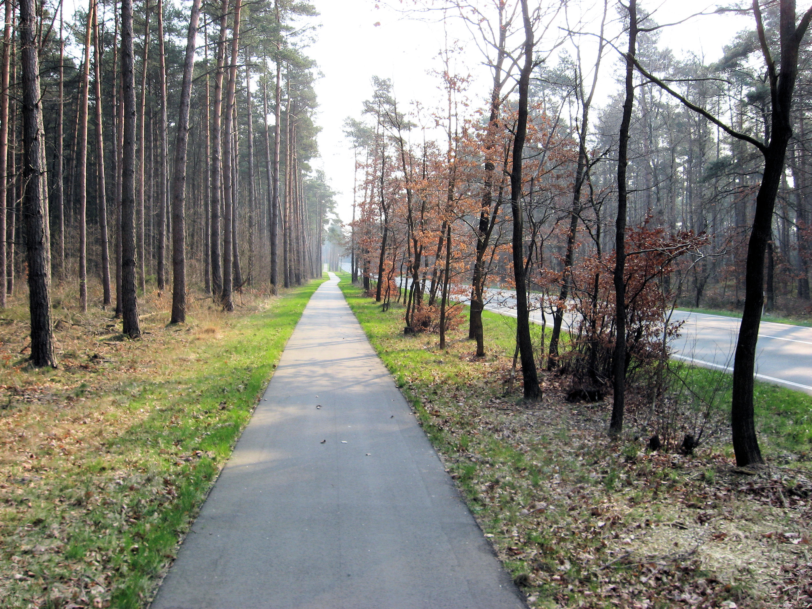
 A beautiful spring day of cycling across northern Germany. I even came to a hill that I could coast down. However, for the most it was fairly flat. All except for about 8km was along bicycle paths such as those above left. The remaining 8km was on a sometimes narrow road, but traffic was fine.
Ate breakfast at the guesthouse and set off for the day. Nice calm skies and cool temperatures. Most of the cycling was along bicycle paths. Occasionally these would become sidewalks as I passed through towns and they would occasionally stray from side to side of the road. At 11km was first town of Freren. We had some very slight grades here. At Furstenau there was a quick detour and then back to quiet country roads. This one even had a hill to climb over and coast down. The trees haven’t yet blossomed, and some things are planted in the fields. I see occasional tractors along the way and people working the fields.
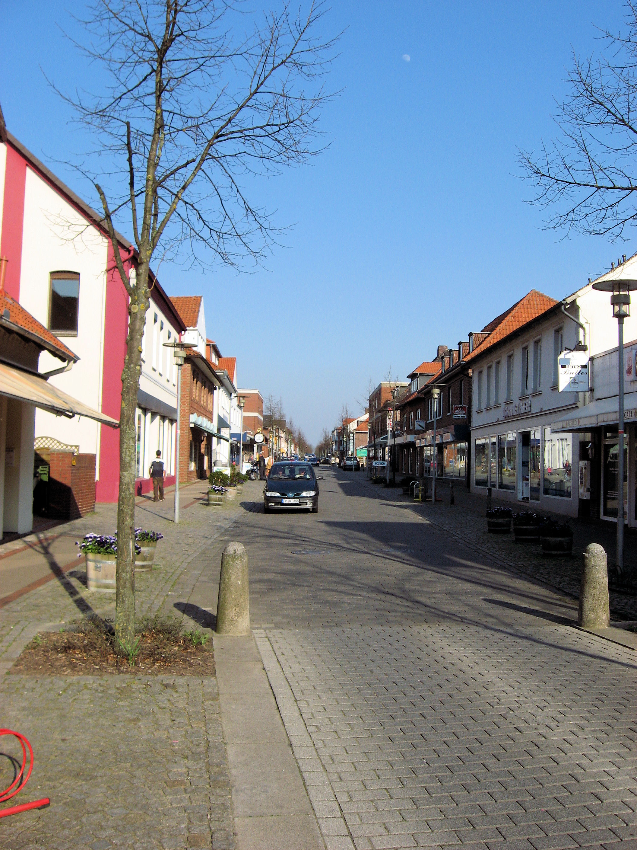
At 56km, I crossed a major autobahn, and they had a road side rest area including a McDonalds. I opted to cycle into Holdorf instead. I found a local supermarket and wandered through and found tasty looking things: yogurt, banana, pastry and fruit juice. At the bakery, person in front of me had a sandwich made. I’ll have to learn a few more German words to figure that one out. From here the cycling seemed a bit slower and my front fender decided to rub for a while. Gave me an excuse or two to stop before coming to Diepholz at 76 km. All day the signs had said “Diepholz” so it was nice to get there. Decided to go just a bit further and went through more open countryside to make it to Sulingen. Here I took the main road into town and then asked for a hotel. As can see at top right, a nice quiet main street. Lots of little ice cream places and otherwise a nice place to stop for the day.
109 km today. 348 km across Europe. 1986 km total.
]]>
 Made it to across the Netherlands and into Germany! Today was another day of great weather, with lots of sun and headwinds from the east. I had a good stay with Tante Gea and Frans in Olst. It was nice to see them again and I appreciate the hospitality. I also dropped a few small items off including my Amsterdam map. I left a little earlier, though surprisingly today was at least as slow as yesterday. I suspect a combination of my tires, winds and conditioning.
Nice calm winds and slightly cool as I set off southbound towards Deventer. I got close to outskirts of town before turning left and following a ring road around Deventer. The next kilometers were a mixture of roads and bike paths as I generally followed signs to nearby towns “Schalkhaar”, “Bathmen”, “Holten”. At Holten I stopped at local supermarket for more to eat. It was a little confusing from here but I found paths via Rijsen and into Wierden. I stopped in at VVV in Wierden and had a helpful person explain routes from here into Almelo.
Almelo was a somewhat large city, so first followed the signs to the centrum and then outbound. Here I came across a “Almelo – Nordhorn” canal with bike path. Since I was going towards Nordhorn, this seemed like a good choice and made for some pleasant cycling without much traffic. I made some good distance along the canal but saw confusing signs around kilometer 64 so turned northbound. This took me on quiet roads and one dirt path via Groot Agelo and into Ootnarsum.
Ootnarsum was a nice little tourist town with a quiet center, a lot of little hotels and a busy VVV office. It definitely looked like a tourist destination. I walked some through town and then set off east again. These roads took me via Tilligte and suddenly I was back at the original canal. I had added at least six kilometers with my detours though also saw a nice town. I followed the canal for a bit, and then came onto the main road leading into Nordhorn.
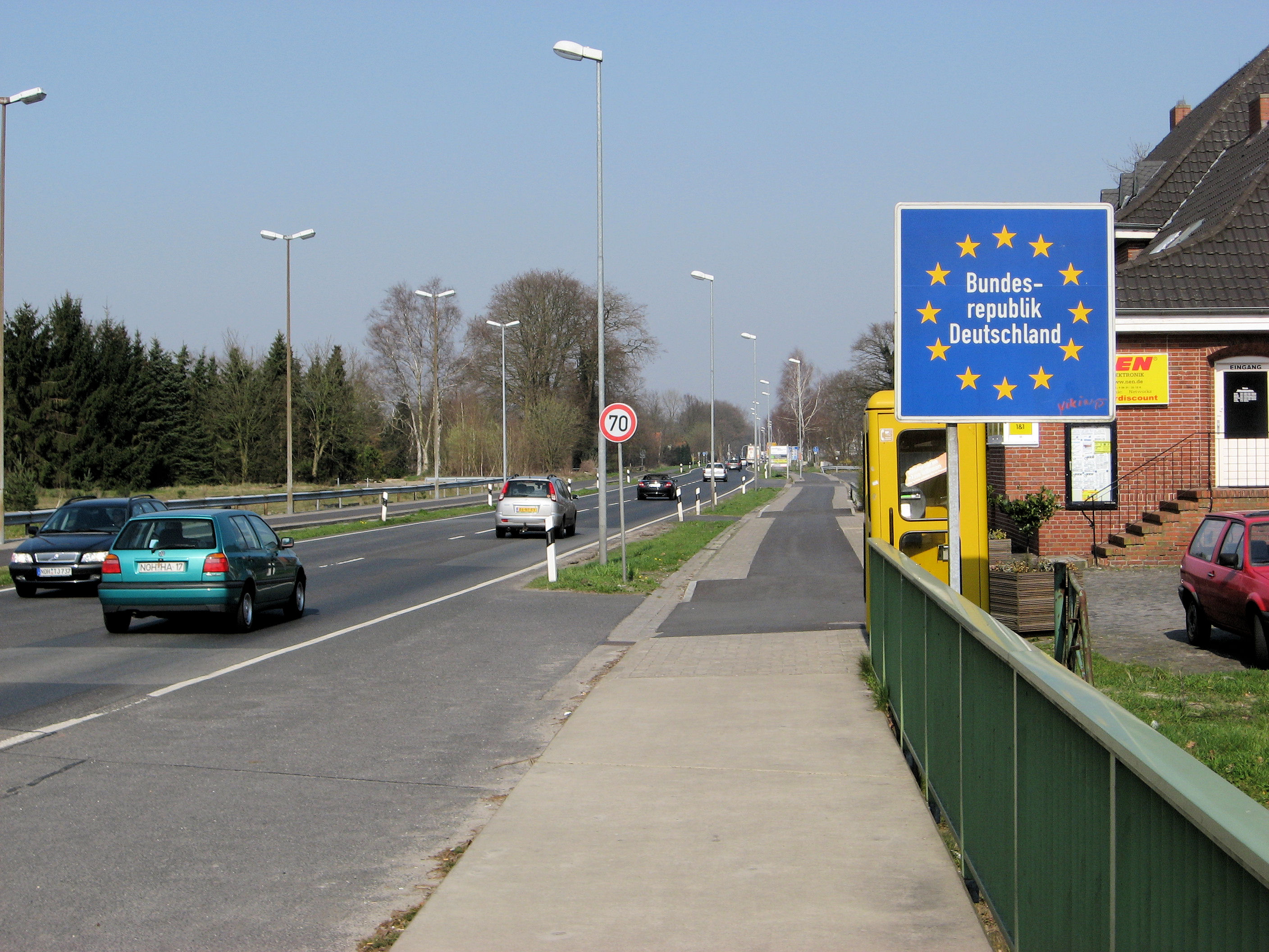
Around three in the afternoon I crossed the border of Netherlands and Germany. Nice to have crossed my first country, though now I would need to work harder at the language. I followed main roads into center of Nordhorn and then outbound towards Lingen. Bike paths weren’t as consistent as in the Netherlands and I was along a busy highway for a bit. Fortunately, the main Nordhorn/Lingen road had a good path. At 96km I saw a nice hotel and was tempted, particularly since the headwind was stronger here. However, I wanted to get at least 100km today so kept going. At 106km the bike path went directly in towards Lingen. I followed it into center of town.
I passed multiple hotels, but none seemed quite right. I kept going outbound out of town and saw signs for two guesthouses 3.5km ahead. The first one was in Ramsel and was closed. The second was in Baccum and with some pantimine and half German, and a few choice Dutch words thrown in, I arranged a room and had a nice schnitzel dinner. Nice end to a day that was surprisingly longer than I expected.
So far Germany looks a lot like the parts of the Netherlands I’ve just been. Slight differences in road signs (yellow not blue) but similar houses and landscapes.
116 km today. 239 km across Europe. 1877 km total.
]]>