 Made it to Russia! The hardest part about crossing the border was finding it. My hotel was close to the border, so cycled inbound and followed the signs. The border station signs pointed to an area with rows of large trucks waiting. This didn’t seem right so I kept going and it looked less and less like the border. Finally, asked someone and from his Russian explaination I could get enough to know: back to the traffic circle and left. Cycled back and found spot for normal cars and also for pedestrians. Saw another bicycle use the pedestrian path, so followed.
I walked up to the Estonian exit, had my passport stamped and wheeled the bicycle through. After exiting Estonia, there was a place to change my Kroon to Rubles, so no more Estonian money. From here the pedestrian path went downhill and across the bridge. Crossing the bridge was a neat view with large old fortifications on each side: one flying the Estonian flag and one flying the Russian flag. Decided not to take photos since I’m never quite sure what is allowed.
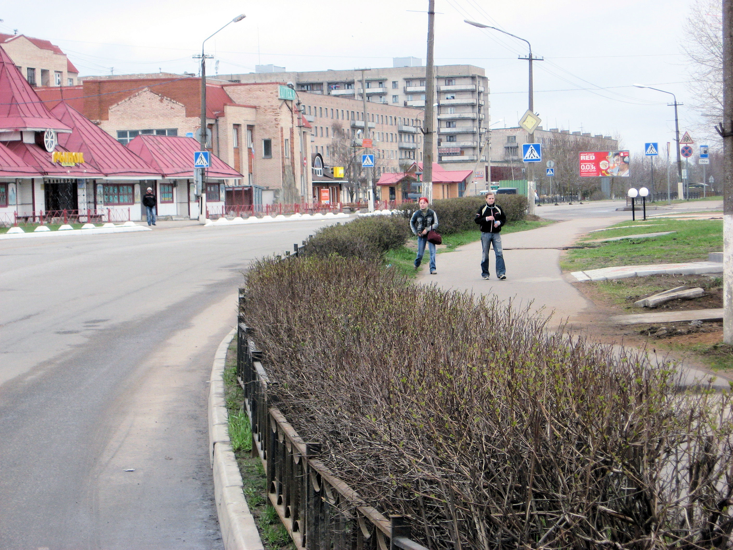
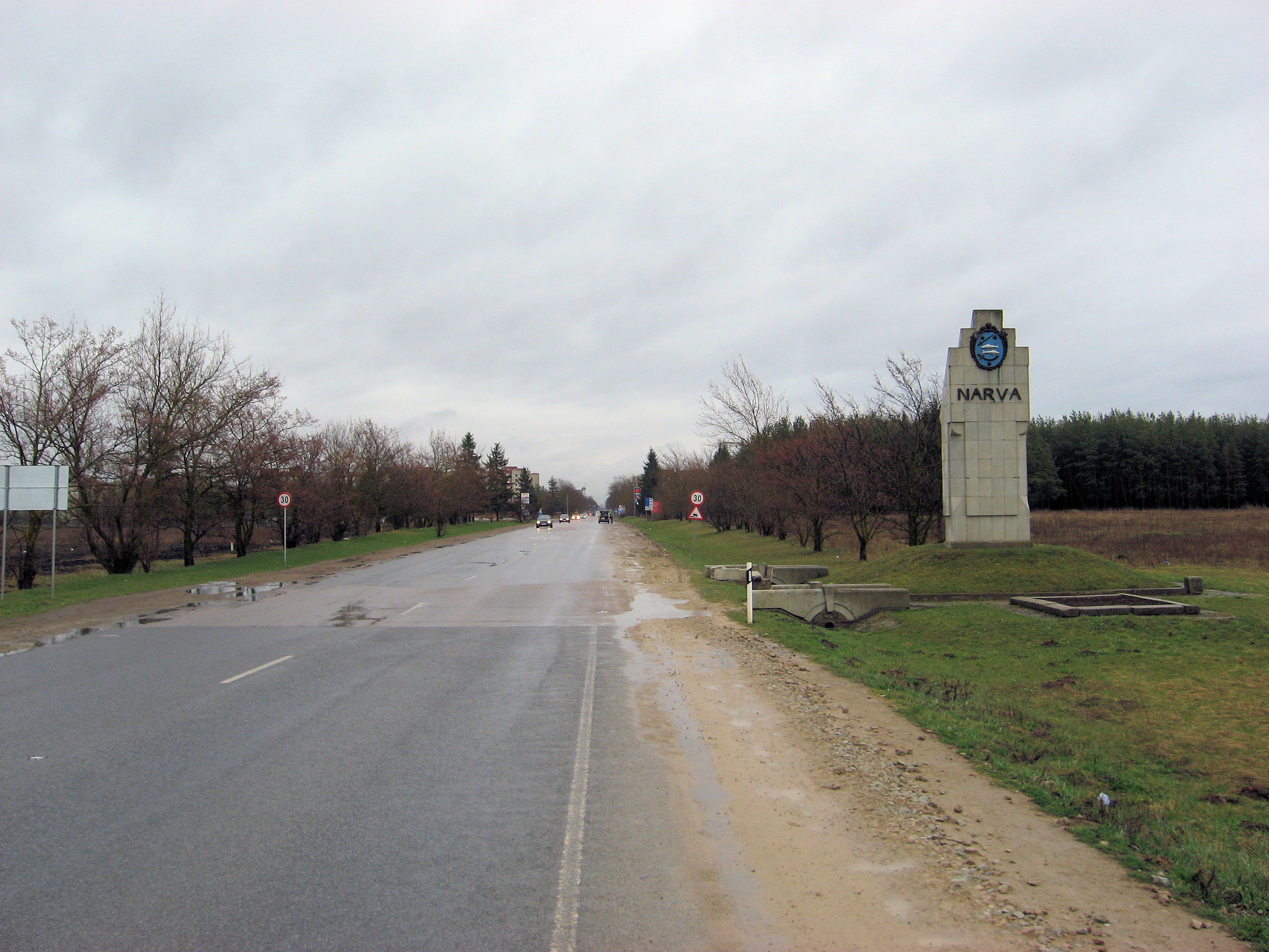
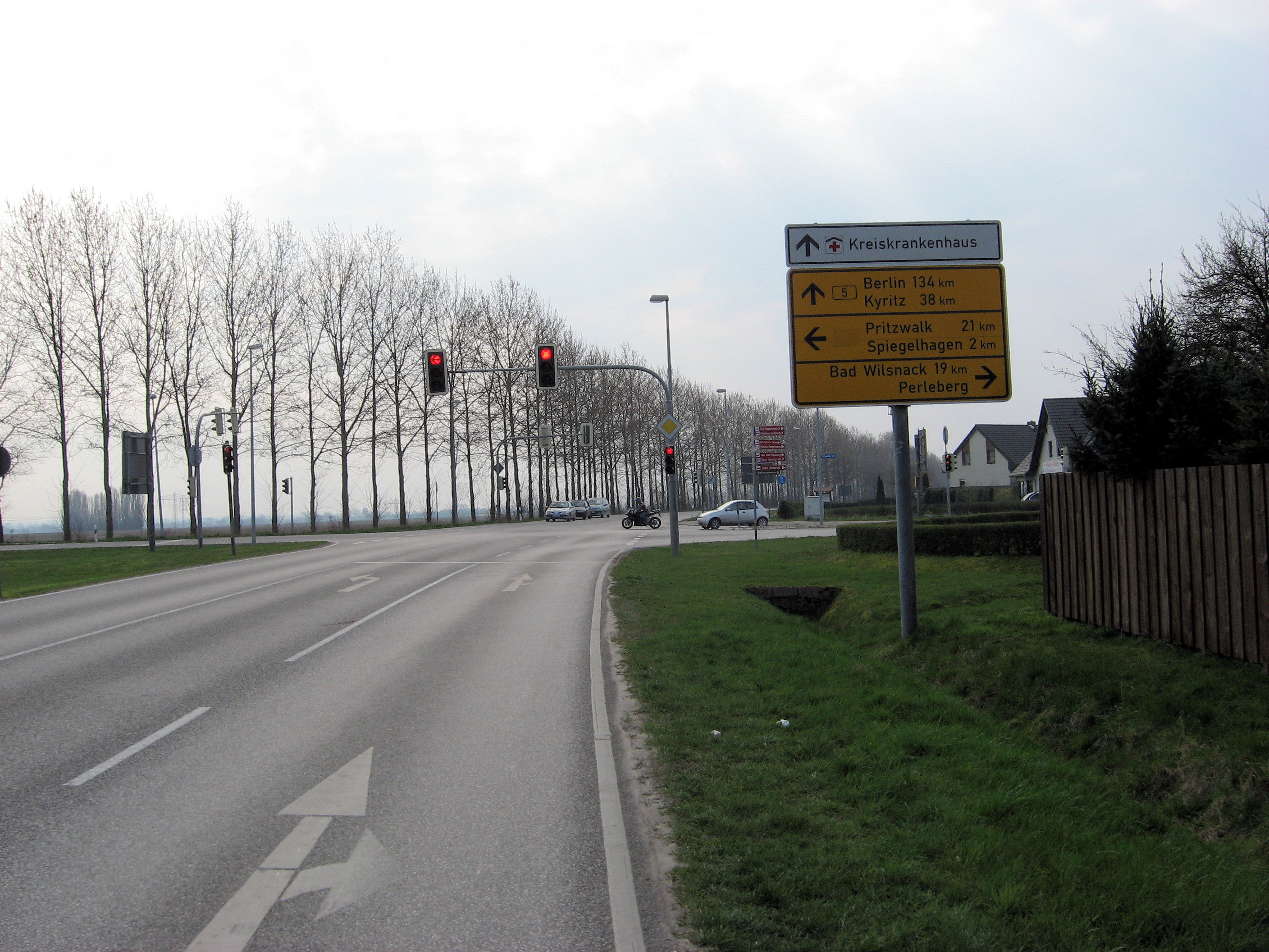
On the Russian side of the river was a similar border control building. I followed other pedestrians in. There was a sign with customs. A helpful lady gave me a migration card and helped me fill in the right blanks. The passport was stamped and that was it! I wheeled my bicycle out the building and walked for a bit along the fence separating pedestrians from automobiles and eventually had the first photo of Ivangorod (Ивангород) and start of the M11 motorway.
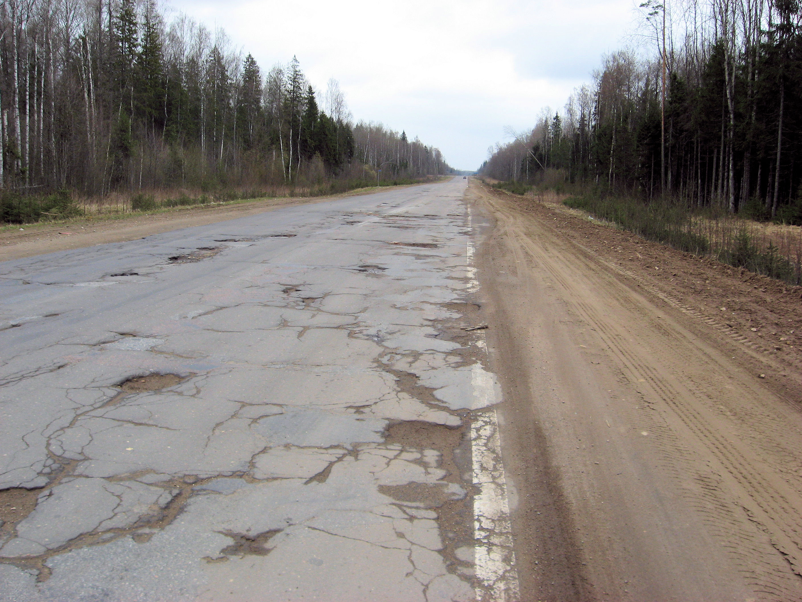
Stopped at the first gasoline station to buy a map and was soon on my way on the motorway. This road was surprisingly quiet and surprisingly variable as far as road conditions go. Some very nice smooth places and also some areas near Kingisepp (КингиÑепп) where it was just one pothole after another. I tried different techniques: slowing way down, riding the shoulder, walking the worst bits, cycling on the other side of the road but it was all pretty slow going. Fortunately at 30km after Kingisepp the motorway was generally better condition.
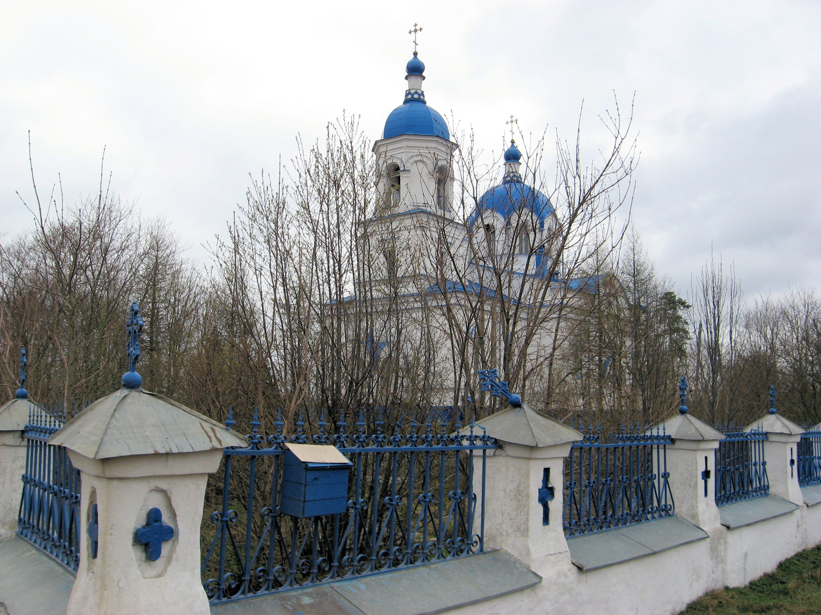
 At 44km was a big orthodox church and turnoff to the smaller P-38 road. With some email help from helpful folks at ExperiencePlus I had identified a hotel in Gatchina (Гатчина) that seemed like a useful destination. (ExperiencePlus has run a trip as part of their Expedition Plusseries from St. Petersburg to Istanbul. If you want to do the same ride I did today but in reverse and without baggage see their trip).
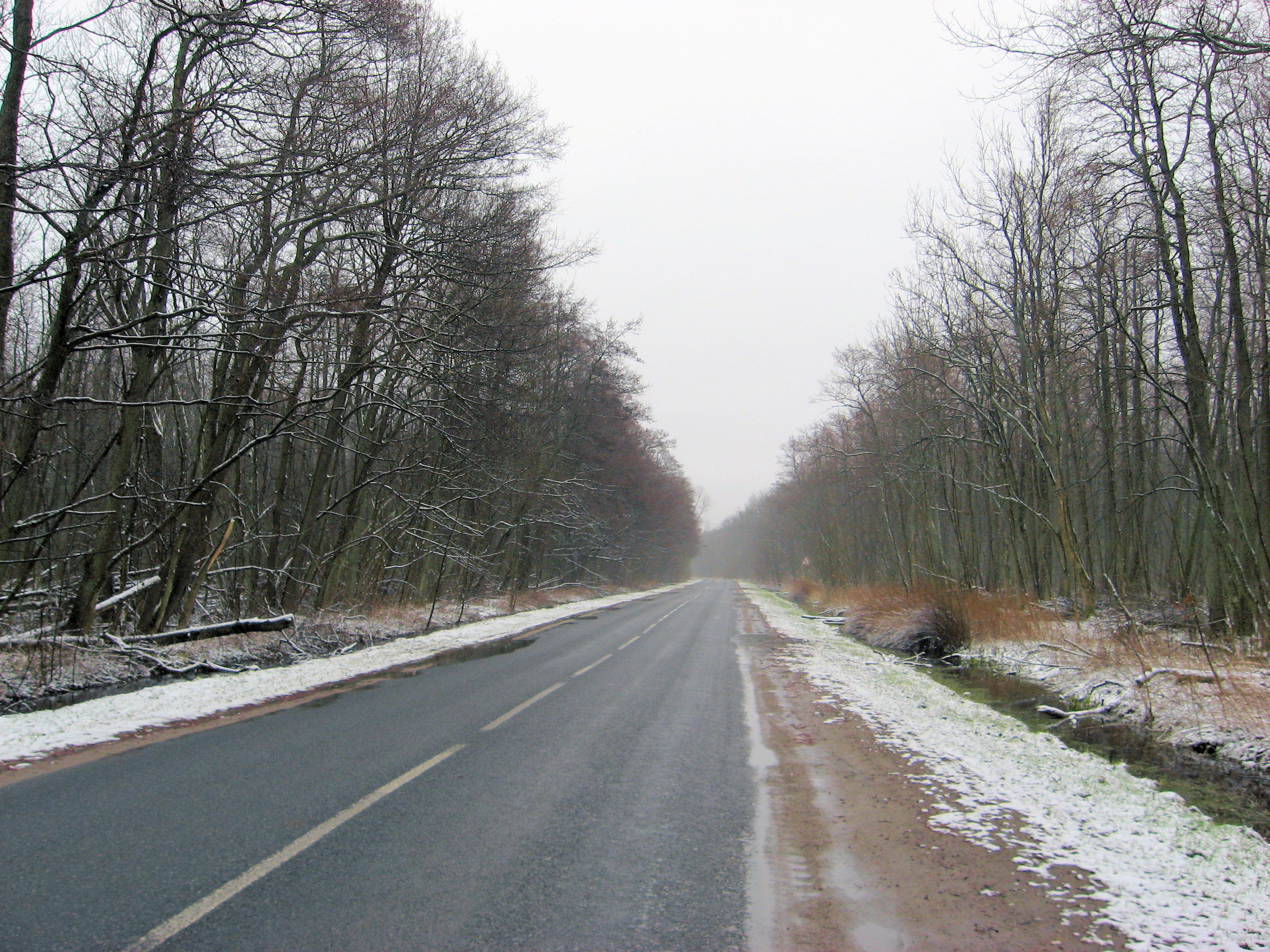
The quiet road really started out quiet and in reasonable shape. It was variable in parts – where the road would be marked as bumpy for 1 or 2 or 2.8 or 5.5 or 6km and then better after that. Seemed like there were some gradual climbs but overall quite flat. Some forests but mostly wide fields, some with tractors preparing the fields for planting.
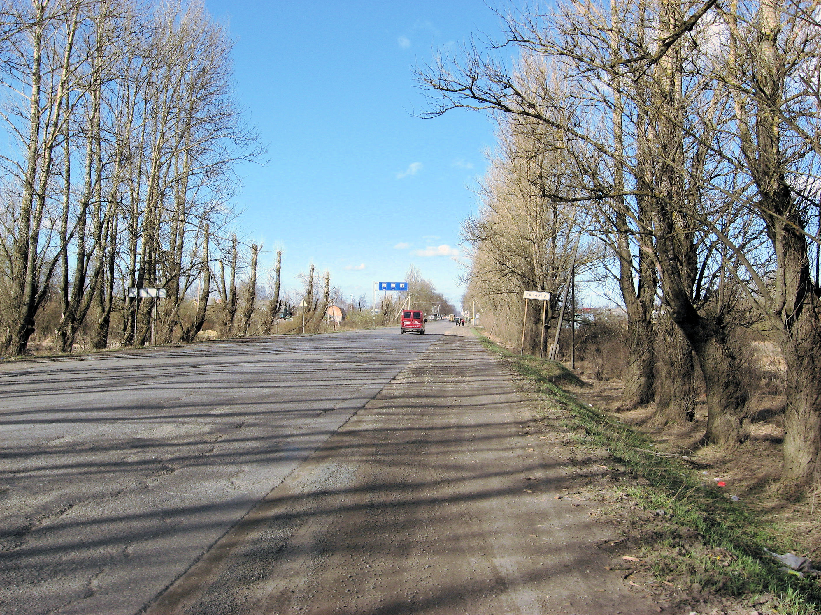
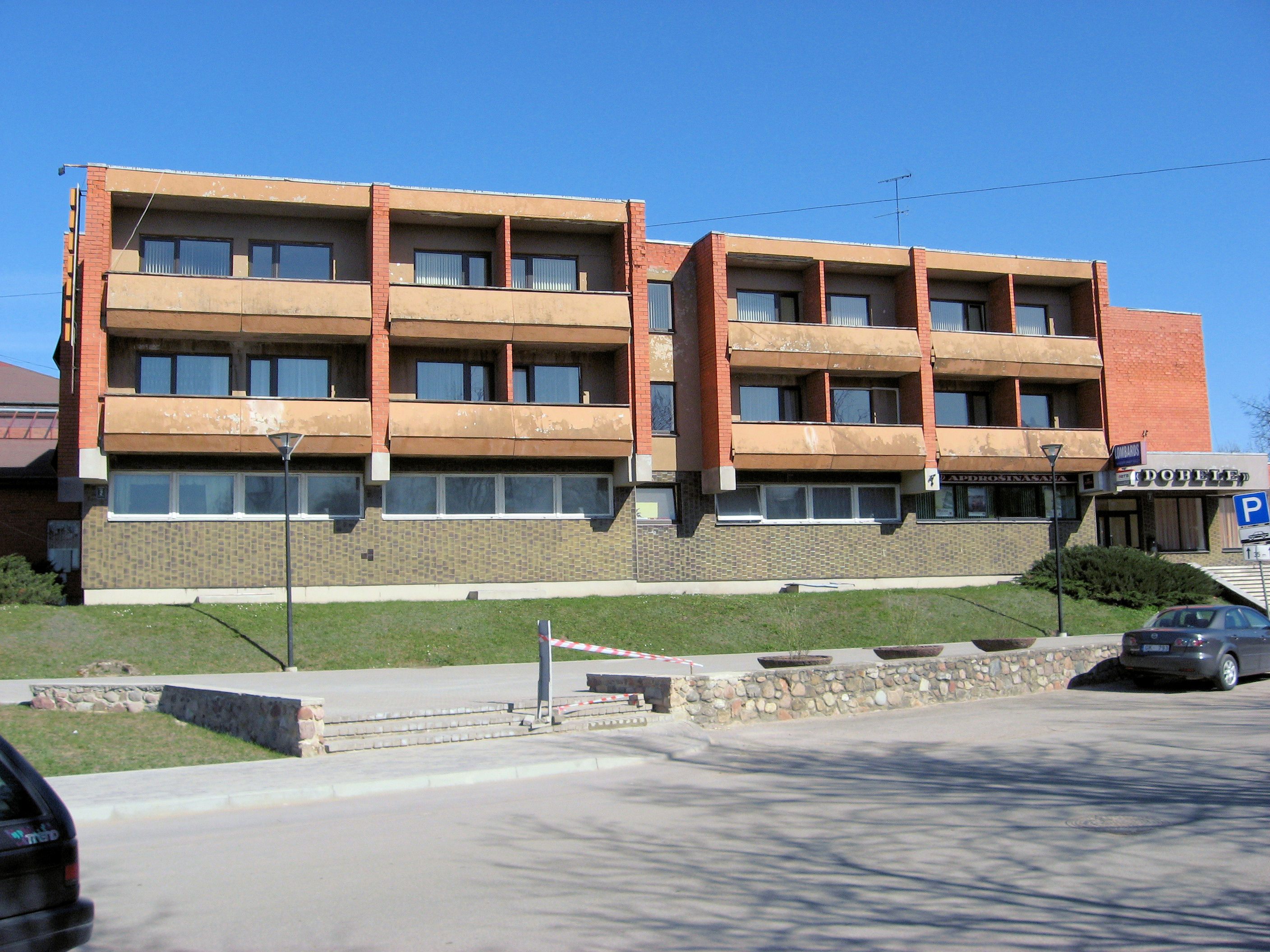
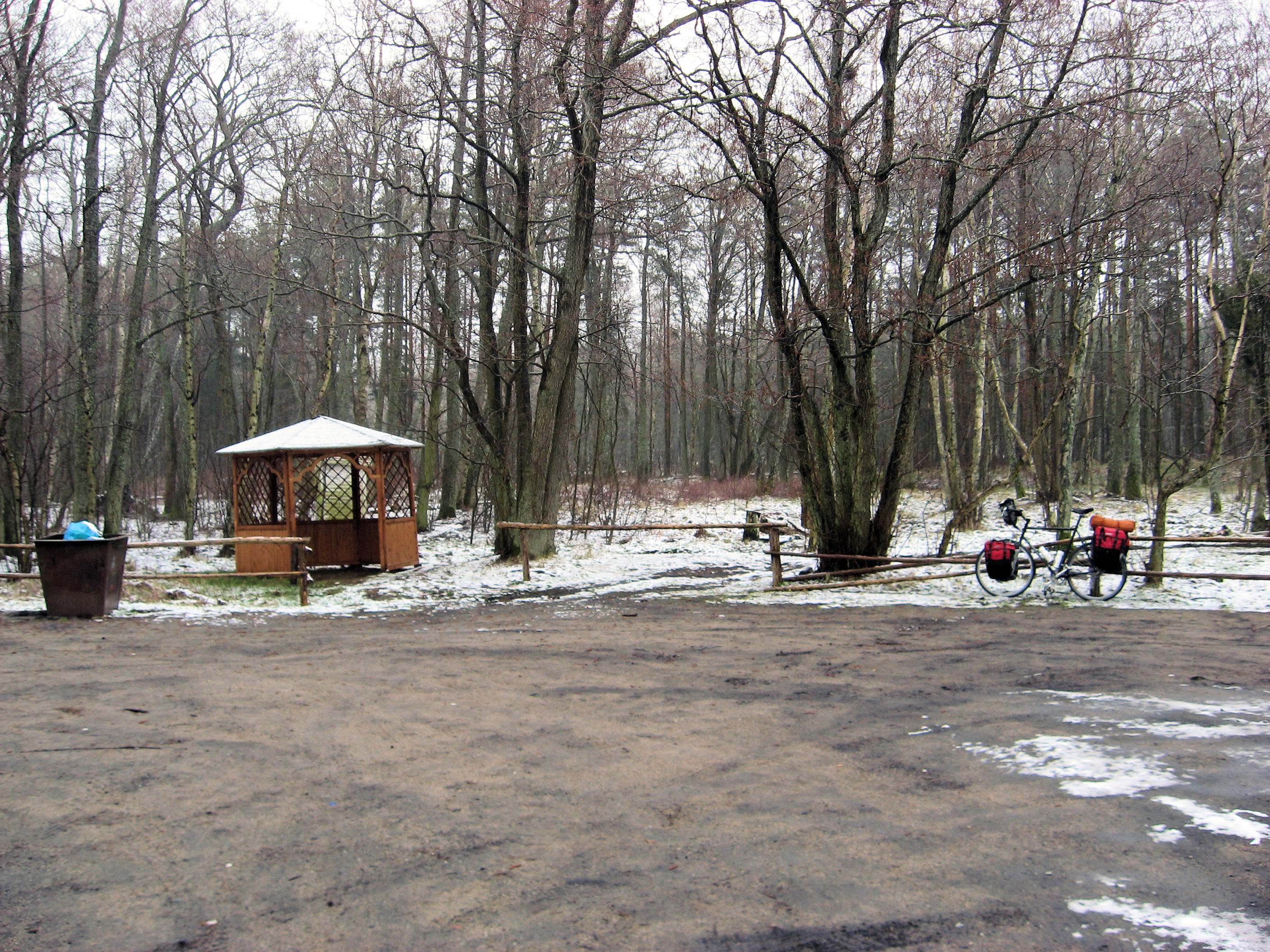
It was nice traveling along this side road. Every 10km or so, would be a small village, some with stores or large concrete block apartments, others with just little houses. Stopped briefly on other side of Volosovo (ВолоÑово) for candy bar and a coke and kept going. The rough spots kept my overall speed down and there wasn’t much wind so it was a slow steady slog. Finally at 116km, came across the main ring road and then just another 7km to the line of Gatchina (Гатчина) . Hooray!, I had arrived. It was a few kilometers of mixed walking and riding and I found my way to the hotel.
The hotel only had room for one night, but they called to other hotel in town and made a reservation for two more nights. Place is to take some easy rest days here before going into the big city on a Sunday morning. Apparently no internet in the hotel, so will see what chance I have to update things.
127km today. 2450km across Europe. 4088km total.
]]>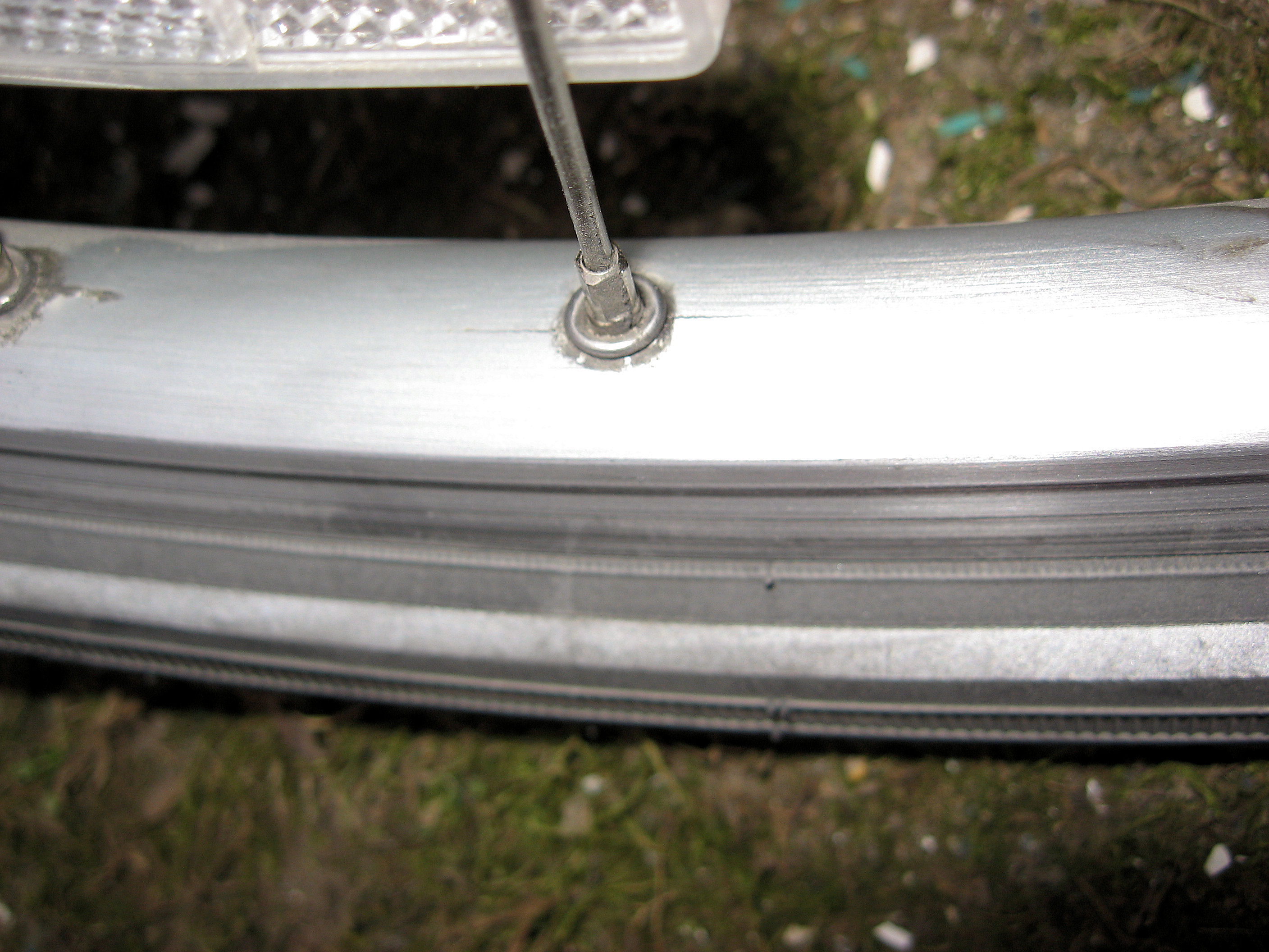
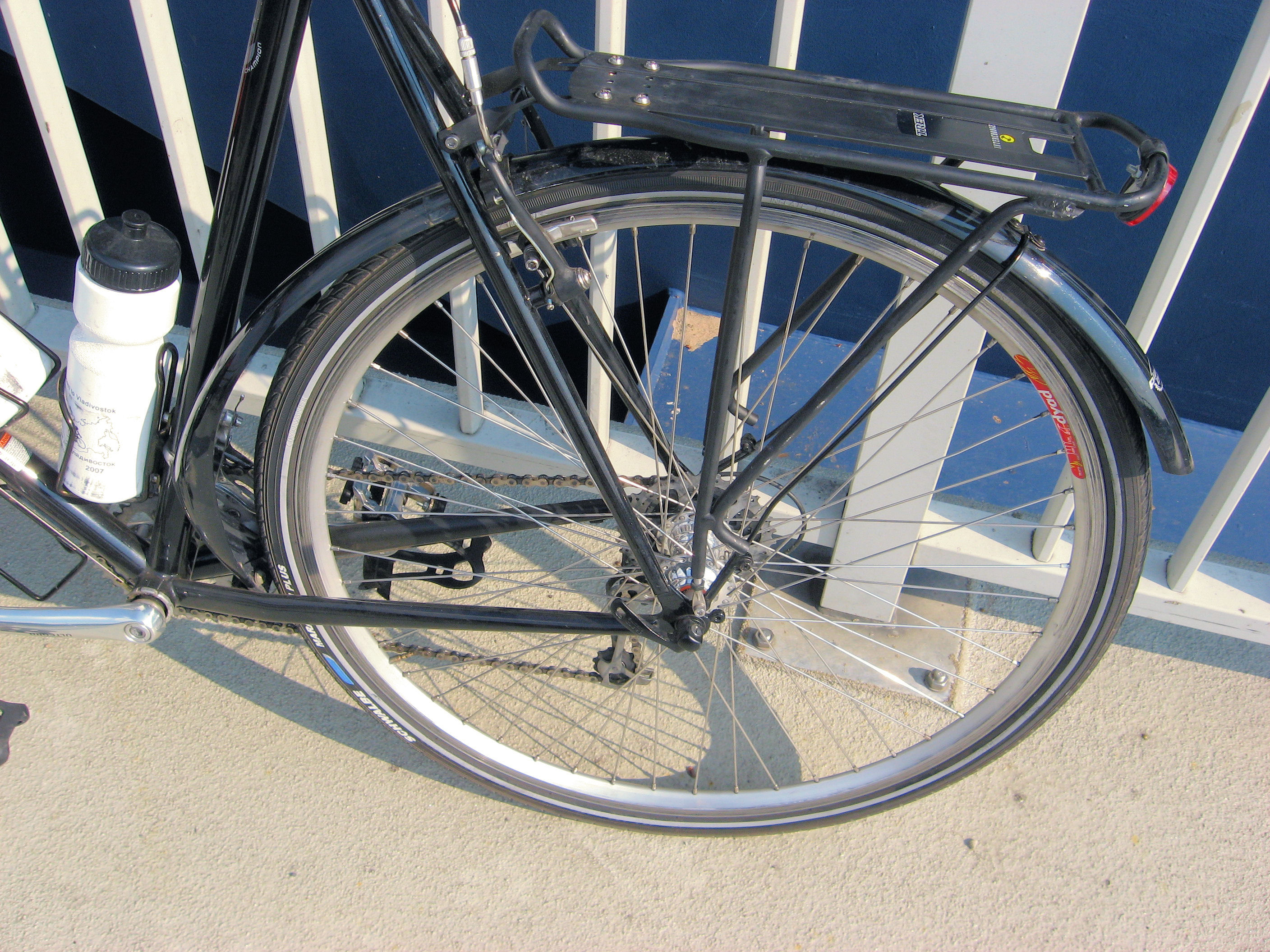
 Today I must have followed a rain cloud into Narva. However, not long after I’ve arrived the cloud moved on and it is sunny with few clouds. The day started out a little slow, since I wanted to check into these cracks developing in the front wheel. As you can see from the photo, it doesn’t look like much, but enough to make me nervous longer term. I left the hostel and wandered through town, stopping at 8am when supermarket opened to get breakfast.
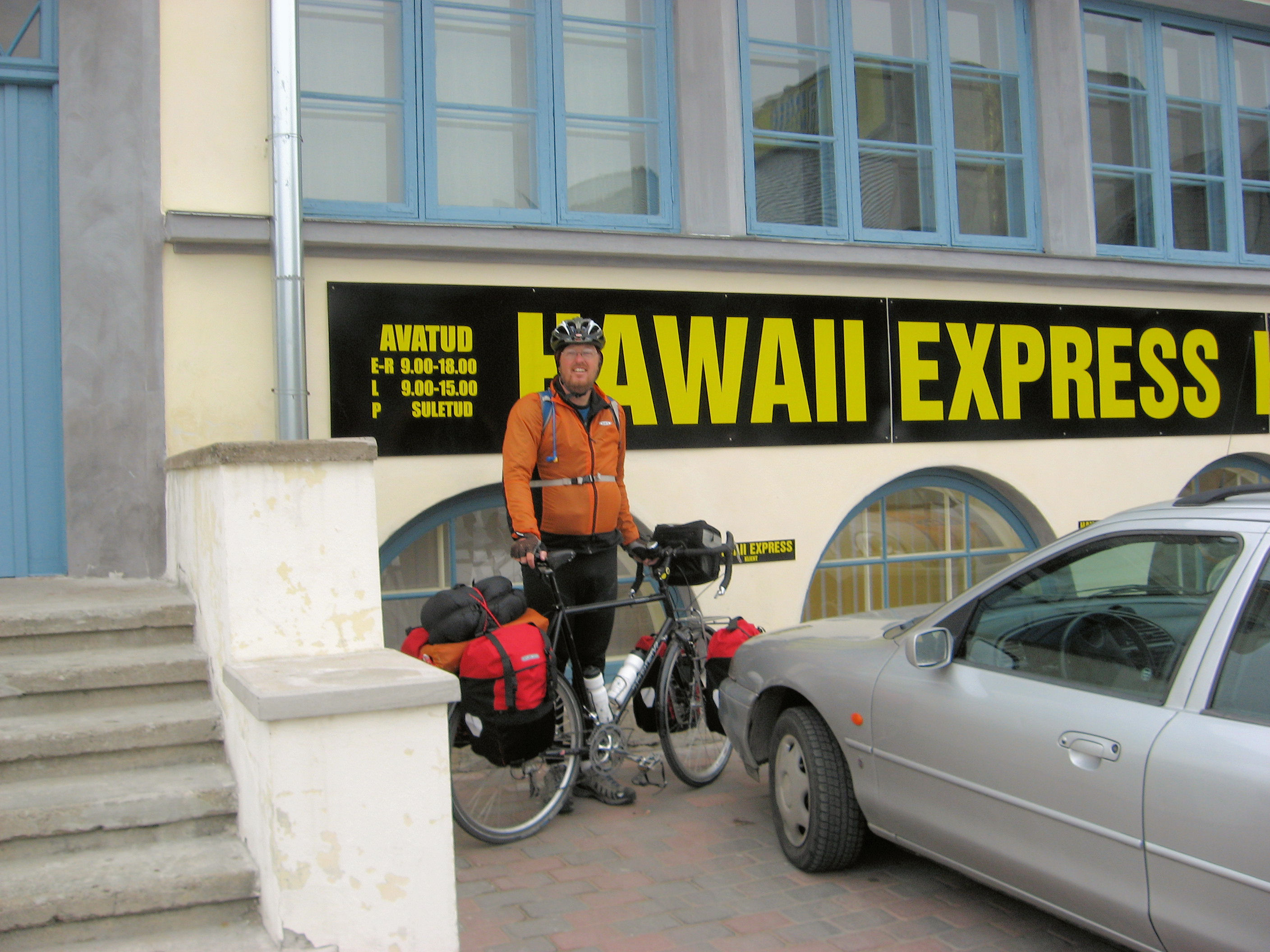
Next to HAWAII EXPRESS bicycle shop. Their sign said they opened at 9am, but I tried the door and found someone at 8:30am. They had a nice deep wheel double wall rim. We replaced my current front rim with a new one. I also refreshed the brake pads in front. It all went fairly quickly and smoothly and didn’t take long before I was ready to roll again. The new rim rides well, though I notice it needs to be trued a little more for up/down bounce. Owners were helpful, even answering my questions of why “Hawaii” when that was exactly 12 time zones away.
Next, I found my way to the newspaper office and got a copy of todays Rakevere Newspaper, that had my article (see below). After all that, was finally ready to leave town. I missed the turn, but eventually found my way out of town.

 Skies were overcast and on the verge of drizzle as I cycled out of town. They became wetter after that. Fortunately, the road was smooth and I had a tailwind. At 30km, I changed my water-repellent windbreaker for my rain jacket. Now it was raining more steadily, so it just became a “heads down keep riding steadily” exercise without much stopping. What I did see of the area was mostly open fields with a few slight hills of glacial deposits.
At 68km, I passed Jarve, and stopped at gas station for lunch. My top had been keeping warm under the rain jacket, but my legs now also got a chance to warm up. I could put on thermal underwear but found in the ride from Kaliningrad that this would mean two layers to get wet. After a warming lunch, it took some willpower to get back on the bike and into the rain. However, I wanted to try getting to Narva since that would give me some more options in following days and I wasn’t certain what weather might do. The roads were a little rougher near Jarve but then became better as I passed Johvi near 80km. At 96km was Sillamae which seemed to have a major sea terminal and many businesses. The truck traffic became lighter as I climbed over what much be one of few hills at 102km into Sinimae.
The rain let up some as I got close to Narva, though the roads were wet enough that passing traffic still gave a spray. Saw the turn off that split between border crossing and center of town. Found a hotel not far from here. I’ve definitely passed into a town where Russian is the preferred second language and English isn’t as common. I’ve now got four days to ride from here to St Petersburg. I’ll try picking the best day weather wise to get to Gatchina and then ride from there into the city on the last day.
Google maps are back to showing high resolution photos, so I can pinpoint the building for the hotel. You can also see the tendency to have large concrete apartment blocks in these cities.
121km today 2323km across Europe 3961 km total.
]]>
 Add Estonia to the list of your next cycle vacations. I’ve always maintained that Newfoundland and Tasmania are two overlooked places for cycling vacations that really should be considered more often. I’ve only seen two and a half days of Estonia but what I’ve seen suggests this is a third place to add to that list. The roads are good and there are small cycle routes indicated that go along some of the back roads. I haven’t figured out Estonian but seem to get by ok with some English. There is long light in the summer.
I had breakfast at the hotel and then packed everything up. Today was planned as a short day, ~83km to Rakvere since after that places with hotels became less certain. Some smooth roads and tailwinds made for a good start. At 5km, I crossed the main road 2 from Tallinn to Tartu. From here traffic was light as I cycled through Roosna-Alliku and past Aravete without noticing too much.
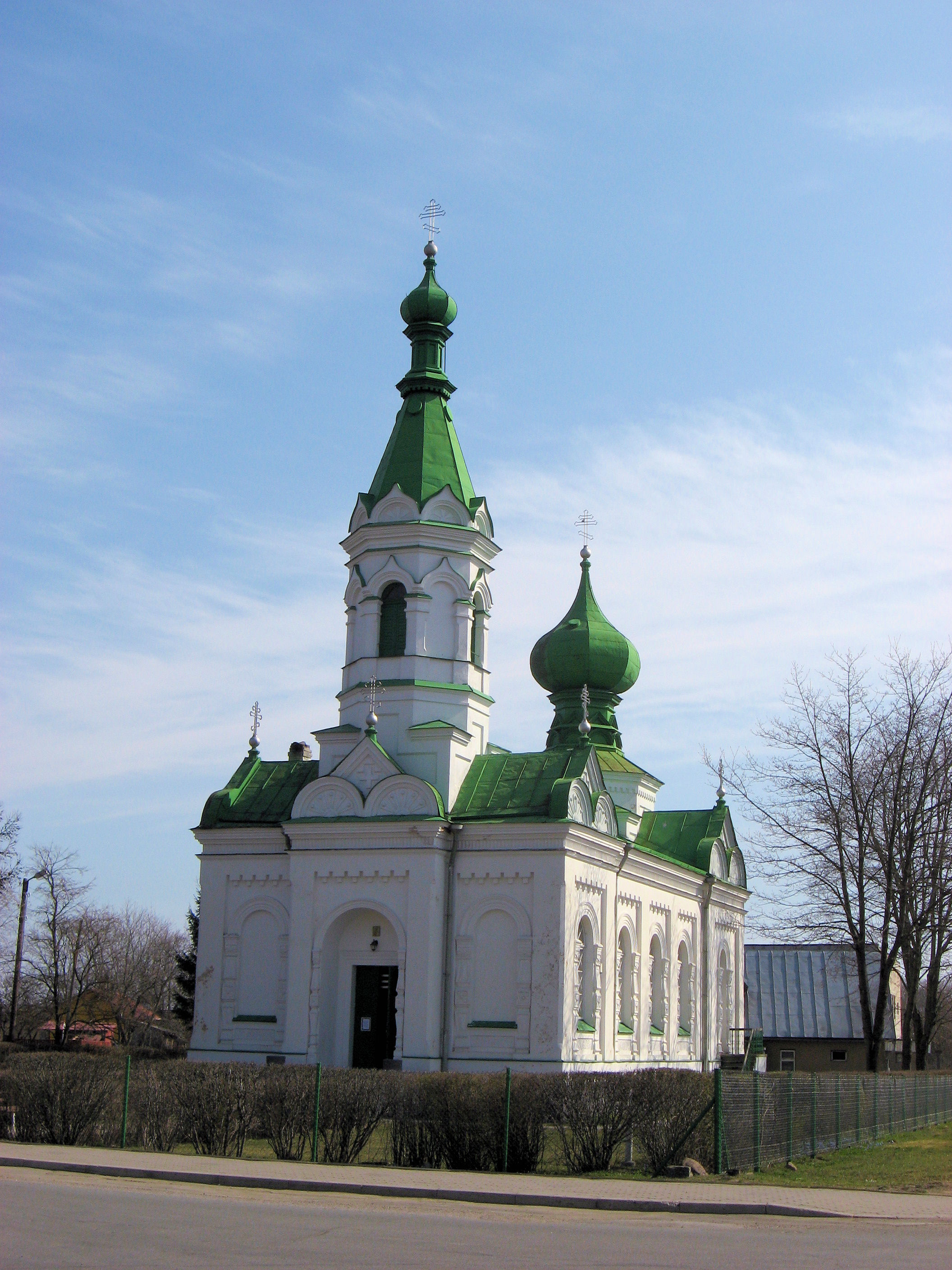
Next big town was Tapa at 53km. I took small roads into Tapa. I may have passed another boundary as this was the first Orthodox church I saw. I parked outside the market and had lunch from the market. I’ve noticed that bananas in Estonia come from Panama. Outside a beggar approached, he asked me for something in Estonian. I wasn’t quite certain so just responded “Ne Eesti”. Surprisingly he responded in English with words “money” and “please”. I still didn’t give money but did think it was interesting that even the beggars here have a need to know some English as second language.
 It took a little wandering out of town but soon back on the main road. As I was cycling along, another cyclist came alongside and we rode together. His name was something like “Indrek” (thank you below for help with the spelling). He was teacher, sometimes philosopher and also bicyclist. It was fun cycling along and learning a little more about things.
After multiple kilometers, Indrak asked if I wanted to see some other back areas. That seemed good. To the north is a large vacant polygon area where nobody lives that may have been used for Russian rocket practice. Seemed a bit too much to go, but as we came to the next road, Indrak mentioned that several beautiful little lakes could be found back there.
The sign said 2.8km, and seemed like an interesting adventure so off we went. The road was occasionally bumpy and surprisingly even steep in one or two places. It looked like an interesting glacial feature that indeed hid behind several different pretty lakes nestled into the forest. There were also these beautiful little purple flowers just starting to bloom.
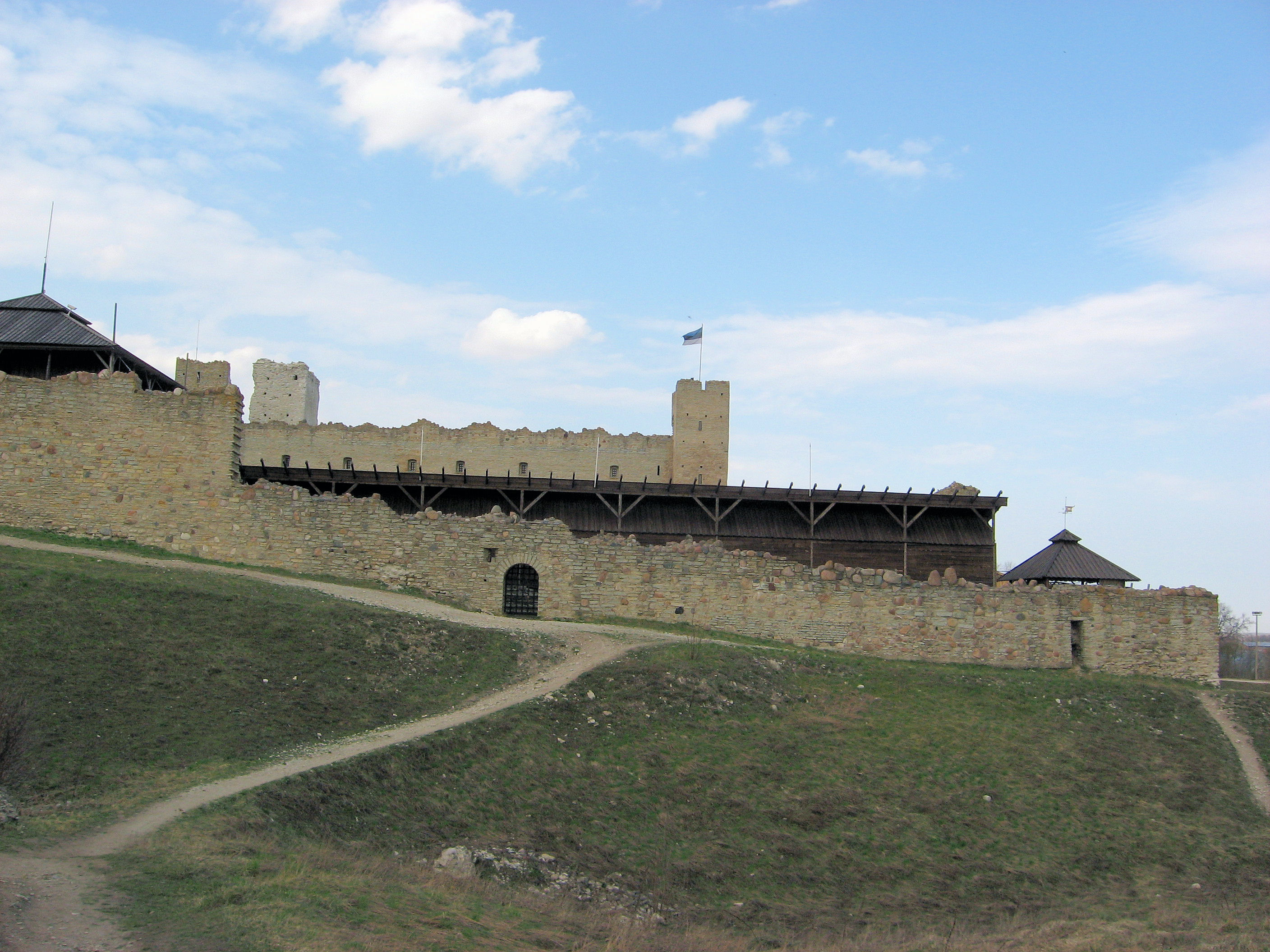
We stopped once or twice to check the local information board about the area. Those boards and my map suggested we might be able to find back roads to Neeruti as well. With one wrong turn, we otherwise found our way to the town. Time to check the map and we found more back roads that would get us all the way to Rakvere. Fun! The adventure continued as we cycled along on quiet roads and had conversations about global warming and other issues. The kilometers went quickly. On the skyline overlooking Rakvere is a large castle. Was I interested in investigating? Sure, seemed like an extra bonus to the adventure. We found our way up to the castle but signs indicated it was open May to September and by appointment other times. However, another car pulled up and seemed that one of those appointments might be happening. So, after negotiating the price, we found ourselves on a guided tour of the castle.
This location dates back to the 6th century as a site for a castle with more recent history in 1200s and wars in early 1600s. I got the history somewhat mixed up (but more can be found here) but seemed to have been fought over by Russians, Swedes, Poles and others. After the 1600s had fallen into ruin until restoration in early 1900s and more recently in 1970s and 1980s. Several tourist oriented items could be found such as torture chamber, archery targets, shops and others.
After the tour we wandered around the castle. They then let me know that a local reporter was there and was curious to write a story about my travels. So, I gave the interview about my trip, where I was going and where I had been. It is supposed to be in tomorrow’s Rakvere paper so we’ll see (better response than I got by telling the Fort Collins Coloradoan).
The tour guide told us where to find an inexpensive hostel, and Indrak helped guide me here as well. Thanks, I certainly appreciated the extra hospitality and occasional Estonian translation help as two cyclists found their way around town. Made a short day a little nicer with some extra back roads explorations.
I did notice that my front rim has developed some cracks around the spoke holes. Not sure how long that has been going on, but I’ve also seen a good bicycle shop here in town so may investigate the two together tomorrow.
87km today. 2202km across Europe. 3840km total.
]]>
 A nice ride into the middle of Estonia. I followed highway 5 which cuts across diagonally and heads towards Narva. The road was a little quieter than the main Tallinn/Riga road and occasionally bumpy but overall a good road.
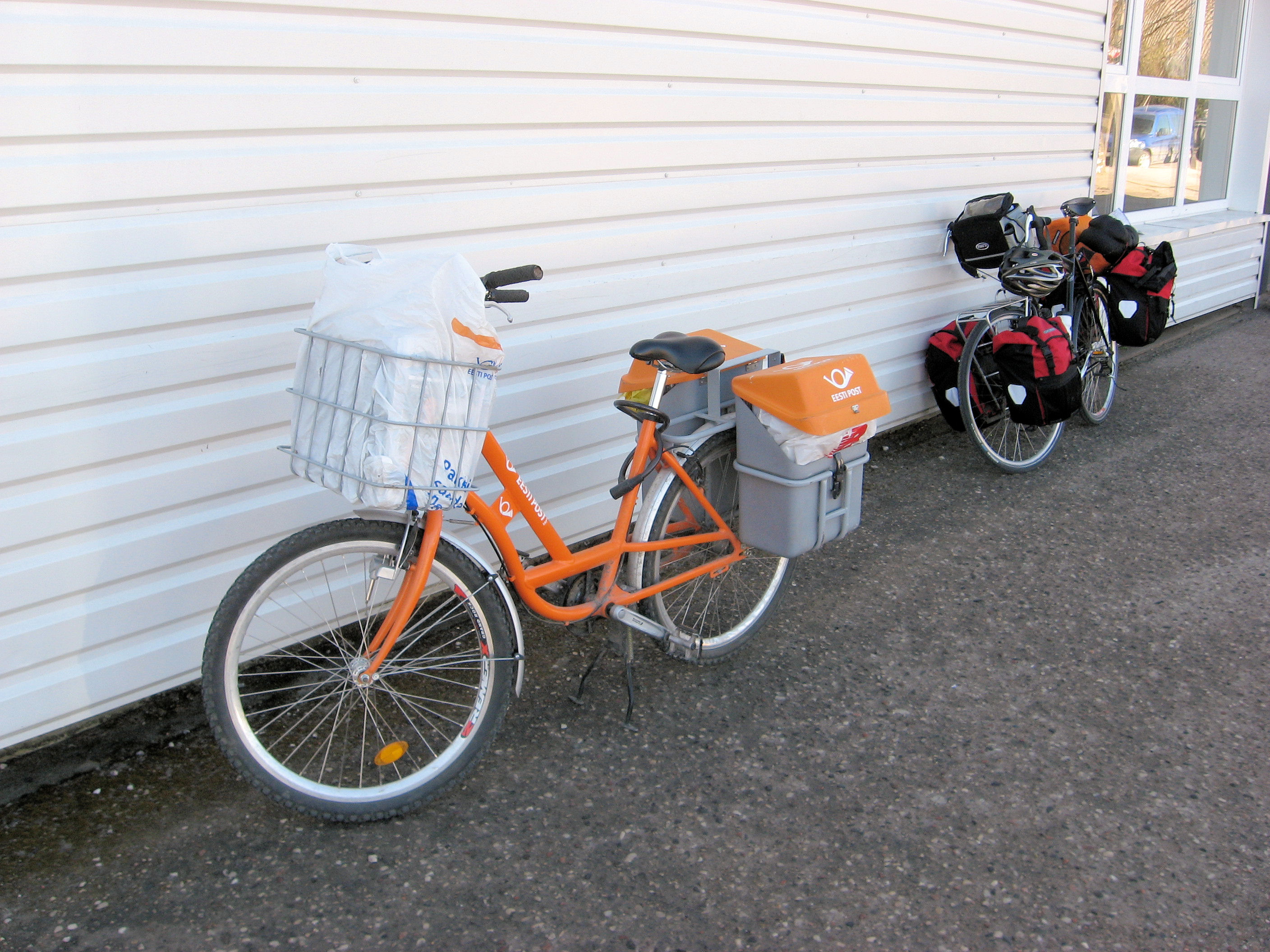
Had breakfast with the tour group at the hotel. This was a buffet and so chance for other foods including some pickled herring that seems to be more common here. I also notice some more exposure to Finland and a little more prevalence of the Euro than in other Baltic States. After breakfast, packed the bike and headed off down the road. It took a bit to find my way back out of Parnu, but the road rapidly became quieter after that. Passed some open pasture lands and also some areas of forest. The road seemed to bypass the centers of the smallest settlements so overall was fairly quick. I made a brief stop at Selja at 26km then a more complete stop into Vandra at 47km. Vandra was off the main road and had a hostel. It also had a market where I stopped for early lunch foods. From photo above left, looks like the Estonian postal bike and my touring bike have some similarities.
After lunch, more quiet cycling through the forest areas. At 65km, came to a region boundary and after that some rougher chip seal. The road stayed flat though detected some slight rises and dips. Close to 80km, a short bike path in Sarevera and then into busier town of Turi. Turi seemed to have a bit of town pride with bright yellow banners and a well maintained town center. It was nice to slow down and walk through a bit of it. From here the road became both busier and worse condition as it was the main road connecting Turi with the next town of Paide.
Came into Paide and went from bypass into center of town. The hotel was located right next to the information area. Nice central location gave me a chance to walk around some and see some of the town. It surprises me how many large apartment buildings there are even in smaller towns such as this. Otherwise, nice easy ride today. I’ve got some extra time coming into Narva, though the weather also looks like a front will be moving through.
94km today, 2115km across Europe, 3753km total.
]]>
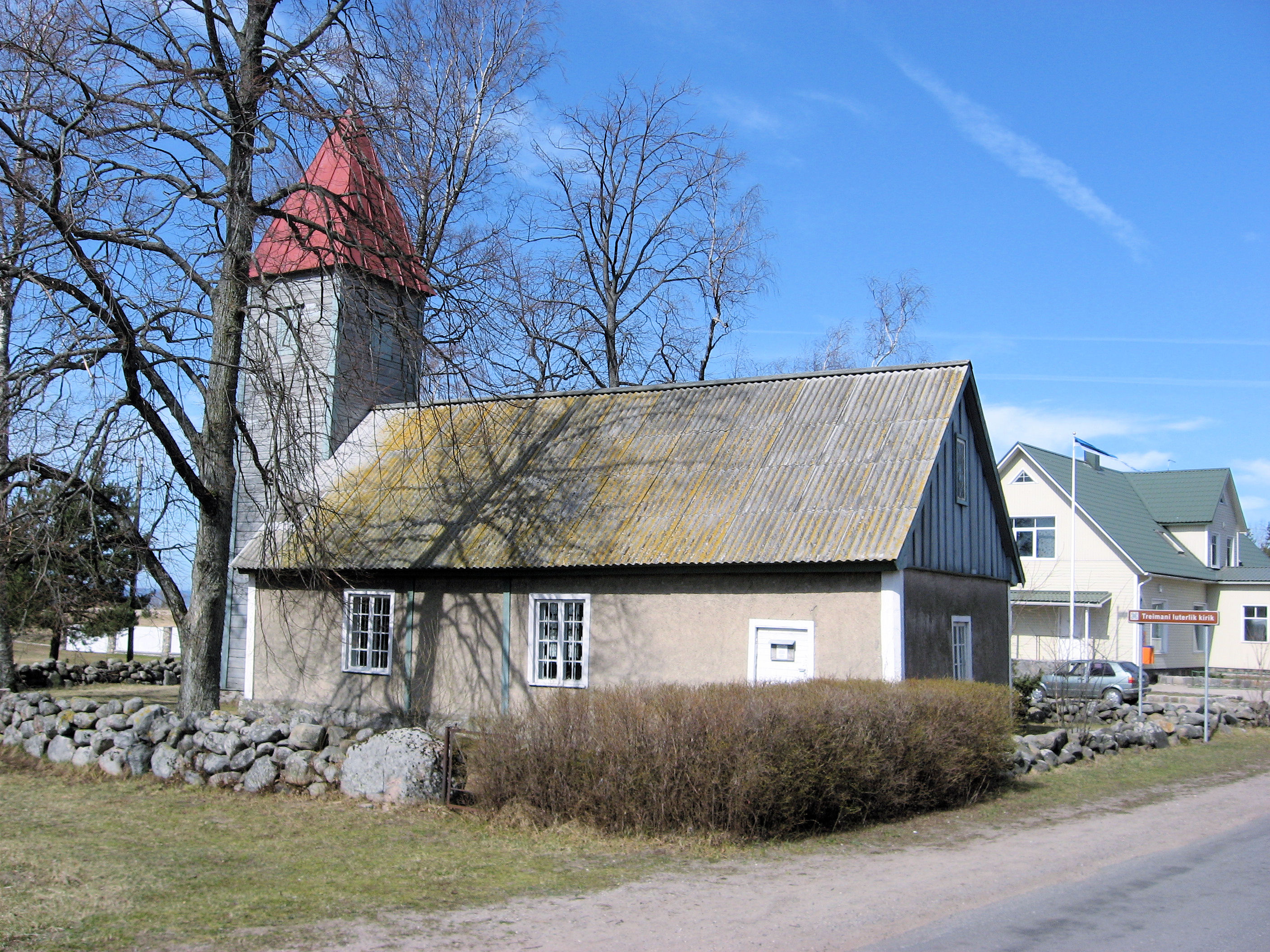 I passed a few boundaries today. There is the border of Estonia at 71km and also 2000km cycled in Europe. Sometime I also seem to have passed a religious boundary as the old churches I see are now Lutheran rather than Catholic. I followed the road along the coast. While I could occasionally see the Gulf of Riga, much of the time I was either cycling inland or hidden behind some trees.
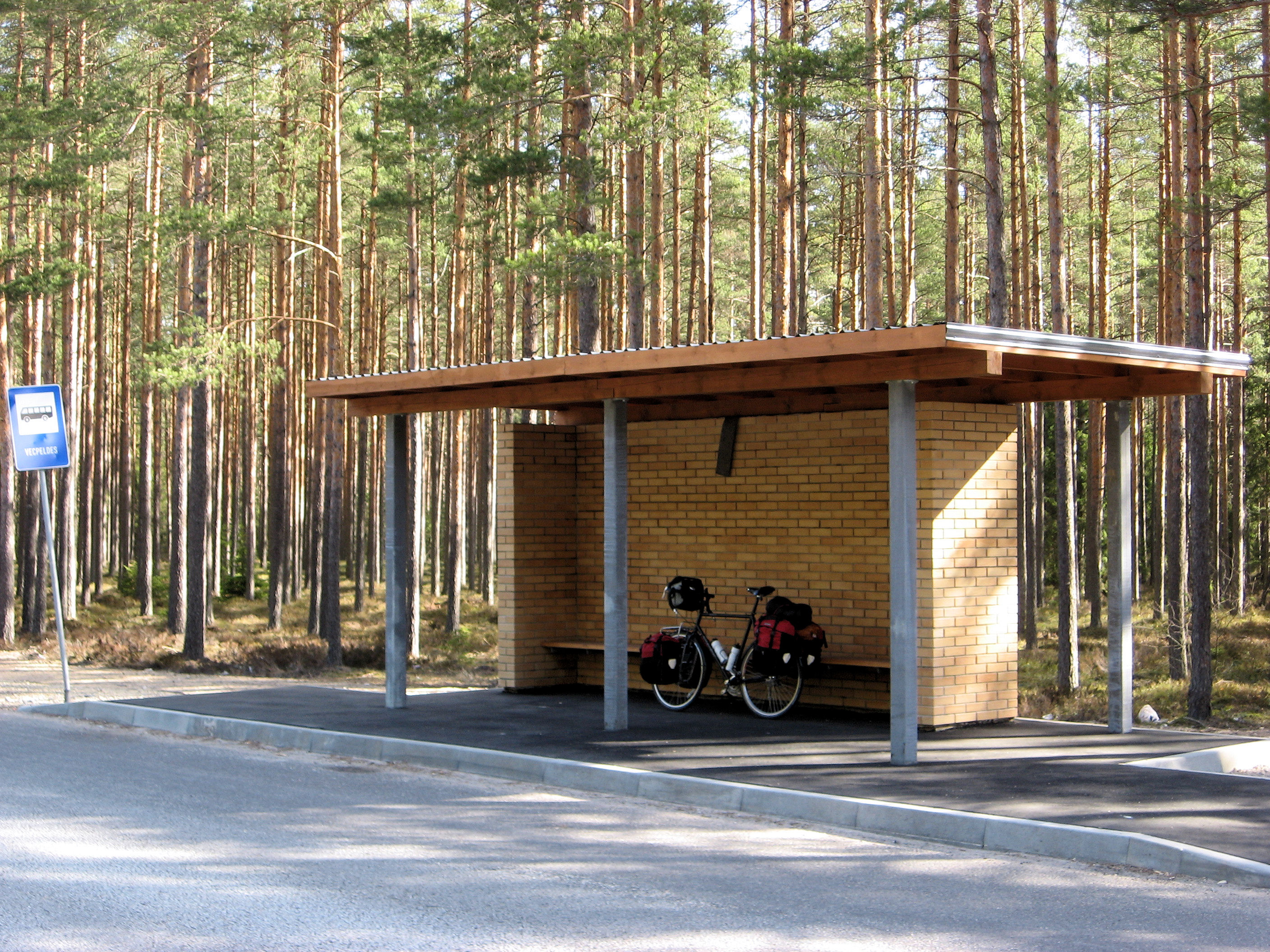
Everyone at the guest house was still asleep as I awoke. So waited until 8am and then made some noises and they figured out how to let me out. Back to the dunes and back to the main road. First 10km, the road was occasionally rough but then I passed through a few construction zones and into an area with brand new road. The next 40km had very smooth new road. As shown below there were even newly built bus shelters. Traffic was very light as I cycled through the forest on the smooth quiet road.
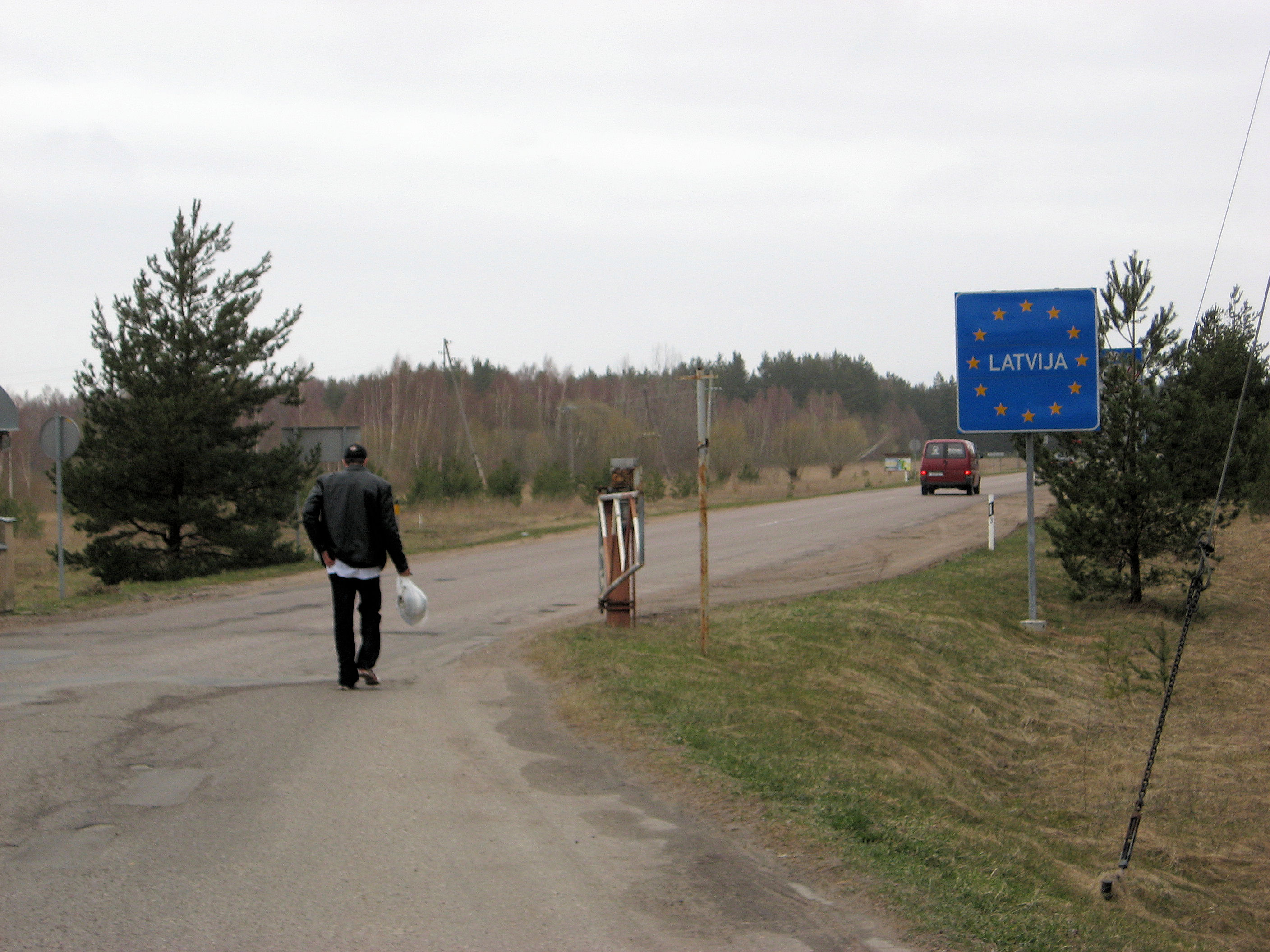
At 51km, I came through Svetciems and here the road become older again. A few kilometers further and at 57km I was into Salacgriva where I had a lunch break at the big gas station. Another 13km was Ainazi. I had originally thought of this as my destination for the day. However, the motel at the turnoff looked uninviting and it was such a beautiful cycling day. So I decided to cross the border and see what I would find. It was an uneventful border crossing just a kilometer further. I asked the border guard where I might next find a cash machine to get money. Haademeeste or another 25km or so. The guard also suggested taking the old road.
The old road was marked as a cycling road and went along the coast. It was peaceful and quiet though a bit bumpy cycling along this road. Lots of trees and forests. In some of these areas I see evidence of logging, but also lots of untouched forests as well. I passed another hotel, but again wanted to see about getting money. Several of these settlements had old Lutheran churches. The houses also seem to occasionally be brightly painted. Finally at 96km came Haademeeste (the Estonian language seems to have a lot of doubled vowels some with double dots on top). I found my way to an ATM. I hadn’t quite looked up the exchange rate (~15 kroon per Euro, ~20 per dollar) so it was fun when the menu gives you choices…hmm how many to pick. I randomly picked some and was on my way. I somehow never quite found the guest house in Haademeeste, so decided to try the main road again and see where I next found a hotel.
There were a few promising candidates as I cycled along, including a nice looking hotel at 114km. However, the sign seemed to indicate it was closed for renovation, so continued on. Went through a nice nature area at 104km that had several hiking trails. Road traffic was slowly getting busier but road was smooth with a 50cm border. I also stopped in at a gas station to buy a coke but at least as much to see how many kroon for a cola and get a sense of the exchange rate.
I passed through Voiste at 114km, Uulu at 125km and then a major road coming from the south. The road now became busier but I was also close enough so decided to continue and see what I found at Parnu. Once I passed the city limits, I took the local roads. I found a nice hotel just as a large bus full of tourists arrived. However, they still had room so I settled in after a long but nice day of cycling. I made my 7th border crossing today. After the 8th, I don’t expect many for a while.
137km today, 2021km across Europe, 3659km total.
]]>
 Today was somehow destined to be a short easy rest day. As I looked at the map, I figured I had two extra days, and considered spending one of them in Riga. However, the hotel was expensive and I had seen a bunch of old town so might be nice to get out of the city. Weather forecast called for headwinds from the north.
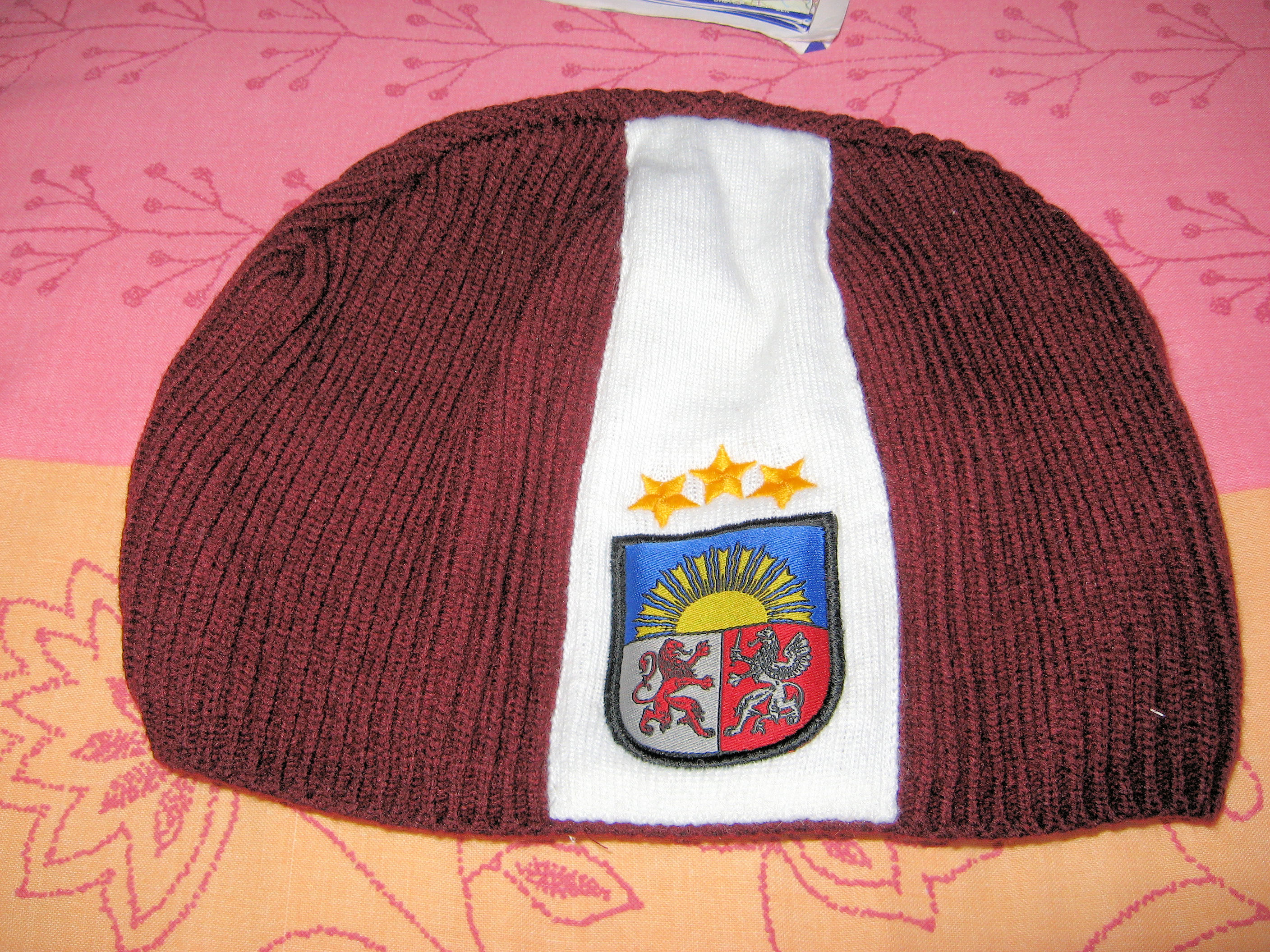
I then noticed I couldn’t find my warm hat. Not quite sure where it went, and it could still show up but with the weather being as it was, a warm hat was important. The hotel desk hadn’t seen the hat, but could let me know where I might find a replacement. So, I parked the bike in the room and went off to the store. Most shops don’t open until 10am, so had to wait a bit before finding a nice Latvian colored hat.
Now off to ride out of town. The main road was busy but straightforward. In one stretch with cobblestones I walked but otherwise was able to ride with traffic. By 10km, the road turned into a major expressway. I stopped briefly to check my map when a police officer came up. He didn’t scold me for cycling on the expressway and was helpful in confirming my next turn.
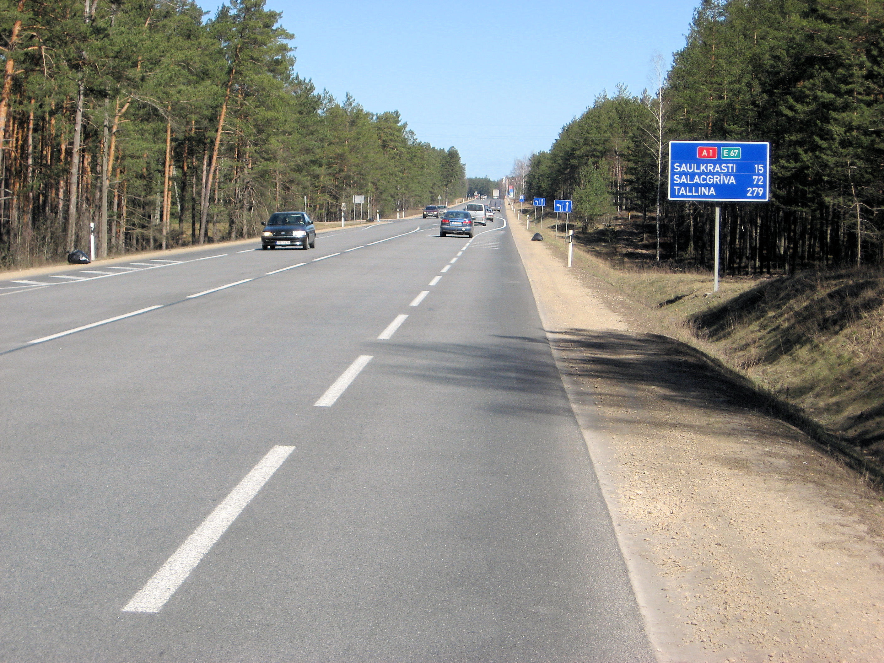
At 14km, came to major road intersection where A1 headed north. I would follow this road on to Estonia. After a brief stretch of forest, it was wide open with a strong headwind. My speed dropped as I slowly cycled against the wind. Fortunately after a few kilometers, the road turned a bit and more importantly went into the forest. The road had a nice shoulder until 35km. From here no shoulders and still a fair amount of traffic.
First signs for Saulkrasti at 41km including a nice looking hotel. Went on for a bit to find the next hotel. Followed signs off to the beach and found a small hotel right on the beach. Has a bit of a feel of a family home that they happen to have a cafe in the basement and rent a room upstairs. Otherwise a nice quiet easy day. Back towards town is something posted as internet cafe so may see if I can send this from there.
44km today. 1884km across Europe. 3522km total.
]]>
 Riga is the largest city I cross between Amsterdam and St. Petersburg. It is also the capital of Latvia. Riga had over 900,000 inhabitants in 1991, but is now has a little over 700,000 as many of the ethnic Russians in the city moved elsewhere. However, I did see more signs of Cyrillic script along the way.
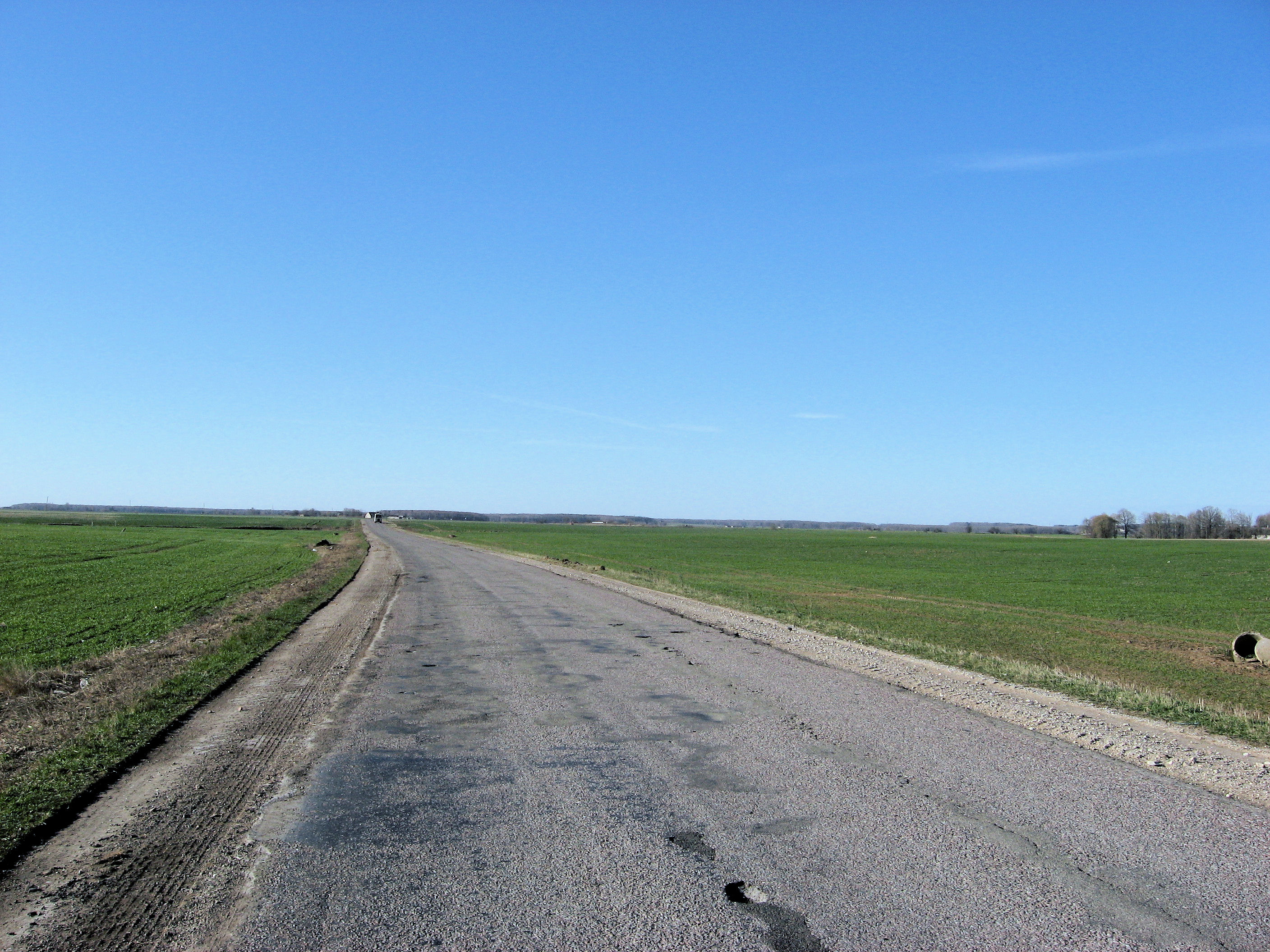
Left Dobele under bright sunshine and calm winds. After finding my way out of the city, through flat open farmland such as that shown at left. The first 14km, the road was a bit rough but got better on joining a larger road. At 21km, I was back to the A9 highway heading towards Riga. This road went through some more forest areas and had smoother stretches. However it was also busier and got a little busier as the morning went along. The kilometer markers started counting down to the end of the A9. Along the roads here even in rural areas are many small bus stops. The small villages might have a real shelter at the bus stop and the countryside just as a bench or even just the sign. What is useful is the bus stops also provide a small place for bus to pull away from traffic and hence also a cyclist to pull over to the side.
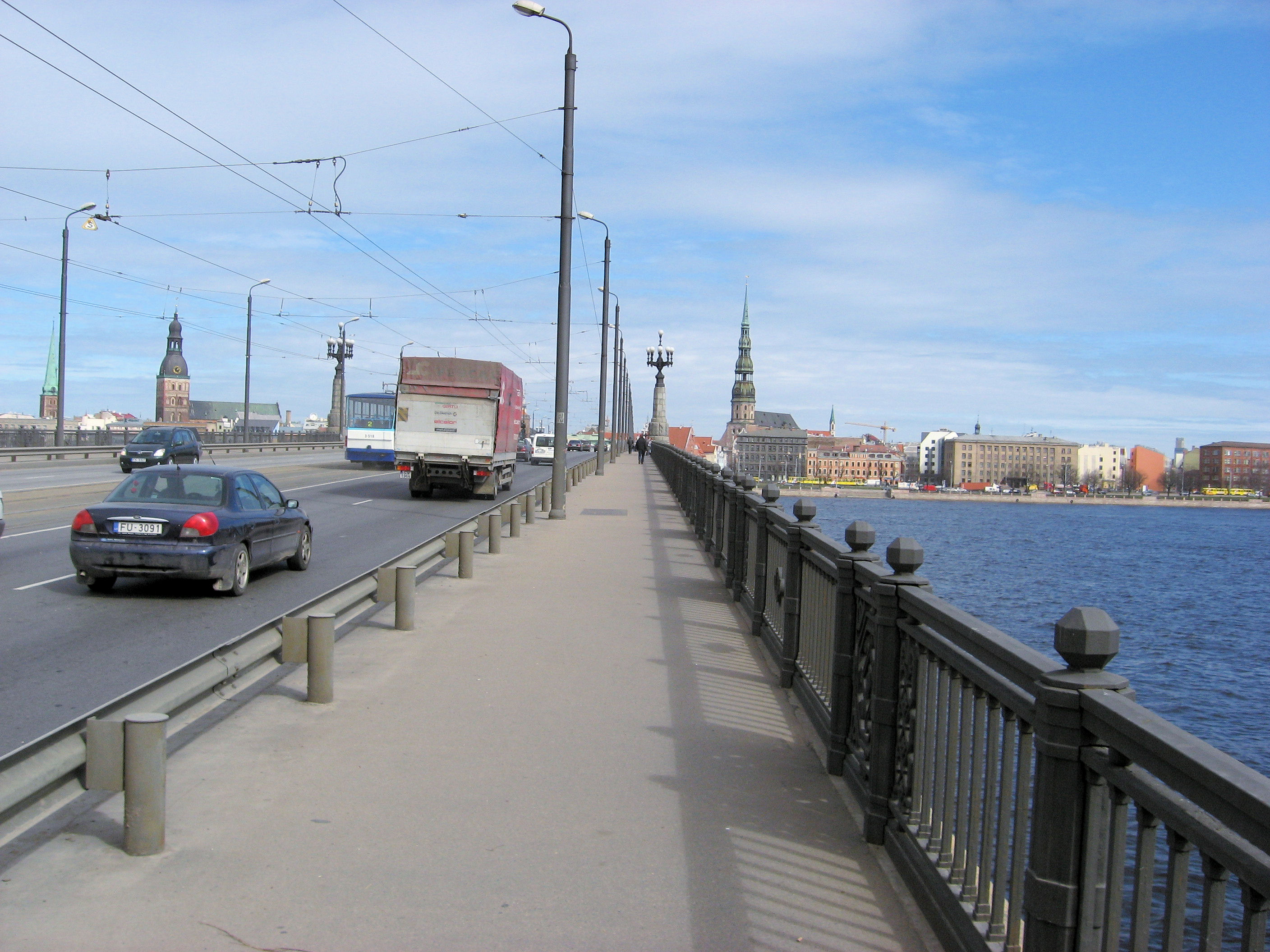
Made good time and by 59km I was to the end of the A9 highway. Now a choice to make of how to get into the big city. The main highway went left, so I followed A5 right instead. After 5km, I came to the smaller P132 road that went via Marupe. This was a little bumpier though also likely less busy. Another 5km brought me into Marupe and shortly thereafter to the city itself. In contrast to Polish cities, cycling into Riga was surprisingly easy as the pavement stayed in good working order. I cycled most of the distance but after coming to the large 1941-1945 war monument walked in further.
The war monument was one of the grandiose Soviet style monuments with three soldiers fighting, a statue of mother Russia and a tall column topped by several red army stars. There were 16 flagpoles (15 republics?) but no flags flying. Also not much else at the monument. From here I walked to the river and then across the bridge into the old city of Riga itself. Hooray, that wasn’t too hard.
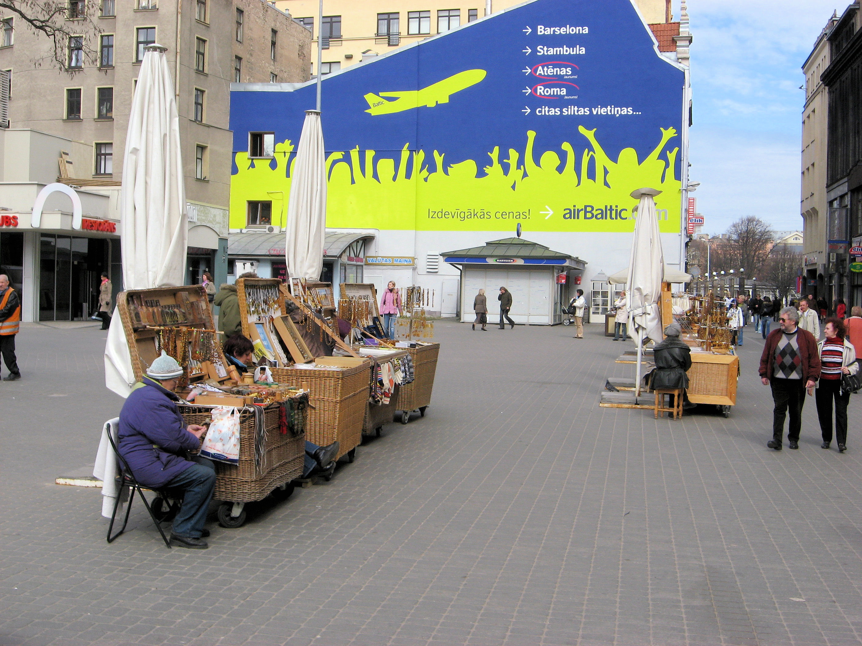
 I went to find a hotel not too far from city center. The first one was quite expensive but could recommend me to something still pricy but less expensive. It was just before 2pm, so after a quick shower and change of clothes I had time to walk back to center of the city and do some walking around. The photo at left shows several street vendors selling amber. Apparently large amounts of amber is found in Kaliningrad area and smaller amounts in other parts of the Baltic States. The photo at right shows the old town square with nice historic buildings.
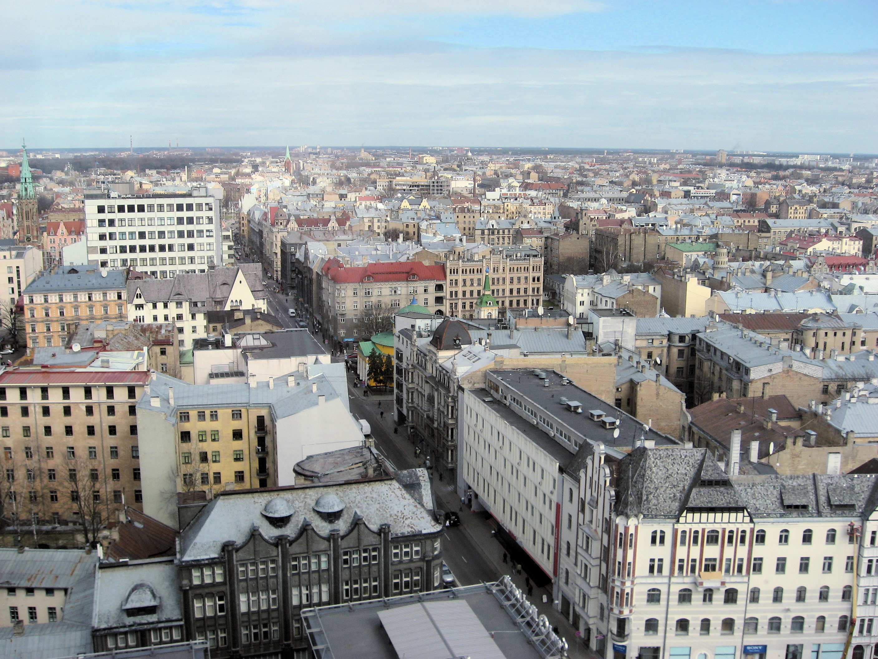

 The next four photos shows an eclectic mix of different images from my wandering. First a nice city view to the east from above on the hotel.
Next, a pay telephone where the interesting feature seems to be that many of these city pay phones are marked as “wifi” phones. It seems that the Latvian telecom has turned pay phones into wireless access points. You can then buy cards to use that give a temporary user name and password and hence use wireless from within ~100m of these phones.
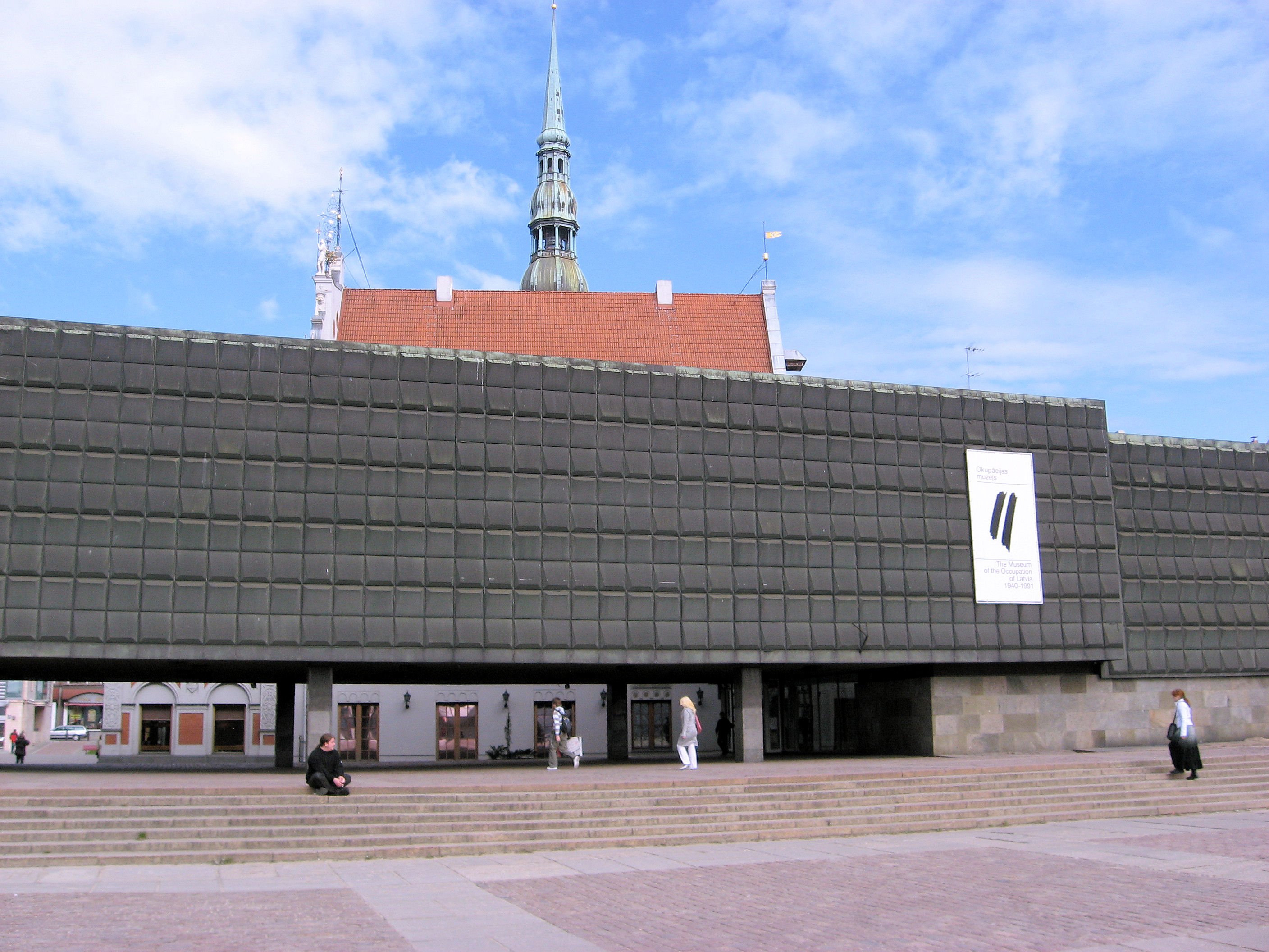
Next was the rather sober “Museum of National Occupation of Latvia”. This was right downtown and free with a donation. I spent some time walking through the carefully chronicled exhibits that showed the history of how in 1939 Latvia accepted Russian military bases, in June 1940 accepted Russian demands to replace its government and how that government a month later joined the Soviet Union. It showed how Latvian national institutions were broken down in 1940, the war years under German occupation and then the post-war years as Latvia was changed to be a Soviet Republic with the means of repression and camps used, as well as how national institutions, agriculture, religion and others were all shaped. It ended with a brief chronology of the end of the Soviet Union along with Latvian declaration of independence. Would be curious to see different perspectives on this history but this museum was strongly nationalistic Latvian.
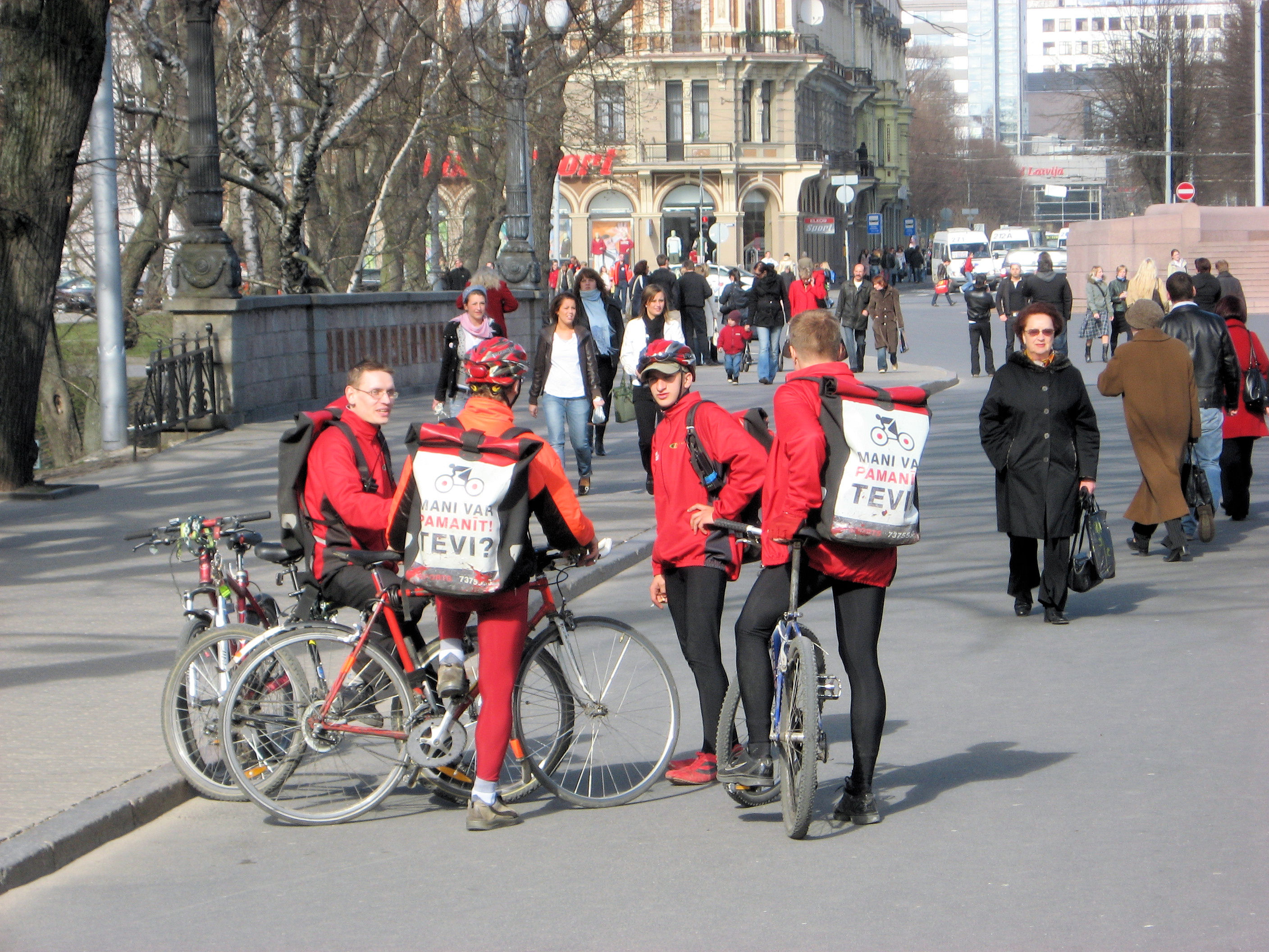
The last photo shows a few bike messengers I saw on the street. Like messengers everywhere, they seem fearless as they dart amongst the city traffic. Quite a bit more nimble than I’ll be on my loaded touring bike.
79km today, 1840km across Europe, 3478km total.
]]>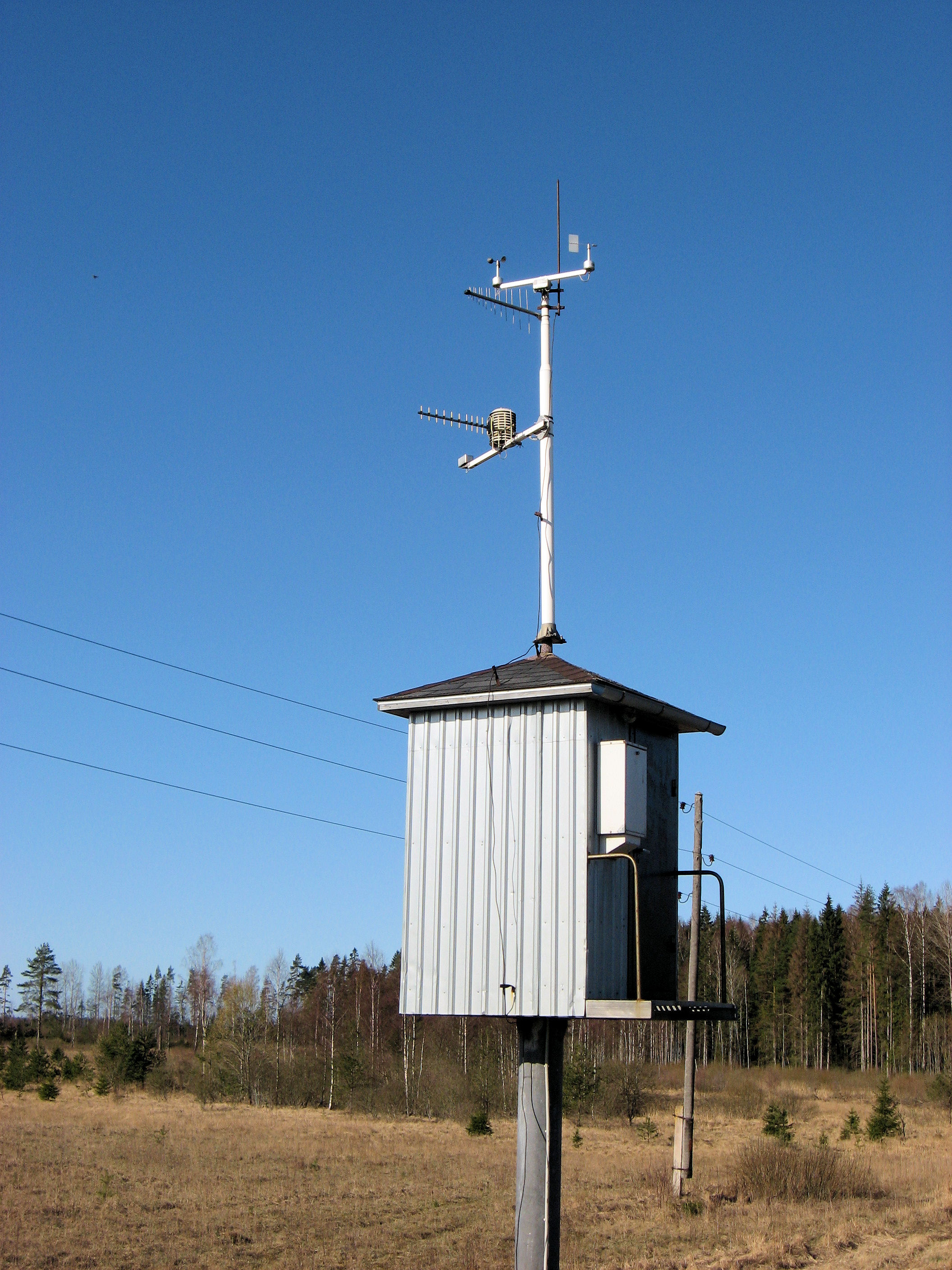
 Weather keeps improving in the Baltics. Awoke to bright sunshine, though cool temperatures. Waiting until 8am to have breakfast as the cafe opened. It was about 160km along the main road to Riga, so wanted to get about half of that cycled today. The road was busier than south of Liepaja but otherwise quiet and good road. There were some gentle grades to go up and down but rarely anything to coast. I’ve passed several of these weather control boxes as on left along the road.
At 10km was Skrunda. I cycled along and before I knew it I was over the bridge and out of town. Occasional forests but also open lands. Saw sheep and open pasture areas. The wind was mostly from behind, so quiet peaceful cycling.
At 35km, came to the turnoff to Saldus. I took the turnoff to go into town as I expected it to be one of the largest places to go through today. Stopped in the center of town at 40km. Saldus had an old church dating back to 13th century. Also an active open market and a supermarket to fuel up on more food.
The photo at right shows the restroom (WC) in Saldus and also an interesting aspect in that you get little receipts here for everything. As you can see in the blown up inset, here is my carefully numbered receipt for Ls 0.15 for use of the toilet. I sometimes keep these little receipts but mostly find next places to throw them away.

 After Saldus it was back to the open road. I saw two of these World War II memorials such as shown at left. I found it curious that the end of the war was still denoted (1945) but no longer the start when Latvia was forceably joined into the Soviet Union. I also saw several concrete type bunkers so can imagine the front was in this area for a while.
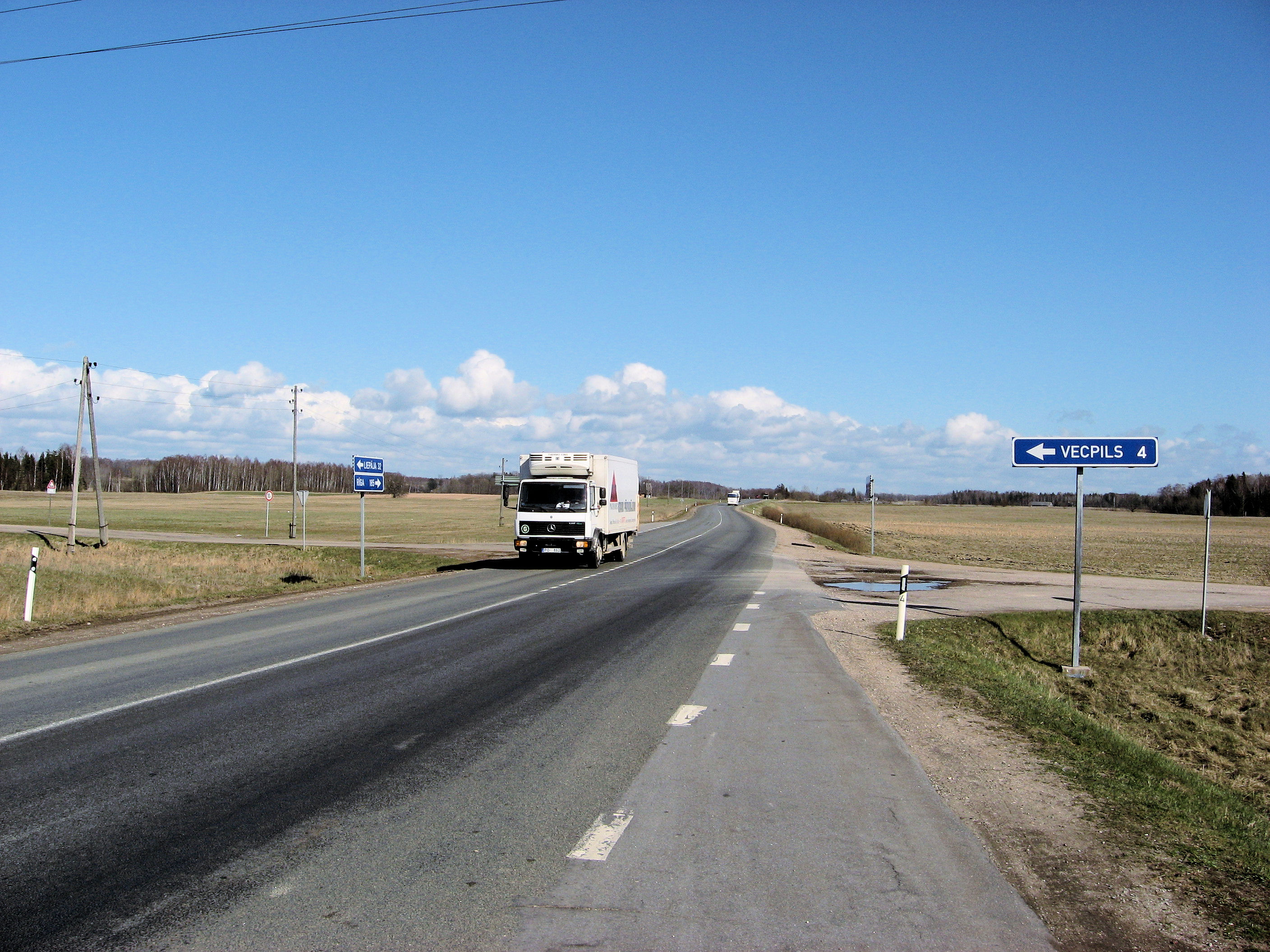
At 65km, I passed the boundary from one region to another. There was still an older Soviet style marker but at least as useful was the large tourist boards. These showed no hotels in the next 95km on the main road. They did however, show a hotel in Dobele, 30 km further on: 16km on the main road, and 14km on a side road. So my destination was set.
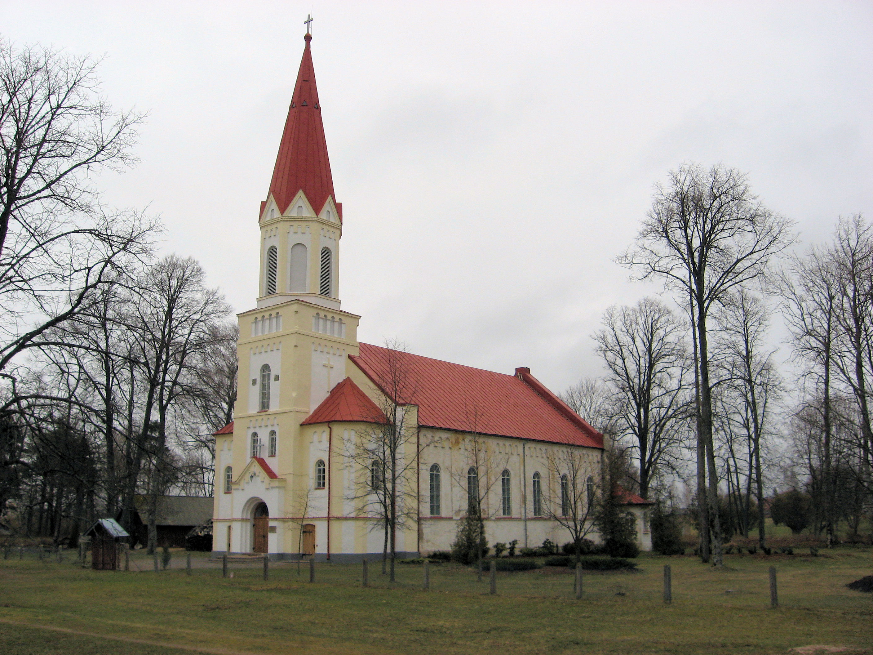
The road became better in the new region. However, at 81km, even the smaller side road was a good condition. Without too much difficulty, found my way to center of town. Here I asked for location of the hotel. Turns out it was right around the corner. Dobele has a nice historic town square dating to 1495. One of the shops even sells bicycles and bicycle parts. There is a nice historic church.
I went out to nearby supermarket. The yogurt was from Latvia, the apples from Italy, carrots from the Netherlands and ice cream from Russia. I wonder how many of those trucks have been passing me on the road.
By the way: if a cyclist from St Petersburg is reading this (or someone has contacts in St Petersburg), let me know. I’ll be there for three weeks and will look for a good place to have the bike serviced and checked before continuing across Russia. Most of my time will be spent on Russian language studies, but would be nice to meet some St Petersburg cyclists as well.
95km today. 1761km across Europe. 3399km total.
]]>
 Crossed another border and now in Latvia. Not that I noticed much difference so far between Latvia and Lithuania except that language is different and that I needed to change currency. Cold overcast skies when I awoke with a wind from the west. I wasn’t too enthusiastic about going out in the cold, so dawdled a bit before packing everything on the bike and going again. Two kilometers to the main road and then north to the border.
The road northbound was surprisingly quiet cycling. At 8km, I came to the border. There must be some rules about insurance in Lithuania since several places to buy insurance on the Lithuanian side. Otherwise, no border control or need to check out. Into Latvia, it was a simple passport check and stamp. I used the chance to ask about potential hotels after Liepaja.
The road was a little worse on the Latvian side, but otherwise similar in going through the forest, which helped block the cross wind. At 20km, I came to the first real village: Rucava so took the turnoff to see if I could find a bank or ATM. There was nice church in center of town and a small shop, but no change to get money.
Continued quiet cycling with a few open spots where I could feel the cross winds as I came to Nico at 42km. I had eaten some breakfast things before departure but was starting to get hungry. I followed signs to “i” and even found a (closed) office for the visitor information. However, helpful person here told me there were no places to get money in this town. Otherwise, looked like a nice cute town with a library, hotel, shop and restaurant.
 Onwards to Liepaja! At 60km, I came to big sign on the outskirts. This helped me plot a route into town and even showed several banks. Liepaja is a town of 87,000 people but was surprisingly easy to get to the center. I followed side road and then walked along the small tram line for a while. Got myself to the center just before 1pm, hooray! Found an ATM and withdrew Latvian money. Also went to the HansaBank to exchange my remaining Lithuanian money. I must have picked the slowest bank in town as it took 55 minutes before a teller was finally available. The lobby was full, and everyone took a number. However, for a while there was only one teller, and even when there were three they seemed to take breaks or have to spend a lot of time with each customer.
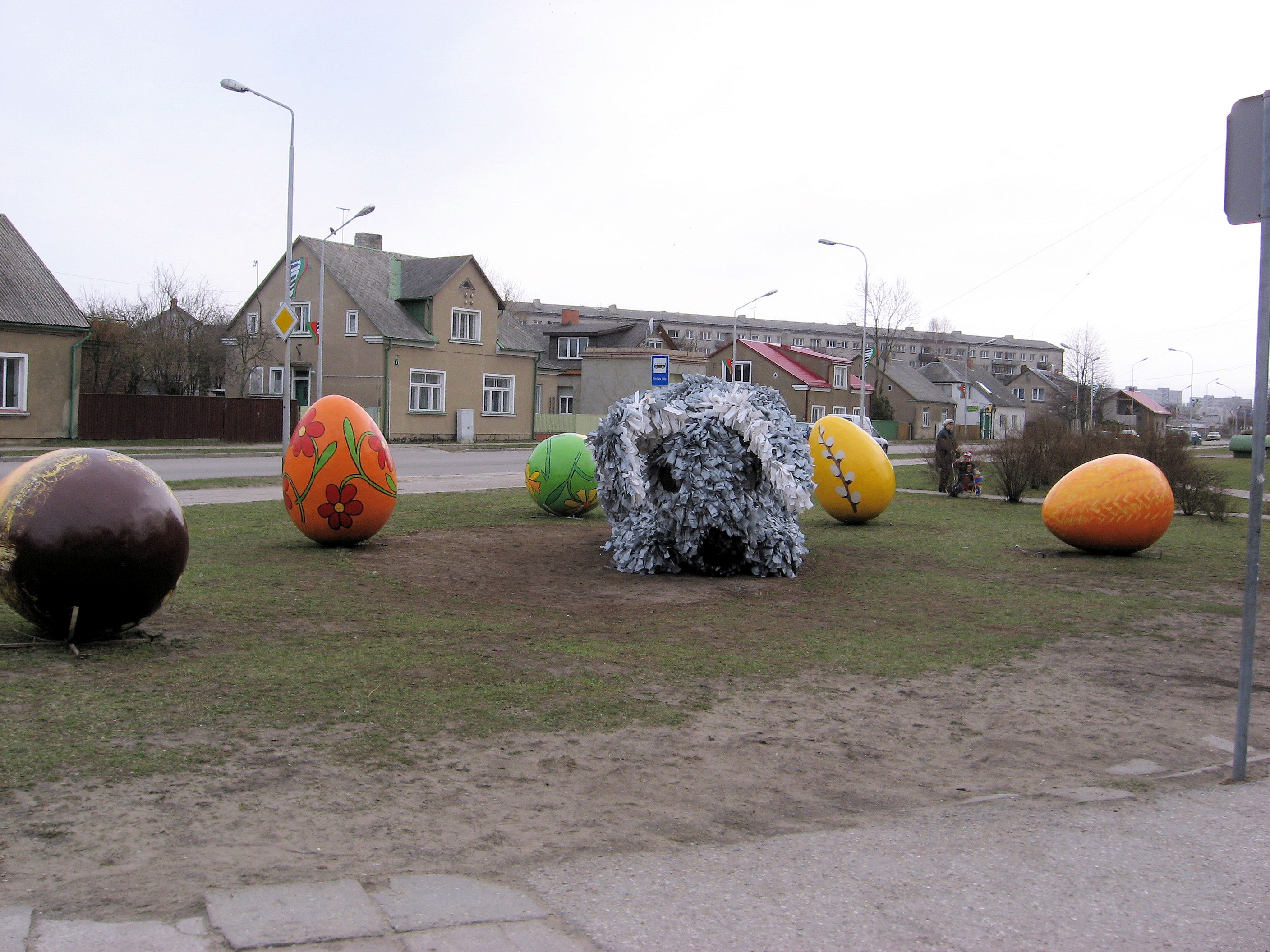
Otherwise Liepaja had a nice town center, and quite a few different big Easter decorations out around town.
After an hour at the bank, I was almost on my way. Stopped at gas station shop for some lunch and then cycling outbound. The west wind was still there so tailwind. The highway was the main one to Riga and busier than the one I had come in on. However, as I got further it became quieter. The sun had come out and it had warmed up as well. There were some gradual hills to climb up and over. There wasn’t much in way of shoulders but traffic was able to pass fairly easily, even in stretches where roads were rougher.
It was starting to be a longer day but found myself to outskirts of Rudbarzi. The customs officer had remarked that there was a small motel in town. I saw a cafe and went to ask about the motel. At the door I noticed a sign with word “Motelis” and so actually had found a motel. Nice place to stay for the night. Internet doesn’t seem as common here as in Poland but am finding nice little hotels to stay at.
By the way, for those of you wanting to watch another cross Eurasia trip: Herman Veldhuizen is about to take off on his trip from Norway to Tibet.
123km today. 1666km across Europe. 3304km total.
]]>
 Today cycled much of the Lithuanian coast on the Baltic Sea. Quiet roads on the Curonian Spit and also some quiet bicycle paths north of Klaipeda. Awoke to cold overcast skies, but very happy to see it was dry. My bicycle made a few new noises after the wet, even after I stopped to oil the chain.
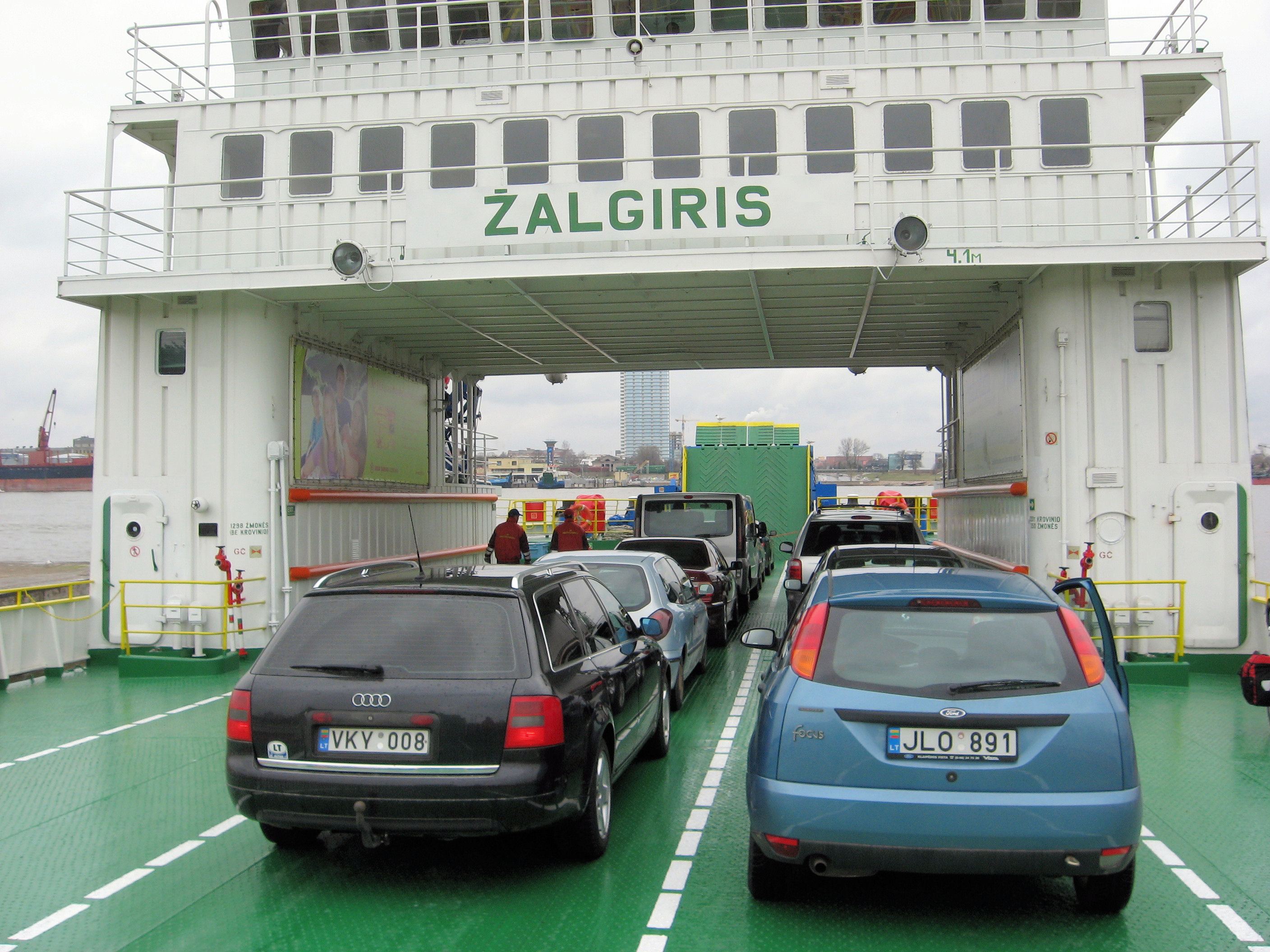
Without too much difficulty, found my way from Nida back to the main road. This road was surprisingly quiet and much of it looked like photo at left. Fairly flat, although a few hills as we neared the end of the spit. The area had signs for a nature preserve as well as indications to stay out of those areas. There was small town of Juodkrante at 30km and at this point the road switched over to follow the bay side. A few small hills and at 46km, I was at the ferry to Klaipeda. As we crossed, Klaipeda looked like a somewhat busy seaport with traffic.
I was still using my large scale Eastern Europe map, so mostly followed the road along the coast northbound. I thought I saw a green tourist information sign, but then passed without seeing it. That seemed to be a theme today as I saw several indications of those information areas in Palanga and Sventoji but at them found not more than an area map. Without too much difficulty, found my way onto 168 and heading north out of the city. Found a gas station here and bought a map of the Baltic States. This was quite useful since it showed the small roads along the coast to Palanga and beyond.
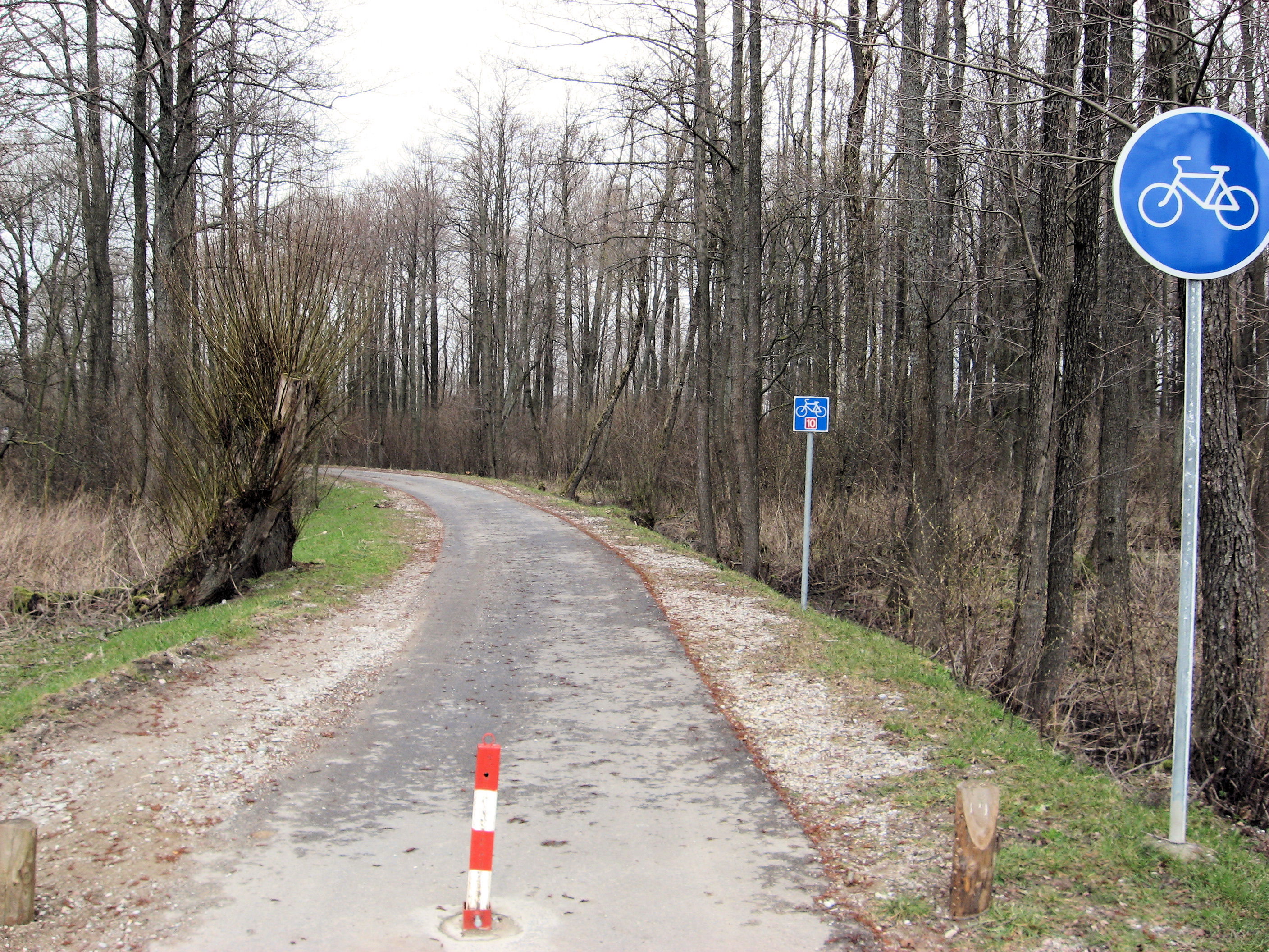
 The small road went along a nature preserve area and had periodic boards with information and maps. It was once again a quiet peaceful road. At 64km, I came passed through Karkle and shortly thereafter came upon these route 10, bicycle path signs. That must correspond to the smallest size route on my map. This was nice peaceful route that brought me through the forest and into Palanga.
Palanga had several hotels, a nice town square and signs but no obvious information point. I did find some signs that had Palanga on one side and Sventoji on the other. What was promising were two things: several points of accommodation listed in Sventoji as well as indications this bicycle route 10 would continue along the way. So, I set off through town and on to Sventoji.
Reached Sventoji and it looked a bit like a ghost town. Several restaurants all looked closed. Their map showed that many of these accommodation points might be guest houses during tourist season. No real hotel or other obvious point. Asked one gentleman who could explain in Russian where to go further down the road. Also three youths with alcohol on their breath who explained they lived in the hotel and I could ask there. Nearby, not very obvious was a small door leading down to restaurant with hotel above. I asked, for 70 lit, found a very nice room and it was a deal. Seemed like a good place to stop since the next 60 km northbound didn’t seem to have much in way of towns. I’m not quite sure if Easter Tuesday is also a holiday but it is all very quiet here in Sventoji. Also no indication of wireless internet, so will see.
I’ve only seen a small piece of Lithuania, but several things became obvious on crossing the border and more today: (1) I’ve transitioned to place where the second language is English, not German. Throughout Poland, and even through Kaliningrad, seemed if you couldn’t communicate they would first see if you knew German. English seems a quicker choice here and also present on some signage. English is more prevalent with younger generation here and Russian with the older. (2) Change back to Latin script from Cyrillic is quick and obvious. This area seems to have more the the EU signs around as if pointing the future to rest of the EU rather than with Russia. (3) Reasonable roads, and surprising amounts of little bicycle paths in this particular area of the coast.
90km today. 1543km across Europe. 3181km total.
]]>
 A wet and cold day as I came back into the EU. Woke up this morning to a light frosting of snow. While it changed to coming down as rain later, the snow on the ground stayed all the time I was cycling. Had a somewhat relaxed breakfast while anticipating the day ahead. Snow showers had mostly changed to rain as I cycled out of town. I was on the north end, so fairly quick on main roads heading north to Zelenogradsk. There was a bit of traffic, but this became far less as I came past turnoff to the airport at 14 km.
There were several small villages but mostly quieter roads after this. The rain was soft but steady so mostly heads down to continue cycling. At 29km, stopped at a Lukoil gasoline station for brief snack. I gave them my Kaliningrad map as I’ve been shedding some maps along the way rather than accumulate them. How far to the border? 50km.
This next part was cycling along the Curonian Spit, a narrow stretch of land and sand dunes approximately 100km in total length. Much of this looked like the photo at upper left, with occasional signs pointing to small paths to either coast, occasional roadside pull outs with tables and a few vacation settlements. The rain caused me to mostly get into slow and steady cycling mode to keep warm rather than stop and look too much. However, looked like an interesting wild and unspoiled area. I was surprised at how many trees I saw along the way.
By 79km, I was through the last of the towns and now onto the border. Curious what I would find here. Exiting Russia was more simple and straightforward than entering and they even let me ride my bicycle across the border. The Russian exit station consisted of four stops (1) first one they just wanted to know what passport I had, once I pulled it out – all was ok and sent me to next stop (2) second stop was customs, once they found out I was US someone came out and asked me in English if I had anything to declare, “no” (3) third stop was passport control, this took a bit and I had to take off my warm hat so they could compare me to my passport photo, then a lot of waiting before finally stamping my passport and handing it back (4) last stop was just a guard gate where they phoned back to make sure I was allowed to leave. Overall, quite simple and straightforward as border crossings go.
Now 300m further was the Lithuanian entry point. Just one stop where the guard came out, took my passport, looked at things and stamped them as good to go. Big signs welcomed me to the EU. I knew Lithuania had its own money but big question was quickly answered for me as I saw signs in Latin script rather than Cyrillic.
The border crossing had caused me to stop and hence feel a lot colder than I had gotten cycling along. I decided it would be better to stop at Nida rather than stay out in the rain too much longer. I took the turnoff and into town of Nida. First stop was the ATM to get money. Next, I went over to a big information area with an “i”. Helpful person there explained (in English) that it was holiday for second Easter Day. Stopped and had some food in the cafe and as I was going out to find a hotel, someone came over and asked if I needed a place to stay. Walked over to these small little cottages nearby. She brought her daughter over who understood more English and we quickly struck a deal. A little wandering through town, but mostly trying to get warmer here from a cold day of cycling.
83km today. 1453km across Europe. 3091km total.
]]>
 Small things. This morning I pumped up the back tire. Well, that sure made a difference. I was riding a bit faster through the day. Perhaps when things felt squishy yesterday, they were in fact squishy. Today was some nice fast flat highway riding and also small roads with hills.
I had a nice breakfast in the hotel. The proprieter was a bit amazed to have someone cycling from Amsterdam to Vladivostok, and shook my hand on the way out. The first 12km were challenging to say the least. Back to busy roads and then onto an expressway going through town. I mostly stayed on the main “7” through town, though in a few spots I tried side paths. There were several no bicycles signs, but I didn’t know other better routes and even saw another bicycle on one of them. I was slightly alarmed though in passing through one of these no bicycles to see several police coming with sirens blaring, but they passed and went somewhere else (and by then I had also quickly gotten onto walking along the sidewalk).
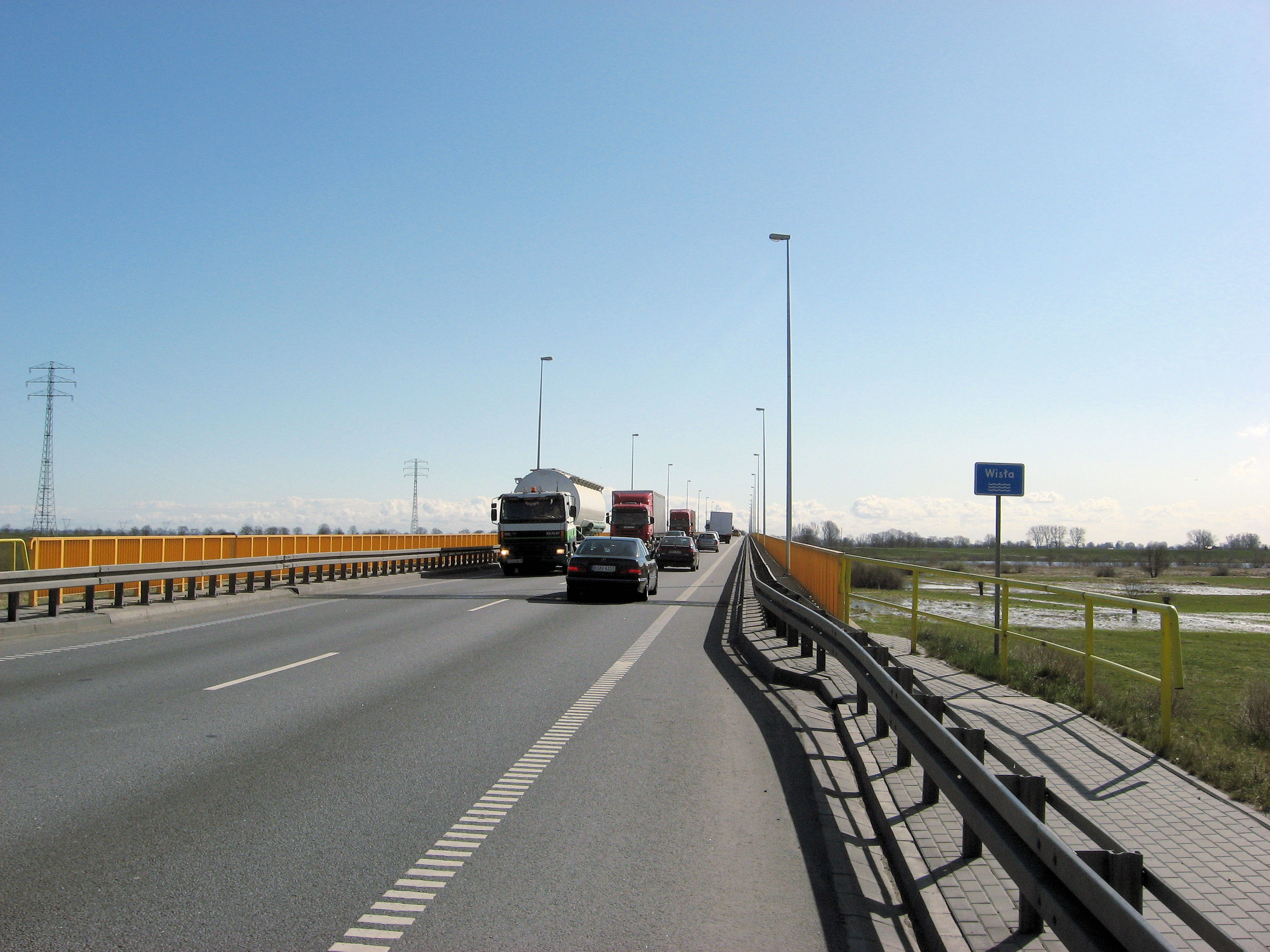
By 12km, reached the other edge of Gdansk and now onto the busy highway with shoulders. Some tailwinds helped me along for a fast ride. I stopped briefly for gas station snack at 26km. Photo at left is crossing the Wisla (Vistula) River at 32km. Even there the road stayed passable. There was some construction at Nowy Dwor Gdanski but nothing too bad. By 61km, I was at the turnoff for Elblag.
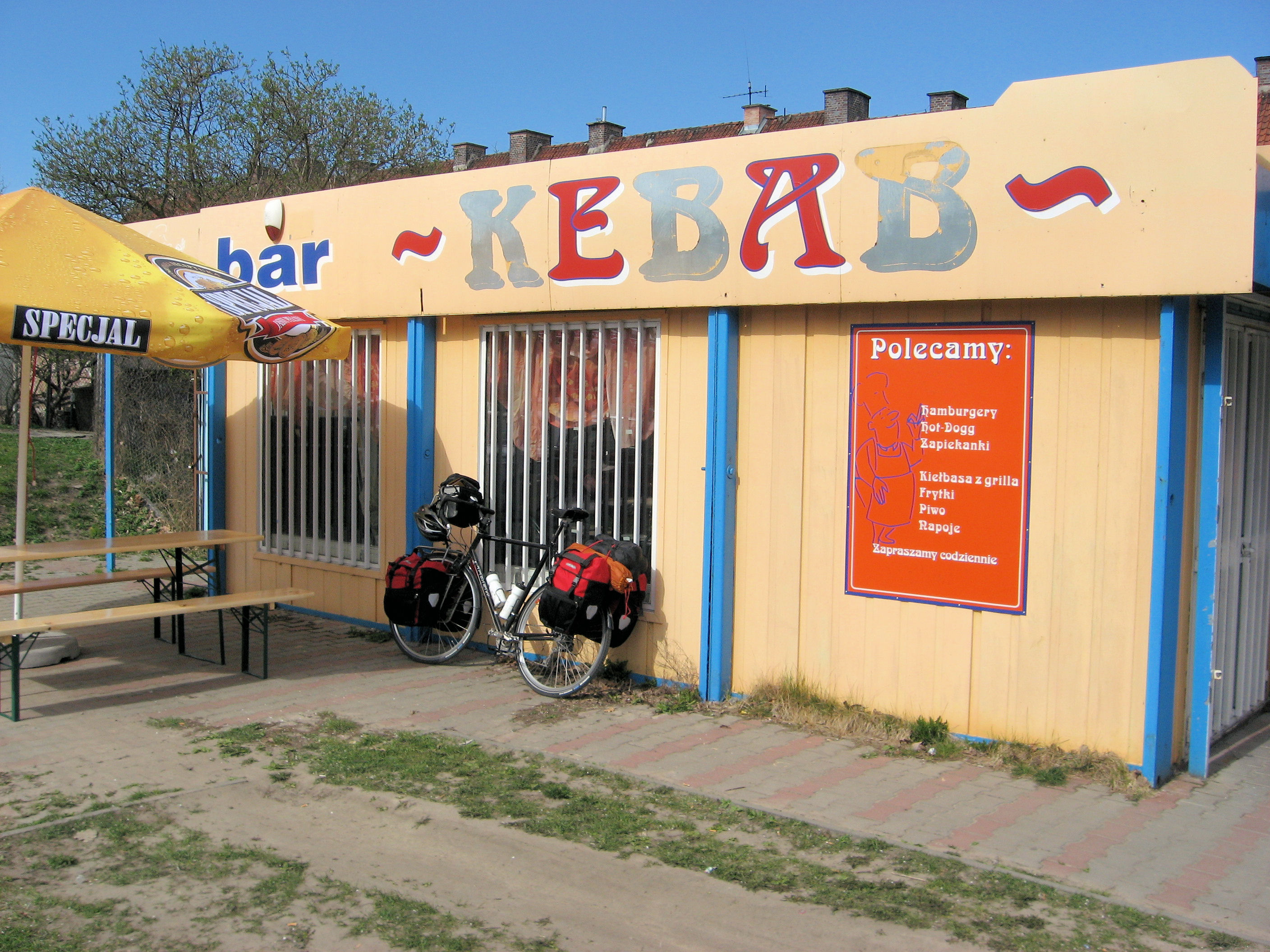
I walked and rode through town. Some broad boulevards, a nice flea market area and as I was heading past centrum, decided for some lunch. Saw the food place at right where the “Polecamy” sign seems to suggest hamburger. On ordering they quickly passed me to someone younger and bolder and I was able to ask “what do you have to eat”. She showed some soup packages, looked good and I had a good meal there.
 Not long thereafter, was on the small road heading up and out of town. The key word being “up” as it climbed gentle grades over the next bit. I shifted more to a crosswind, so also slower going.
This next road was variable. A few spots nice and smooth, but also among the roughest roads I had ridden so far. The cars seemed to be locals who knew where they were going and were driving fast. So, it was tough to pick the smooth parts of the road. It was slower riding with hills, but a little more scenic than the highway.
By about 92km, I saw the Baltic Sea off to the left. In a few kilometers I came to small seaside town of Frombork. It was still on the early side but the hotel at right was just too inviting to pass up. I almost did pass it up, but then also saw a “hill” sign heading out of town and that sealed the deal. Turned back dropped into the hotel.
Had some time to wander through town. The shops still open on Good Friday. I do notice that they still have better toilet paper here than the Russian type from later.
Tomorrow comes a decision point between a “Plan A” and a “Plan B”. My preferred plan is plan A to cross the border to Kaliningrad tomorrow and take Easter Sunday off as a rest day to see the city. The potential issue with this plan is that I noticed too late that Kaliningrad is one of those special cities with restrictions, so don’t know if my business visa will get me through the border.
If I am not allowed to cross the border, then plan B will be to cycle east for next few days to cross into Lithuania. Weather seems to suggest some tailwinds but also some rain on Sunday to Tuesday. Most shops will also be closed on Sunday and Monday. So will just see what choices pop out.
95 km today. 1300km across Europe. 2938 km total.
]]>
 Small things. I had been missing my wool hat, and last night I found it amongst my clothing pannier. Good thing, since today I could use it well. We started the day with another continental breakfast. The person brought me the menu and I couldn’t make out much. After having a puzzled look on my face, he suggested choice #2, and it was a good choice. Eggs and also bread with toppings.
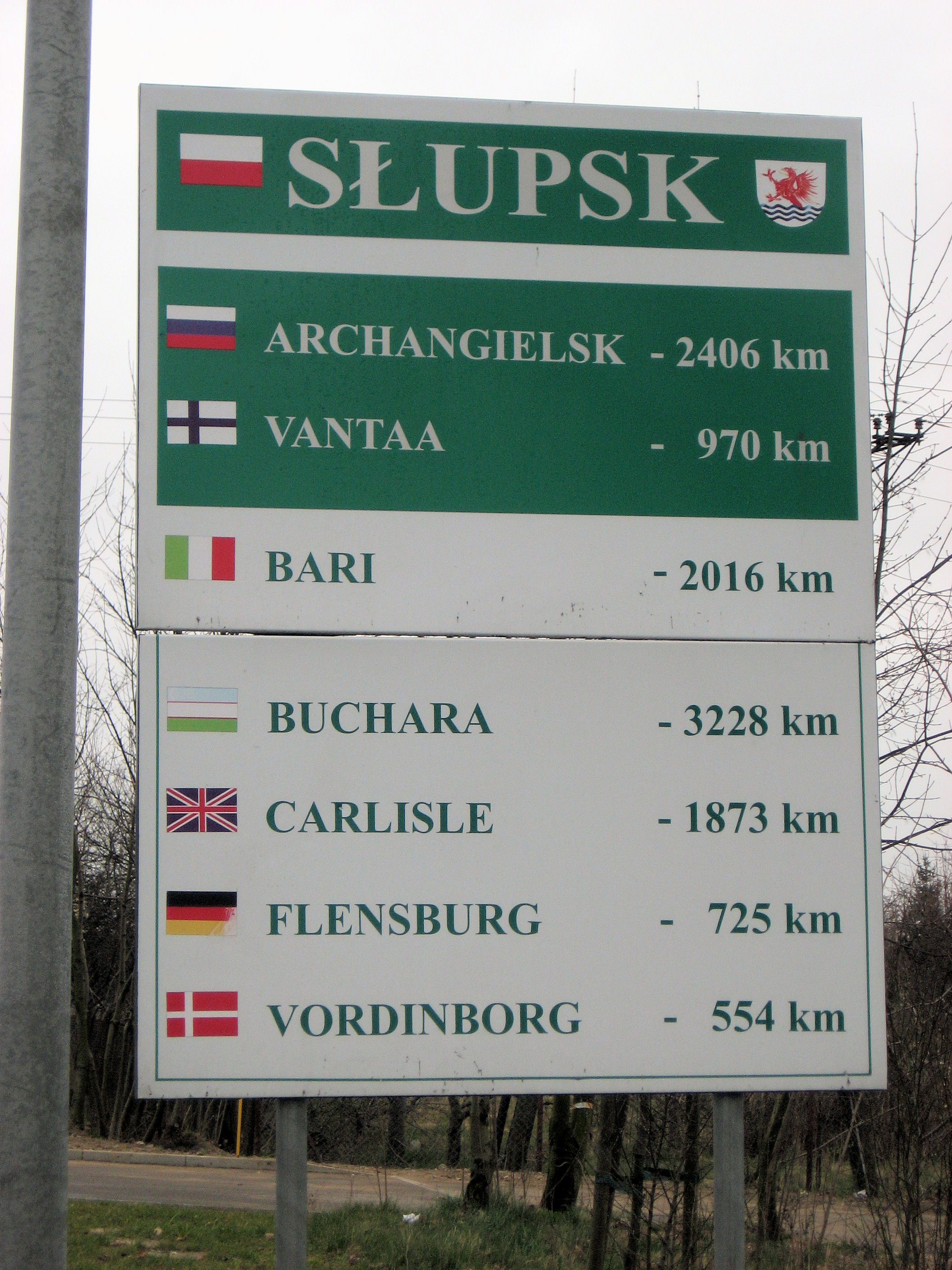
The weather was looking ugly, slight drizzle, cold and overcast. The saving grace was a strong tailwind. I had that tailwind for most of the day, though I’ve found I don’t go much fast, just get less tired during the day. Initially the route took me along the same highway and at 3km, started crossing Slupsk. This town wasn’t too hard to cross and soon I was back in the countryside. Before I knew it I was at a gasoline station at 25km. Here I decided to take the smaller “yellow” road rather than continue the expressway. While I liked my smooth road and shoulders, this route would hopefully get me better situated to pass Gdansk.
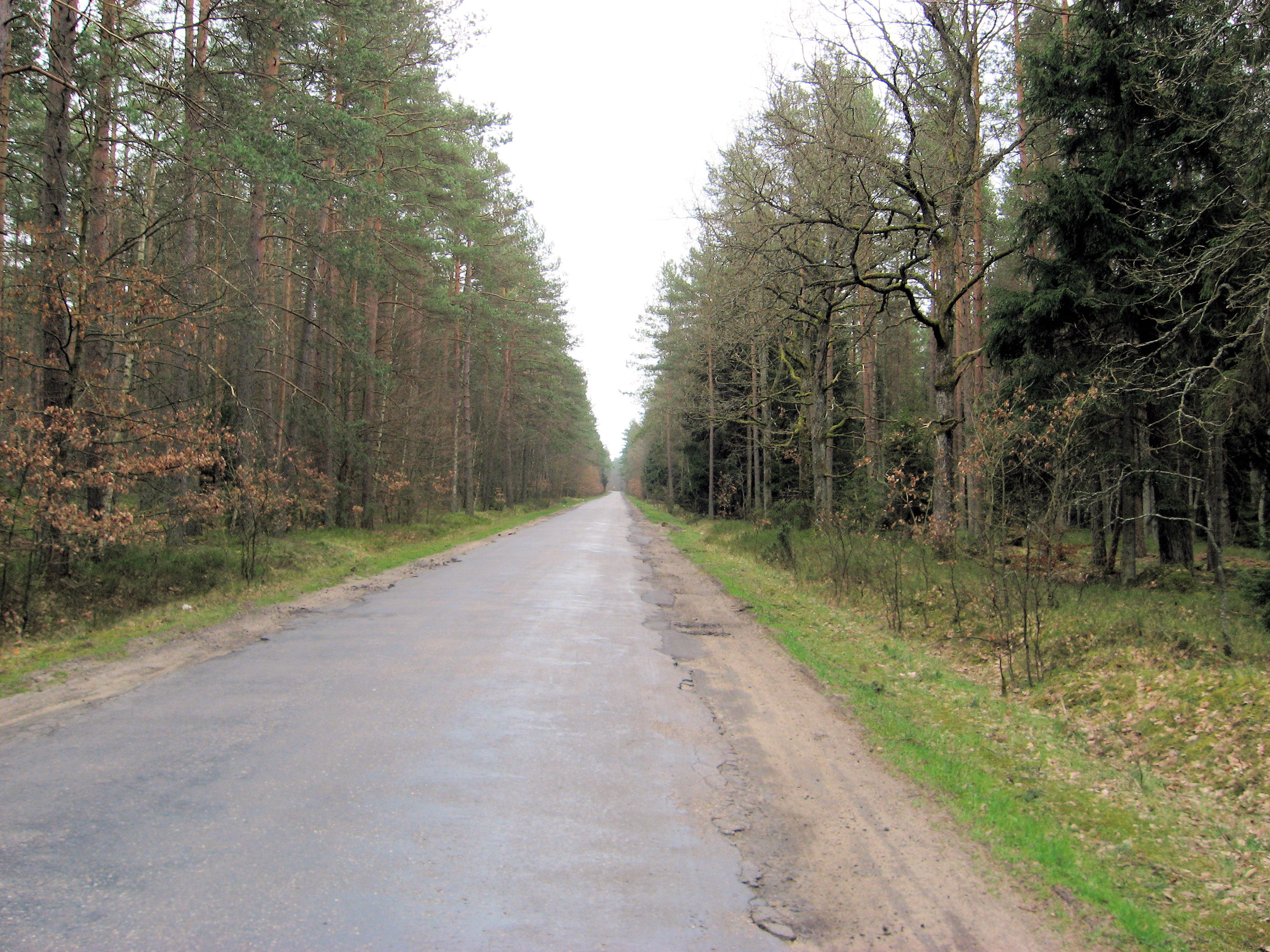
The quality of this small road varied widely. Some pretty smooth and some you really wondered what were the patches and what was the original road. Fortunately, the traffic was very light so I could usually pick the smoothest surface. It was nice to go through these little towns again. This area had a few more hills so occasional climbing and descents. My tires feel a bit squishy when I’m this loaded so I kept the speeds quite slow. By late morning I was through Czarna Dabrowka at 46km.
The next 23km to Sierakowice were nice cycling. Quiet roads and hills and farms to pass. I still had my wool hat and still had the nice tailwind. Sierakowice had more fruit sellers than other places, and a nice downtown. It was still early to come through at 70km. After this point, the road started getting a lot busier. Typically enough room to pass but traffic was occasionally bunching up. I climbed a large hill and then at 90km, came through Kartuzy. This would have been a fine stopping point, though didn’t see any hotels nearby. So, continued on through town and into Zulowo at 104km.
 In Zulowo were two large rotaries as the major road 20 coming to Gdynia met up and this was also the start of road number 7 into Gdansk. Route 20 was entirely blocked up – with traffic at almost standstill. I never quite figured out why.
Road 7 was an adventure. No shoulders and a lot of traffic. Also in severl spots, the very right of the road had poor surfaces. So, I mostly cycled along and let traffic back up behind me. Most was pretty well behaved. After crossing the main E75 highway shown in photo, traffic was entirely blocked the other way. So, I cycled in my lane and let traffic go slow behind me. The car right behind was fine, though several back was a bus and the driver knew how to use his horn. There wasn’t much other choice, and I did pull over once or twice. I was happy though to see the “Green Hotel” up on the right. Nice contrast in different riding today.
It is nice to see that according to the Great Circle distance calculator, that I am now just as far from Amsterdam as from Saint Petersburg. Will see how the actual distances work out.
118 km today. 1205km across Europe. 2843 km total.
]]>
 A cold start to a beautiful and sunny day. For the entire day, I followed the same highway eastbound and for the most part, it had shoulders like those left. Exceptions were crossing the town of Koszalin and several kilometers of road construction near 80km today. In hindsight, I really lucked out with the hotel in Ryman, I didn’t see much equivalent for a while. Had a nice breakfast and then packed everything up for the day.
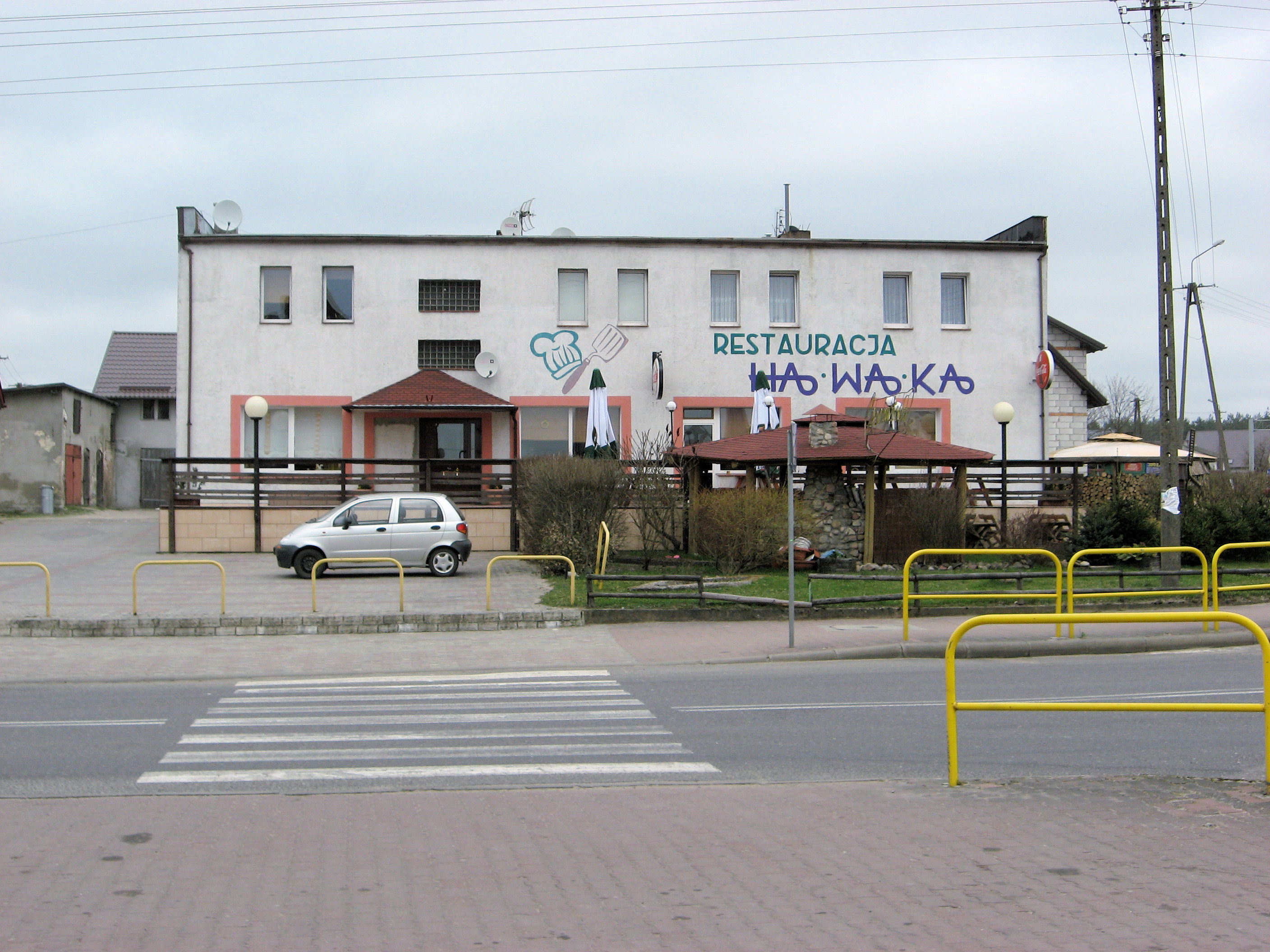
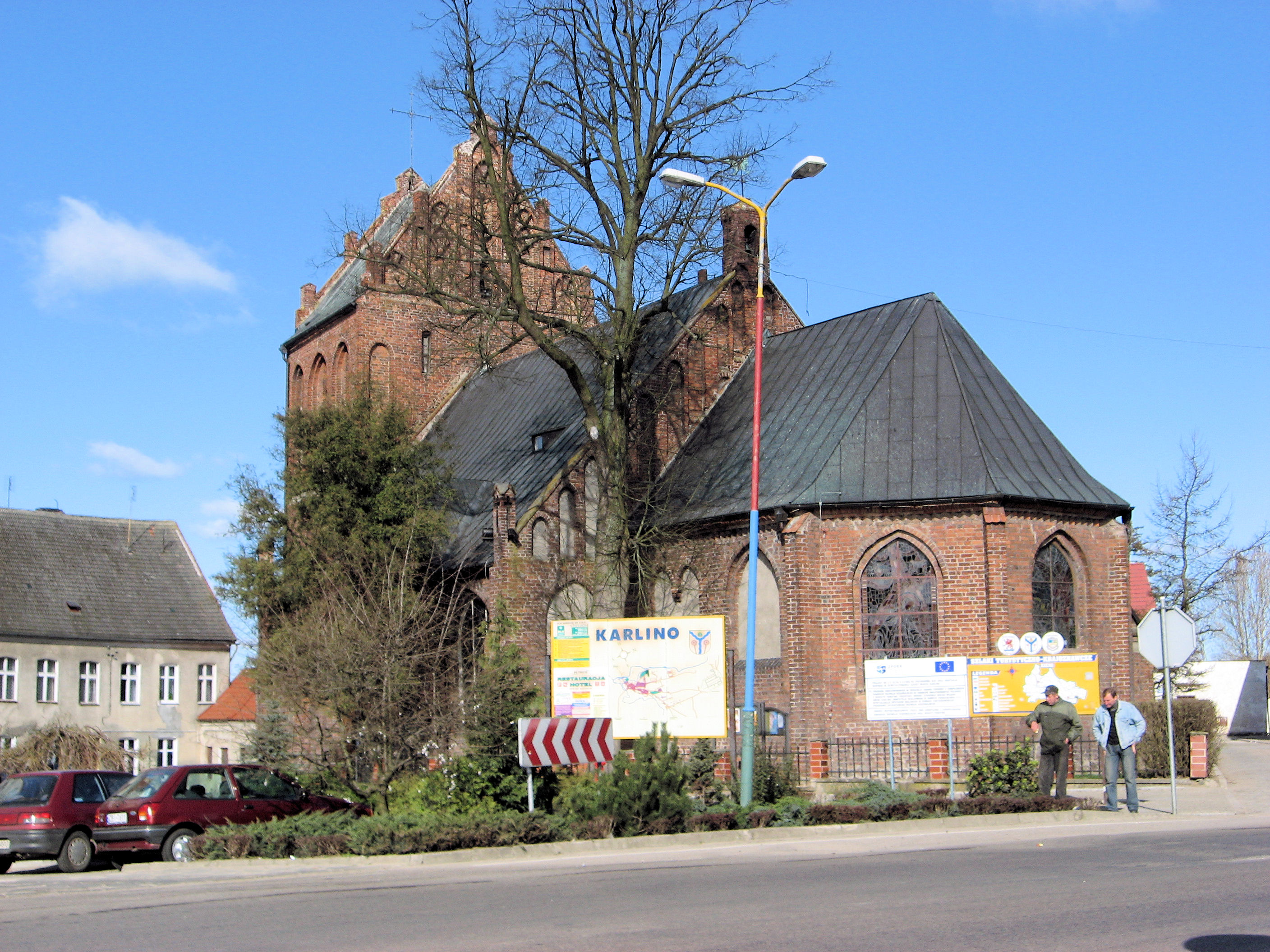
As I came close to Karlino at 25km, I decided to take the road through town. Like most of the towns, the church is in the center and photo at right was the Karlino church. I’ve done several of my stops at the gasoline station and at 30km stopped at the one on other side of Karlino. They seem to have good international pictures of services. This area had very slight grades but otherwise mostly flat and along the highway. It became rural quickly as I headed towards Koszalin.
Reached Koszalin at 50km. These larger places continue to be awkward to cross. I first took roads to the center and then a mixture of bike paths, walking and the main road. Each had their drawbacks. The main road is frequently narrow with lots of traffic. The bike paths weren’t consistent, sometimes fine but often very bumpy. Walking was a nice break but took a bit longer. What I did find interesting was the large number of concrete apartment buildings in town. Looks like a level of construction similar to Soviet Union. Often painted in shades of pastels. Fortunately, by 56km, I was mostly through the town. A bit of a climb from here and then back down to Sianow.
 I’m learning little bits of Polish from signs along the way. For example, sign at the left shows some similarities with Russian (Monday – “Poniedzialek”, Saturday – “Sobota”) and was also useful to see stores might be closed both Easter Sunday and Easter Monday. The sign at right shows a more simple translation between Polish and German and English. There isn’t a lot, but definitely more non-Polish on signs here than non-German in Germany. A lot of it you can figure out from context.
After Sianow, the question was to continue to Slawno (96km) or Slupsk (121km). I decided to stop if I found a good hotel but otherwise continue. The land had flattened out some and I actually had a tailwind! Great, it was nice to glide along on open country a little easier. This bike (or more likely bike rider) is slower than it has been on previous trips, so nice to be riding a little easier. Some fields with potatoes and some empty along the way.
At Sycewioe (109km) was a tempting looking guest house but decided I might be able to do better and in deed, found an interesting motel just a few kilometers further. Nice ride overall, and a bit easier. It is still a little amazing to me to be at a small little roadside motel in Poland with a wireless internet connection outbound. Shows the world has been getting smaller.
114 km today. 1087km across Europe. 2725 km total.
]]>
 Today a shorter day and welcome break at end of the day at nice hotel. I left my truck stop hotel a little early and headed back to Stargard Szczecin. Without too much difficulty, found the small road 106 heading north to Nowogard. My Polish map showed the major highway along the north (E28 / 6) mostly had shoulders whereas the road to Walcz (10), did not. It would be a bit of a gamble since I’d already seen that the shoulders get used to give oncoming traffic passing space, but decided I’d prefer that to cycling several hundred kilometers with traffic and no shoulders. I’m sure I’ll get enough of that in Russia later.
A brief climb out of the city and then it was countryside again. Lots of potatoes and also some fields still to be planted. It was a little colder today and I actually switched from normal cycling gloves to mittens. There was also a slight wind from the north. Otherwise good cycling with stop in Maszewo at 21km. From there north to the town of Nowogard. They have the Aldi supermarket chain here as well as Germany, so this was my late morning snack. From there walked a little through the town before finding the major road heading eastbound.
The next 30km of this road would not have shoulders. There was a fair amount of traffic, so some careful riding. Trucks generally gave me room and oncoming traffic seemed to check before passing. I only got one truck horn. I also noticed that some locals also cycled along this busy highway so I wasn’t the only one. In a few spots, the road wasn’t even so created rather strange bobbles along the right side. This was awkward to cycle. There was also a more consistent north wind, mostly a cross wind. This and very light drizzle. There were slight hills but tough to tell how steep they were vs. how much I was feeling wind.
At 75km, I came to view at right, shoulders! Hooray, this was accompanied with slightly more drizzle but was nice to have a better place to ride. I had thought about riding roughly to Karlino (113km) but with the wind and not knowing Polish hotels as easy to find, also decided I would stop at a reasonable place. Just as I was thinking that, I came up slight hill to Ryman, saw a nice hotel on the right. Great place for an early stop for the day.
My Polish still isn’t very good. I’ve figured out “yes” and “no”. Many of my greetings and thank yous I say in German and they seem to figure that out.
86 km today. 973km across Europe. 2611 km total.
]]>
 Made it to Poland! First day cycling through Poland was an interesting contrast with Germany. I hadn’t prepared much for Poland nor thought much about the country other than as a large unknown space separating Germany and Russia/Belarus – guide books would be a bit heavy to carry.
Had a nice breakfast at hotel in Angermunde before setting off. Both sides of the Oder River had some hills so there was some climbing and descent today. Fairly busy on the road but otherwise good travels as I went through last few Germany villages before reaching Schwedt at 24km. I half walked and cycled through town and then found road heading east to the Polish border. The river area itself was several kilometers wide with a shipping channel and some broad river areas. As I came close, looked like this would be a real passport control rather than just a sign as I had seen at the Dutch/German border. They stamped my passport twice, once to leave Germany and once to arrive in Poland.
Krajnik Doiny was the town just at the border. Apparently cigarettes and gasoline were cheaper in Poland as there were prominent signs advertising both. Also a lot of open markets with fruit and such. I got my bearings and headed north on the small road along the river. A few climbs and descents. A little rougher road but hard to tell. After 11km, came to a larger road heading north to Gryfino. The road signs were now green after yellow (Germany) and blue (Netherlands). The roads had a few more rough spots than Germany but otherwise good.
After 40km, I came to gas station at upper right. Stopped in to get something to drink and some chocolate. The attendant told me the amount in Polish. I went to pay with a five euro bill. The attendant looked at me funny. So I asked to see the register of how much…6.80. Wow, seemed a bit expensive so I got out a 10 euro bill. He then explained they didn’t take euros only the Polish currency, zloty. Now I felt foolish. I knew Poland was part of the EU, and thought I had heard something about them joining the euro, but that must be in the future and I hadn’t learned enough about the country to even know their currency. I really had treated this like a blank space (though in my defense, I had been confused when gasoline stations at the border advertised prices in euros…but that was just to convince the Germany tourists what a good deal it all was).

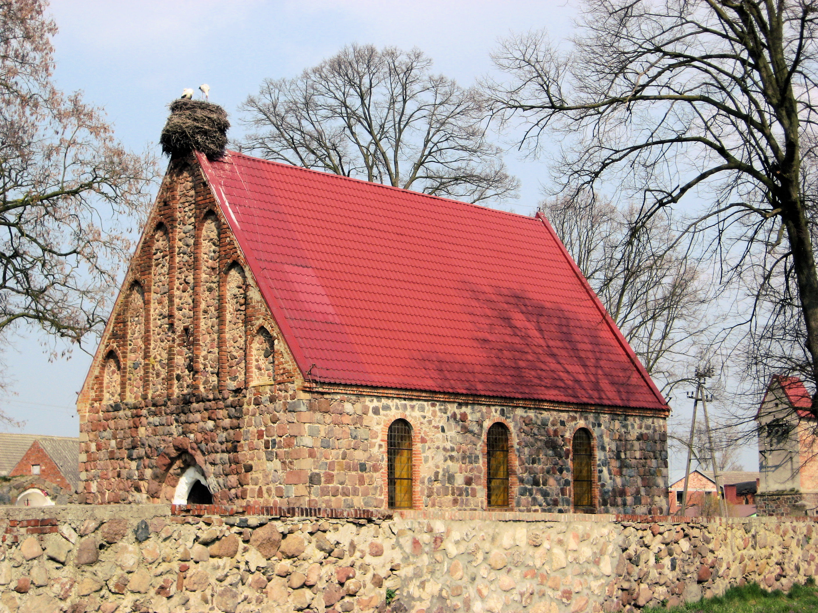 Photo at left was the big church in Gryfino which I reached after 58km. Lots of people out on the streets. I stopped at an ATM to get some Polish currency and then headed east on smaller roads. A little climb out of the river valley and then some gentle hills to climb. This road was nice traveling. One of the small towns had the church shown at right. Look carefully, instead of a steeple, there are two storks building a nest.
Went through small towns and bought some in a shop, eventually coming to a major road at 80km. This one even had shoulders, though I noticed the traffic was using them to get out of the way of passing traffic. Followed this for 4km before eight more kilometers of small road.
The last 10km or so were into the town of Stargard Szczecin, a mid sized Polish town. These towns really aren’t made for bicycles. The sidewalks become narrow and bumpy and prohibit bicycles, the roads are quite busy. I walked some through town and sometimes was on the road. As I came into the center I looked for a hotel. This was tougher than I thought. I got mixed reactions asking people. One or two helpful suggestions. One or two complete cold shoulders as they realized I couldn’t speak Polish. In the end, I didn’t quite find a hotel and was suddenly heading outbound past city limits. Oh well, as necessary I could try me tent I had been carrying along. However, just past 2km from town I saw a small bed symbol at the gas station. A small hotel! It was tough to translate the language – but we figured it out. The hotel itself had seen much better days but was also about a quarter of the price of night before. I was just happy to have a place. I walked back to town for dinner and then turned in after an eventful day cycling in Poland. I also picked up a Polish auto map that seems to give some hints about sizes of shoulders, so may backtrack just a bit to take another road tomorrow.
108 km today. 887km across Europe. 2525 km total.
]]>
 Mostly quiet roads on a Sunday cycle through the German countryside. So far I don’t see much difference between eastern and western parts of Germany. There are fewer bike paths here, but then also fewer towns to go through. I see several other cyclists out on the roads, particularly today. Left the hotel in the quiet morning and half biked and half walked to outskirts of Neuruppin. There do seem to be more cobblestones here.
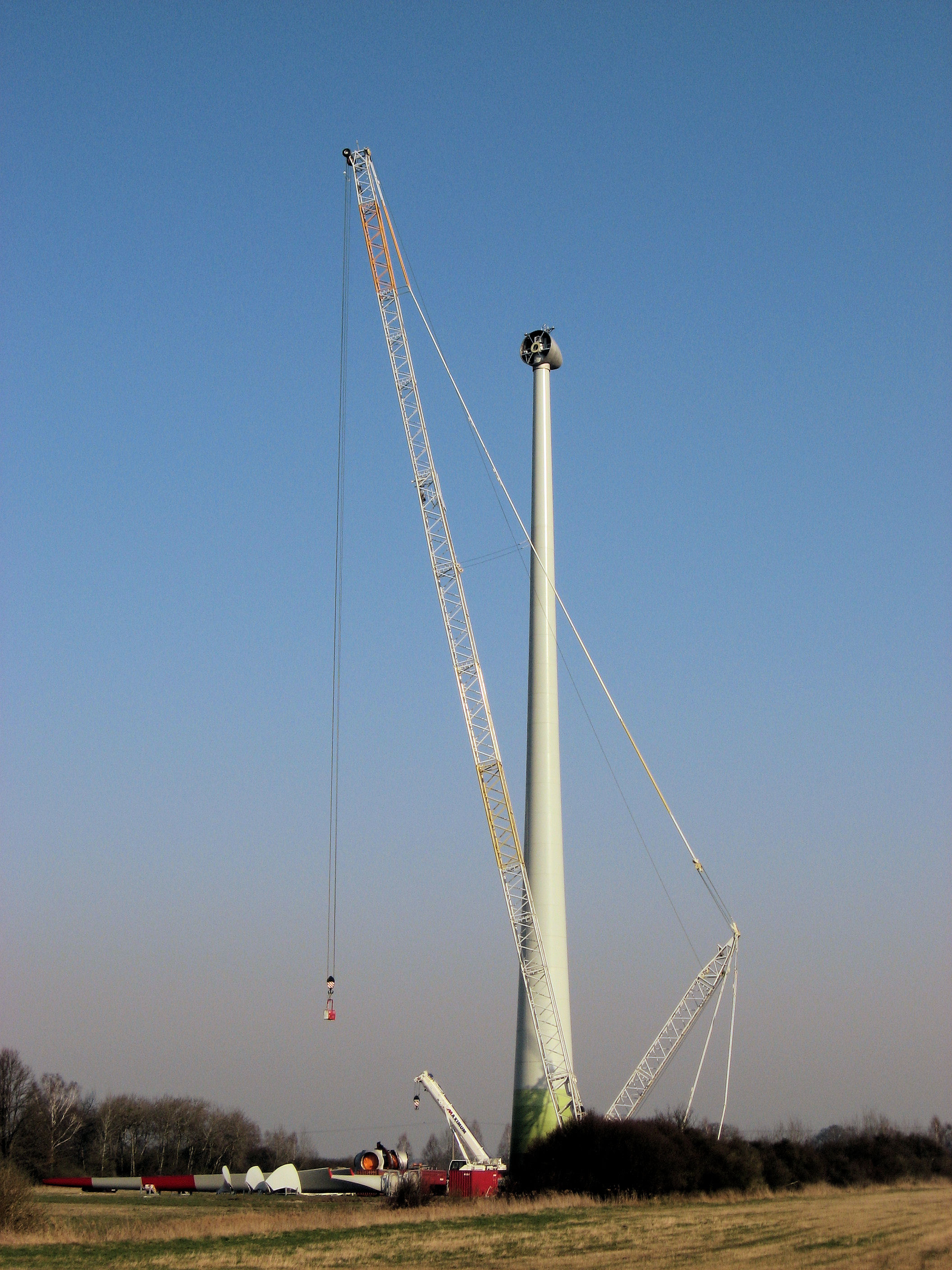
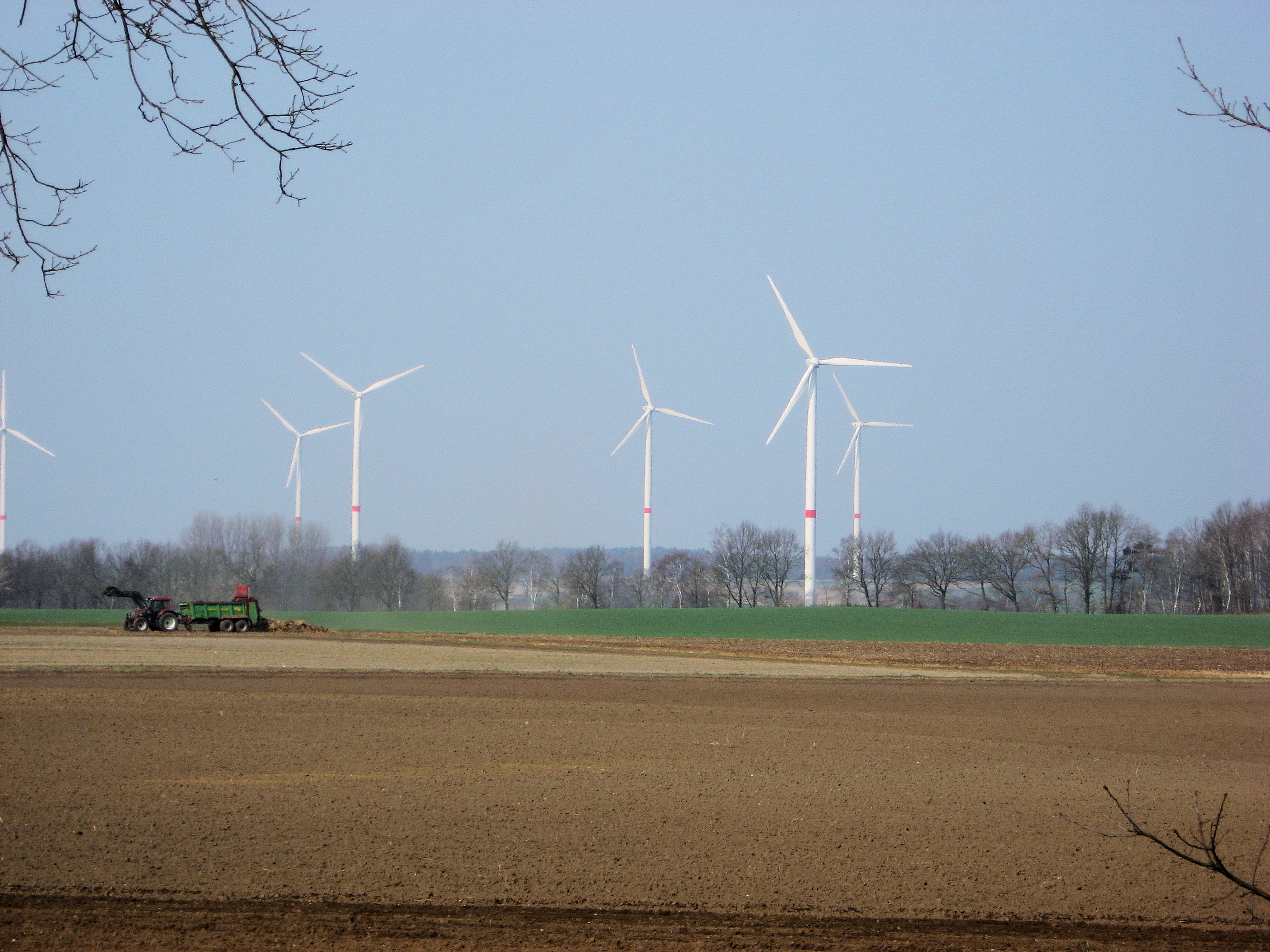
The weather forecast had said winds from east, but overall I was pleasantly surprised. Winds were lighter and I also crossed several forests. Neuruppin and Alt Ruppin were towns to go through but then it was back to country roads. Not much traffic on a Sunday morning. I had adopted a habit of stopping fairly often, so wasn’t making fast time but was enjoying the ride. Welkow seemed to have a big prison. From here mostly forested for a while with train tracks right alongside. Below left shows one of those big wind turbines they were assembling. Fortunately the windmills weren’t turning as quickly today as yesterday.
Lowenberg was a nice little town and first longer stop at 28km. I had a more complete stop at Liebenwalde at 46 km. This town had a historic old church under restoration. At each of these points, roads went due south to Berlin. Only 40km or so to the outskirts. There were a lot of motorcycles out today, and as motorcyclists do – they would occasionally pass at quick rates of speed.
 From Liebenwalde, another 20km to pass over the Stettin/Berlin autobahn. In contrast to these autobahn crossings further west, no businesses right next to the junction. After this came more populated areas of Finowfurt and then a long drawn out town of Eberswalde. What I saw of Eberswalde was a little disappointing. Lots of nice old buildings painted in pastel, but a drawn out city where I didn’t cross a nice old core. I stopped briefly for a late lunch and then headed northbound on highway #2.
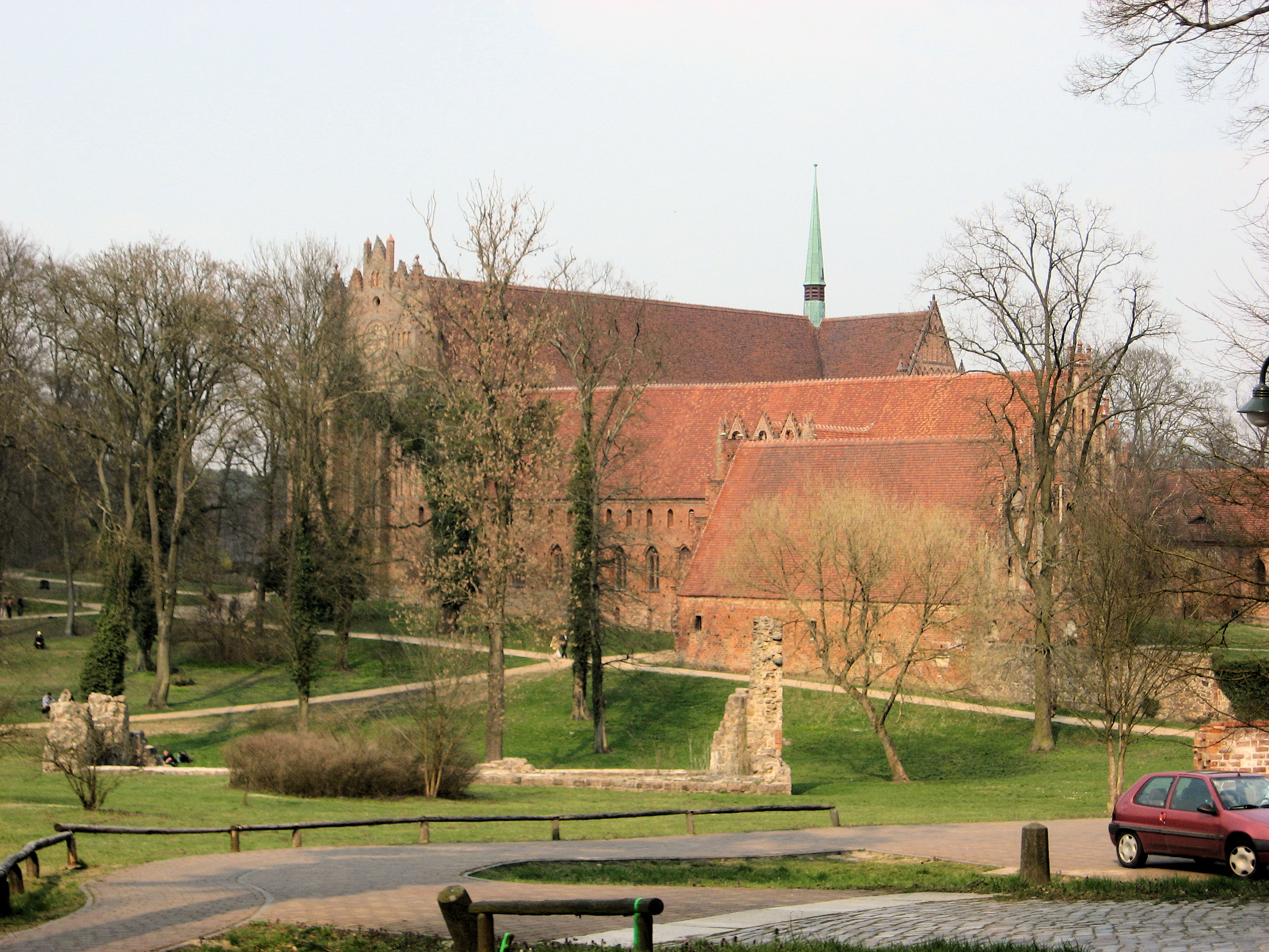
At 80km, a bike path joined again and the next 20km of forest was a tourist zone. Several small lakes and then a large old monastery at Chorin. Signs explained this area were edges of the terminal moraines from the glaciers (I think signs were in German). There were several small hills to climb over but didn’t take much effort. Also several small lakes on either side and looked like some camping and some vacation houses. I kept going to Angermunde. I haven’t yet visited but the town has a historic center dating to 1233. Definitely several old and historic towns around here.
101 km today. 779km across Europe. 2417 km total.
]]>
 I decided to relax some today, since in my enthusiasm to get underway I found myself too concerned about things I couldn’t change. Instead, just take it a little slower and stop occasionally to check the map or just because. However, still turned out to be a tough day because of some consistent headwinds most of the afternoon.
The day began like many others with continental breakfast. A surprisingly filling amount of bread, yogurt, egg, tea and everything else. The evening before I had negotiated the time. The exchange went similar to several others. I’ll ideally want to get on the road earlier because of less wind. So in half-German I’ll suggest a time. This goes back and forth with the innskeeper suggesting a bit later and a good amount of facial expressions. Today we had settled on 8am.
Nice and cool starting out without too much wind. I decided to try one of the small yellow roads marked on the map as I went to Karstadt. Excellent choice as the road was very smooth and had a slight ride coming from the Elbe basin. At 11km, a brief stop in a village of Mellen until reaching the main road at 20km. This main road like those I mostly followed today didn’t have a bike lane, so on the shoulder and without too much traffic. Every 5-10km or so one would come across a village. I decided those plants I am seeing everywhere are potatoes. Relatively flat areas, though also somewhat open so good chance to give the large windmills some wind. I slowly followed this main road inbound to Perleberg where once again I followed small streets into town.
On far side of town, I stopped at local supermarket. I’ve found these to be good snack/lunch spots and went in for mixture of fruit juice, yogurt, pastry and other things for the hungry cyclist. Interestingly, I noticed that the product code for golden delicious apples is the same in US as Germany (4021). There weren’t many bananas but those they had came from Ecuador. At 36km, it was already 11:30, my slowest day so far. From here the next 40km would be along the main highway to Kyritz. The wind had started to pick up, so it was a slow ride into the wind past the open fields and occasional small town. Fortunately, once I reached Kyritz they had another supermarket. I stocked up on a few extra things since stores will be closed tomorrow.
Kyritz was one of those nice small towns with a cobblestone street. That is even bumpier on a bike than the tiles or bricks. Fortunately, the bike paths were frequently brick. I took a nice relaxing break before finding my way out of Kyritz. The signs were starting to say Berlin and less than 100km now on this road. However, after another 10km, I turned northeast again into a stronger wind and last little bits.
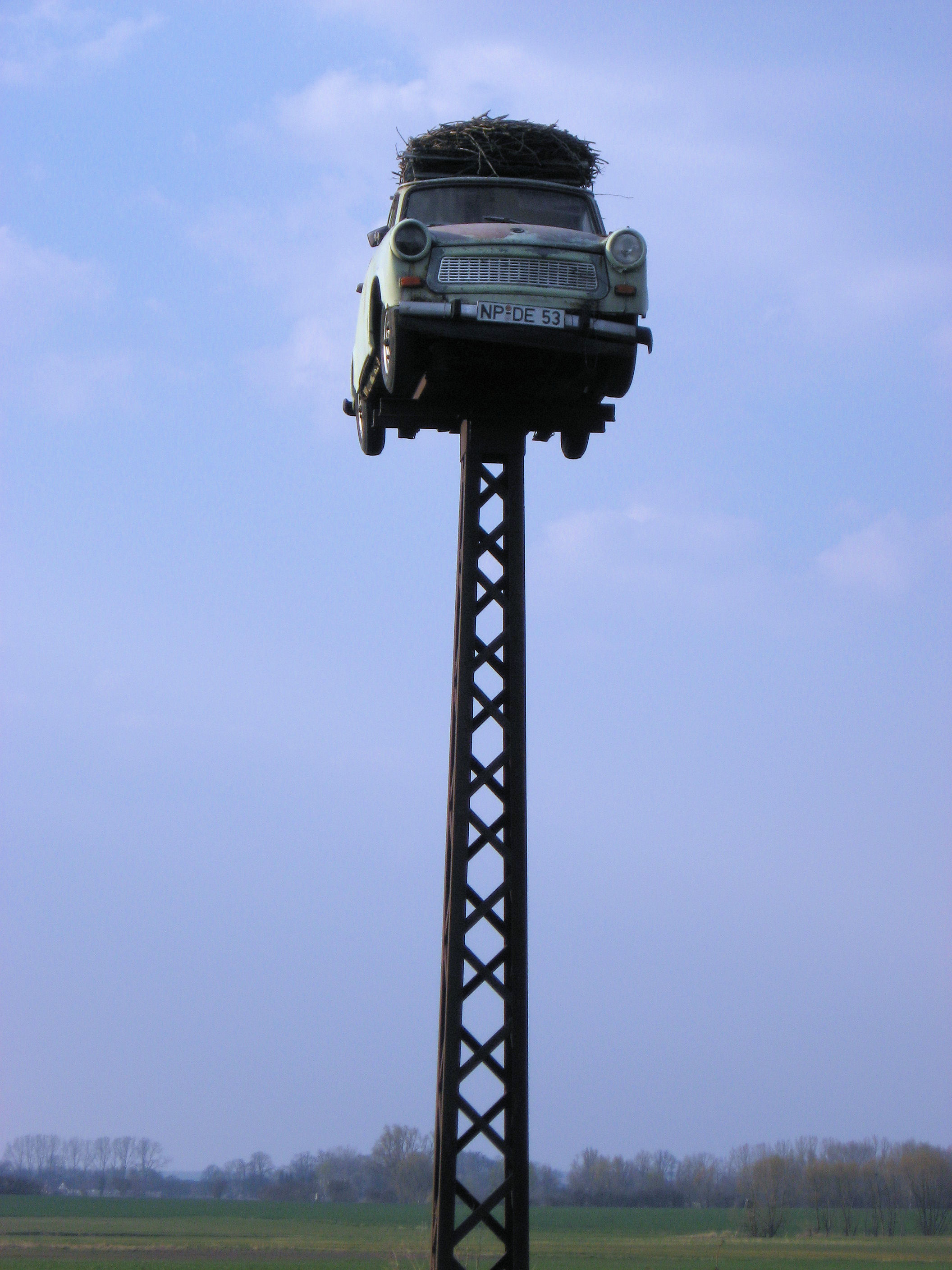 It was another 18km, against the silly wind until I reached the main Hamburg/Berlin autobahn. In several of the small towns I took a bit of a break by walking the bike for a bit to get a break from the wind between towns. As I crossed the autobahn, I saw the car on pedestal at left. The storks sure found an nice place for a nest. The last few km went into town. I found the town center ok, but it took a question or two before I found a local hotel. A very nice little place on the water and cost was even reasonable. What had started as a bit of a relaxing day turned out to be a tough ride this afternoon.
By the way, I added some geographic coordinates to these last few posts so if you click on “Map” above you can see a rough progression across Germany.
111 km today. 678 km across Europe. 2316 km total.
]]>
 Today a little tougher than yesterday. A few more hills as I made it across the Elbe River and into the area that used to be East Germany. Last night I was one of few guests at the hotel as they had a party with 130 guests. Overnight it rained lightly and there was very light drizzle as I got up. That stopped and rest of the day was clear. I got back onto the bike path at Escede. The path was smooth but there were occasional ups and downs as I crossed some slight hills. Enough to try some different gears. There was a lot of forest here with occasional signs for forest paths. This part of Germany seems to have some forest bike paths, though the distances to towns always seem larger than the more direct routes.
At 20km, the road joined with a larger road and time for a quick break at the gasoline station. I followed this road until it got close to Uelzen, and once again was directed onto smaller paths through town. This town had better signs and wasn’t too difficult to find my way through. Before I knew it, at 38km I was already on other side of town. From here the bike path discontinued at Stocken (45km) and onto the main road. Seemed like there was a bit of a headwind again. More significantly, were some gentle hills. I shifted into lower gears and slowly lumbered over these hills. Could definitely tell the extra weight of everything. Several small towns, one even with a cafe. Enough open spaces to catch some wind, and see some of the windmills such as those above right. There are multiple country signs for potatoes, honey and even some apples for sale.
Once I got to Ziernen, it looked like the largest of the hills were behind me. I was even surprised at a fair descent of several kilometers. Guess I must have climbed some and not just been slow. A few kilometers further, around km 65 or so, the bike path started again and came into Dannenberg at kilometer 77. A nice small city, where the main road went just past city center. More importantly it was flat here. I stopped for a late lunch before continuing on towards the Elbe River.
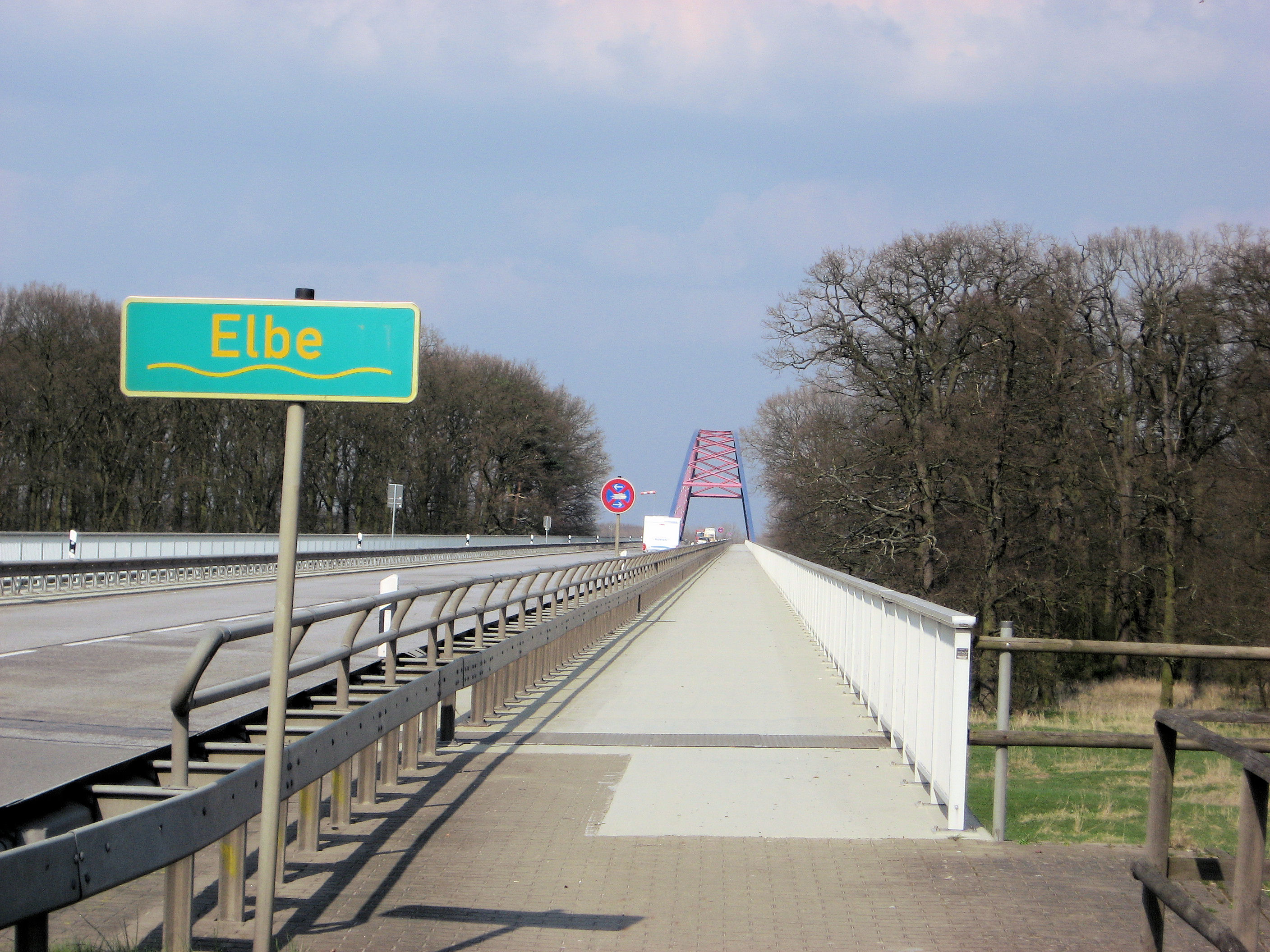
 At kilometer 89, I came upon the bridge crossing the Elbe. This point had formerly been a border between East and West Germany. I stopped to take a photo and then cycled the long approach to the bridge itself. Just as I got onto bridge itself, pow! My bike was instantly stopped. As I crossed the bump onto start of the bridge, my right rear pannier had fallen into the spokes. This pushed the fender forward and stopped the wheel. Wow! I took luggage off and assessed the situation. My big worry was the rear wheel and particularly the rim. Best I could tell, the fender had stopped the wheel quickly and spokes looked ok. This type of thing always makes me queasy until I have another 100km behind me…so hopefully all will be ok. I bent the fender back, got things back to looking ok and decided to walk across the rest of the bridge.
From here, I turned east (into the wind) and slowly cycled into Domitz. A very quaint old town with several hotels and lots of old looking buildings. I wanted to get a few more kilometers on the wheel so continued out of town. Here I took the back road via Polz since it was 3 km shorter than the main road. That old road did have some very bumpy sections though so I took it slow. I was ready for a stop as I came into Lenzen. Looks like the wheel is doing ok so far. Weather turned out nicer than expected, so perhaps this was all of the quick system that was coming through.
109 km today. 567 km across Europe. 2205 km total.
]]>
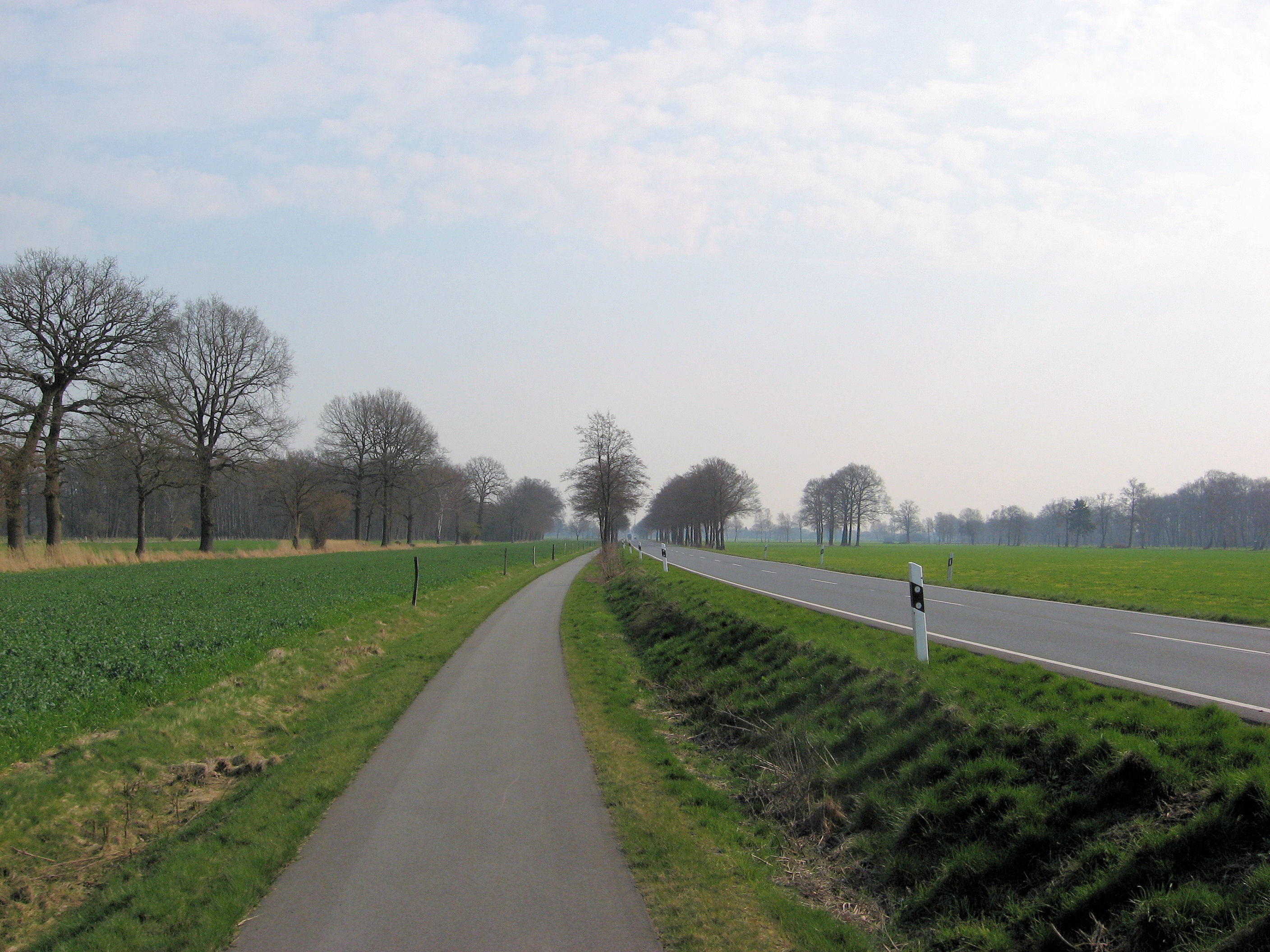 Another beautiful day cycling through Germany. More trees, so noticed the winds a bit less. Many places had bike paths such as those at left or right, and other roads were reasonable. I found it a little tricky to cross the two small cities on my way today: Nienburg and Celle. There seemed to be fewer signs than before.
Had a nice continental breakfast and was on the road before 8am. They let me know I was the first cyclist they had. I wasn’t quite sure if this was for the season or ever. In these places, I’ve been parking the bike out back in the garage. I’d prefer the room, but locking things in the garage seems ok as well. Centers of these towns have bricks and so are rougher than roads outside. Left Sulingen and was soon on some nice smooth roads and paths such as those shown here. Seemed to be making some nice progress in cool morning air. At 24km, the road started to become larger and now the exercise was to cross Nienburg. I first followed bike paths through town of Lemke, and then followed signs to center of Neinburg. A bridge crossed the broad Weser river. From here one or two signs outbound before finding signs to the right suburbs. My detailed German map definitely helped here. After that back in the countryside with easy riding again. Steimbke looked like a nice quaint touristy town.

 Anyone have a good idea what the sign at left means? (Reply with a comment). I see these signs occasionally. Coming through Schwarmstedt, I also saw a number of military trucks on a field exercise. Soldiers were up manning their guns. Several of the trucks had large blue flags as in “blue team”. Just a little past that, I came underneath the main Hannover/Hamburgh autobahn, and several rest area businesses including a McDonalds. Decided on a McDonalds meal here and saw a number of different soldiers here as well. I wonder if the army exercises include McDonalds?
After lunch, just 28 km on to Celle. Most of this was a flat forest path, but last few kilometers through a few small towns. Outside Celle was a large map. Ok, plan was to go underneath railroad tracks and then eventually northbound across the city. Celle was at 94km and considered stopping here if I found a nice looking hotel. My route didn’t take me past anything too interesting and soon I was north of the city again. From here I decided to go to Eschede, 16km away. My map had the town underlined so I hoped there might be a guest house or hotel. More nice forest path as I came into Eschede. Earlier than previous days by 3:30pm or so.
I found the first guest house. Nobody was there. I waited for a bit and someone came. In a mixture of German and pantomime, I learned they were full. There might be room just down the road. “How far”? “Not very, just around the bend, 5 minutes”. So I started cycling around the bend, up the hill and out of town. Hmmm… I didn’t see anything that looked like a guest house. Decided to turn around. Came into town and next hotel. Sign said something like hotel and restaurant guests, wait until 6pm. I was sitting there weighing my options (cycle to next town 37km away or wait and hope they had something), when I noticed a button for hotel reception. Yeah, they had a room and I was just as happy finding a place for the night.
110 km today. 458 km across Europe. 2096 km total.
]]>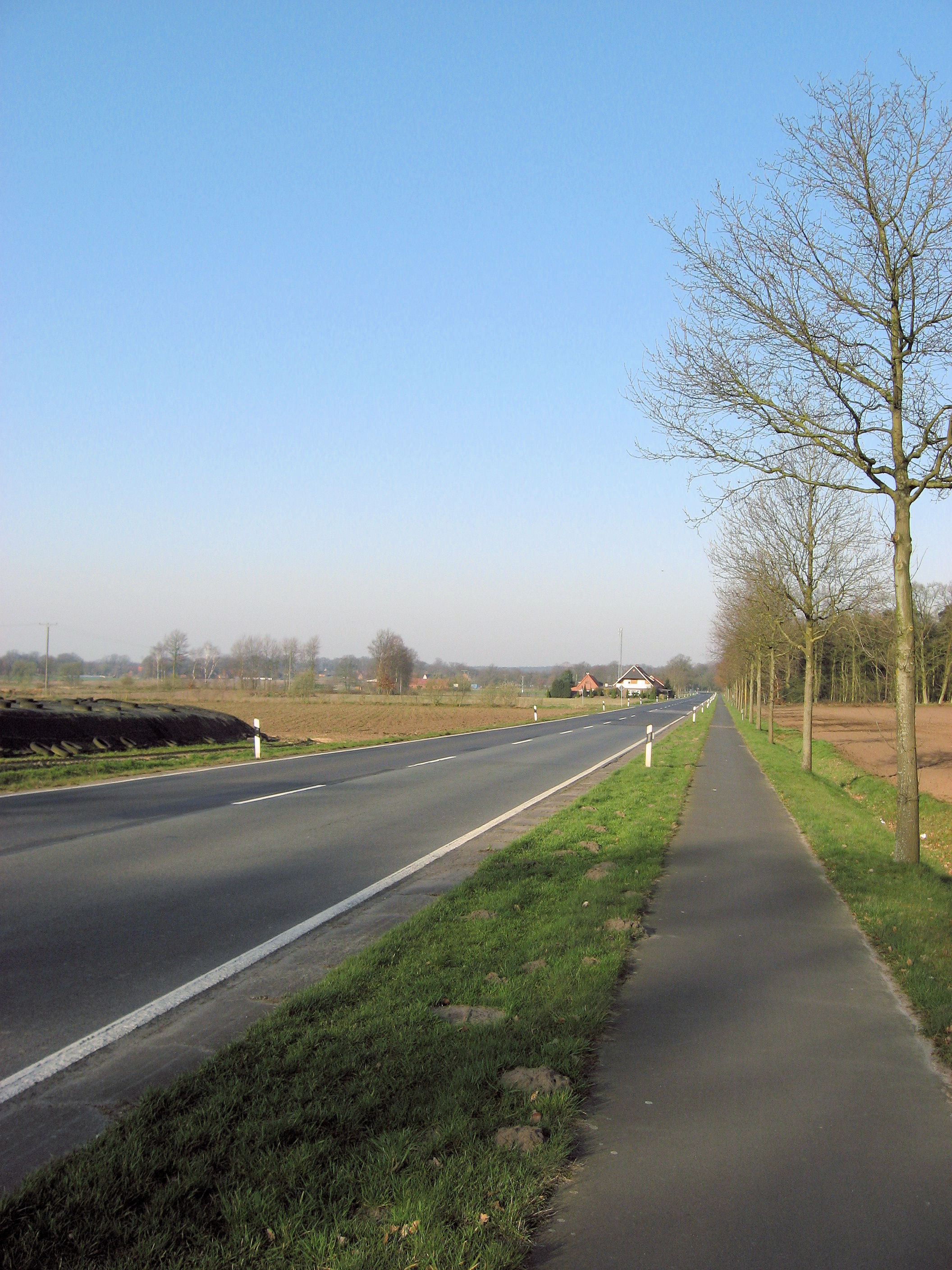
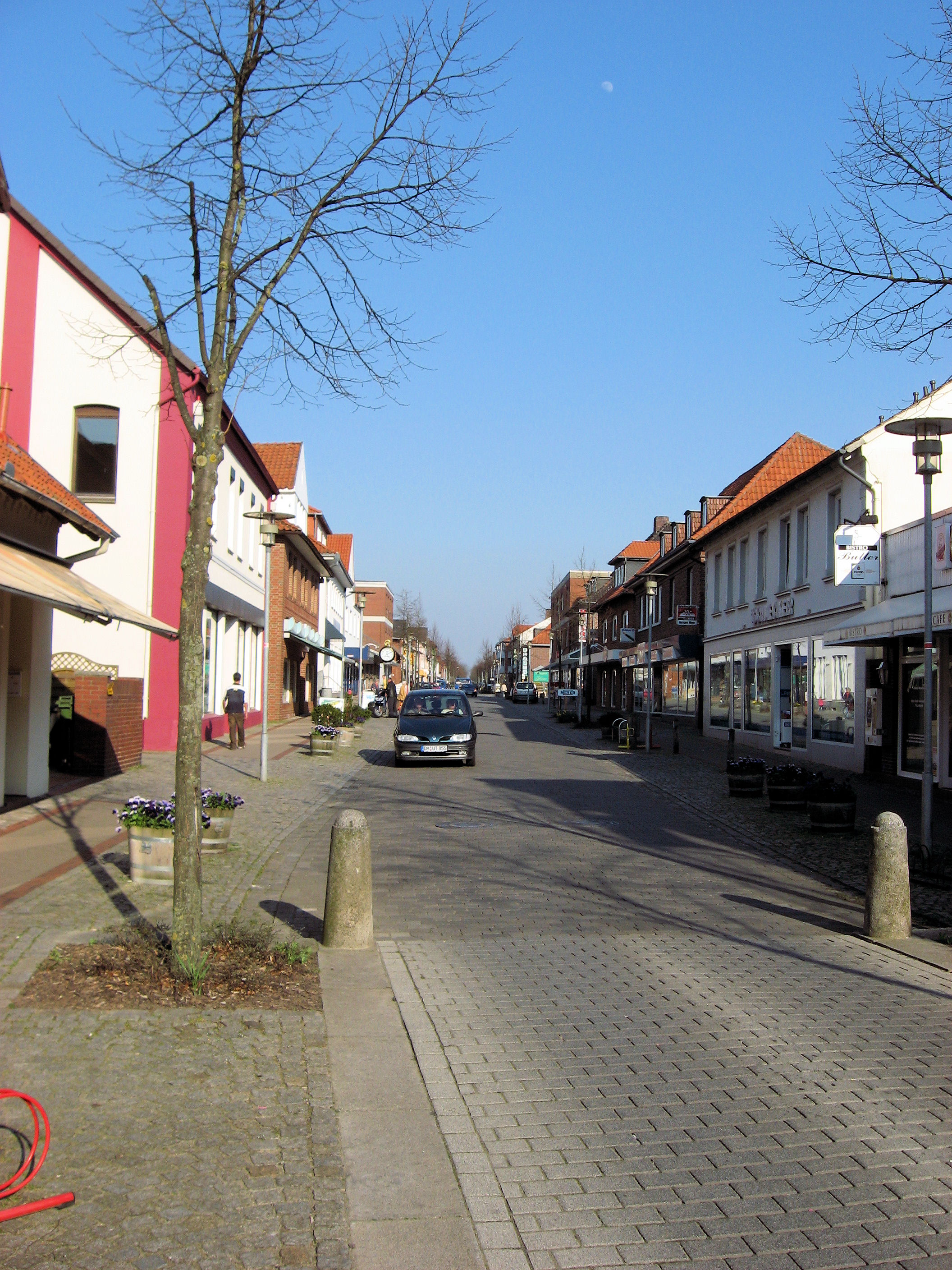 A beautiful spring day of cycling across northern Germany. I even came to a hill that I could coast down. However, for the most it was fairly flat. All except for about 8km was along bicycle paths such as those above left. The remaining 8km was on a sometimes narrow road, but traffic was fine.
Ate breakfast at the guesthouse and set off for the day. Nice calm skies and cool temperatures. Most of the cycling was along bicycle paths. Occasionally these would become sidewalks as I passed through towns and they would occasionally stray from side to side of the road. At 11km was first town of Freren. We had some very slight grades here. At Furstenau there was a quick detour and then back to quiet country roads. This one even had a hill to climb over and coast down. The trees haven’t yet blossomed, and some things are planted in the fields. I see occasional tractors along the way and people working the fields.
At 56km, I crossed a major autobahn, and they had a road side rest area including a McDonalds. I opted to cycle into Holdorf instead. I found a local supermarket and wandered through and found tasty looking things: yogurt, banana, pastry and fruit juice. At the bakery, person in front of me had a sandwich made. I’ll have to learn a few more German words to figure that one out. From here the cycling seemed a bit slower and my front fender decided to rub for a while. Gave me an excuse or two to stop before coming to Diepholz at 76 km. All day the signs had said “Diepholz” so it was nice to get there. Decided to go just a bit further and went through more open countryside to make it to Sulingen. Here I took the main road into town and then asked for a hotel. As can see at top right, a nice quiet main street. Lots of little ice cream places and otherwise a nice place to stop for the day.
109 km today. 348 km across Europe. 1986 km total.
]]>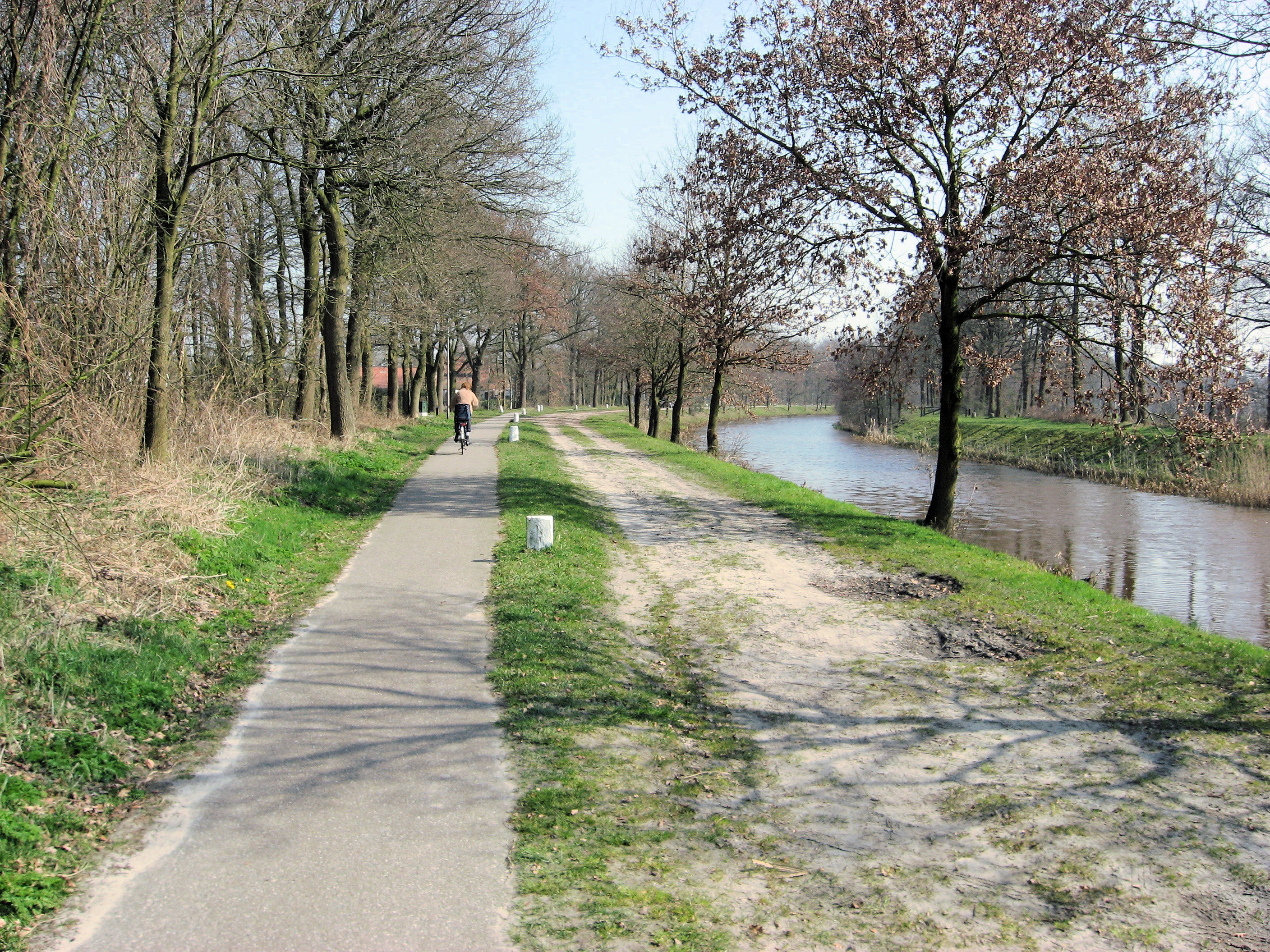
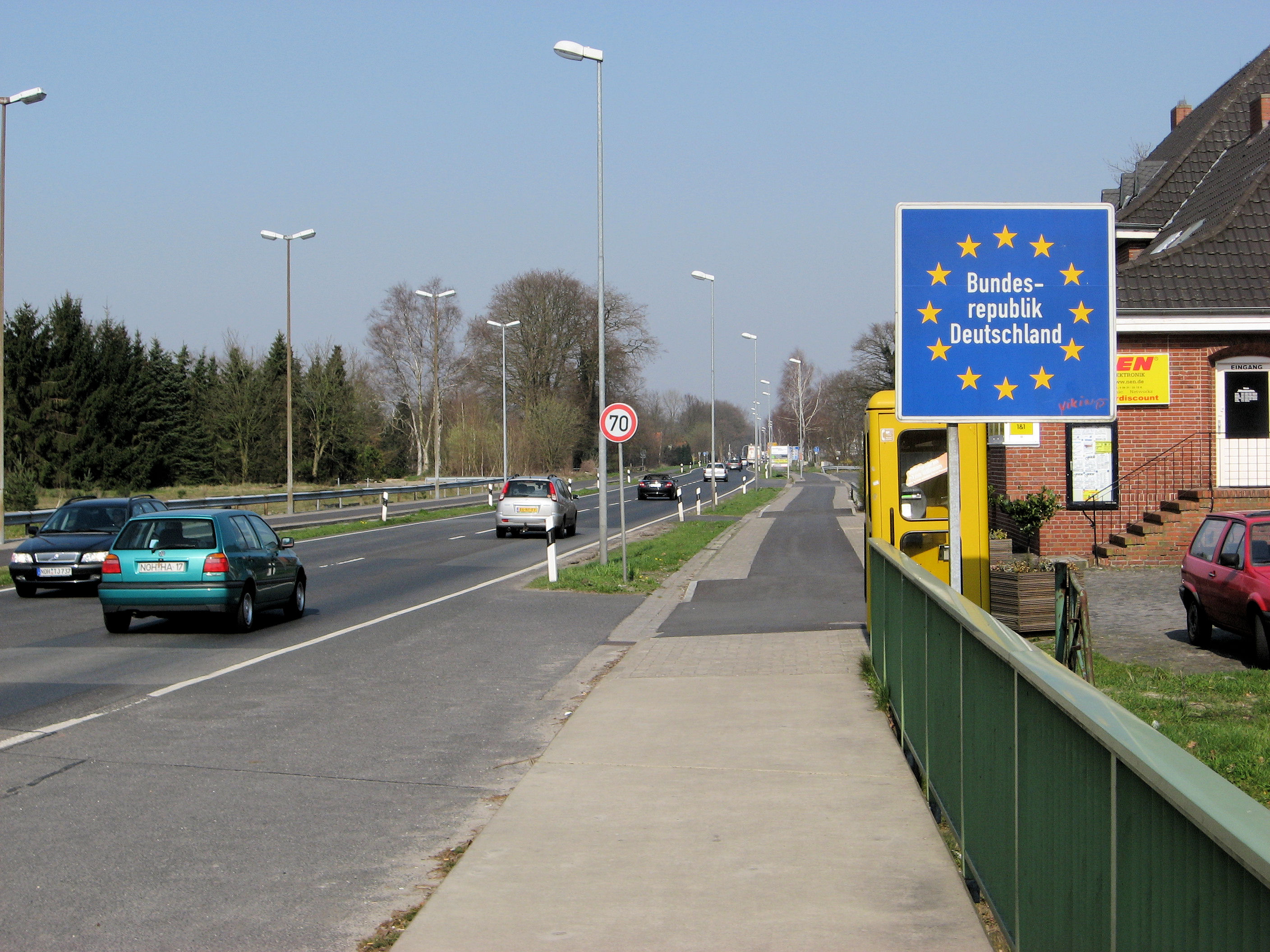 Made it to across the Netherlands and into Germany! Today was another day of great weather, with lots of sun and headwinds from the east. I had a good stay with Tante Gea and Frans in Olst. It was nice to see them again and I appreciate the hospitality. I also dropped a few small items off including my Amsterdam map. I left a little earlier, though surprisingly today was at least as slow as yesterday. I suspect a combination of my tires, winds and conditioning.
Nice calm winds and slightly cool as I set off southbound towards Deventer. I got close to outskirts of town before turning left and following a ring road around Deventer. The next kilometers were a mixture of roads and bike paths as I generally followed signs to nearby towns “Schalkhaar”, “Bathmen”, “Holten”. At Holten I stopped at local supermarket for more to eat. It was a little confusing from here but I found paths via Rijsen and into Wierden. I stopped in at VVV in Wierden and had a helpful person explain routes from here into Almelo.
Almelo was a somewhat large city, so first followed the signs to the centrum and then outbound. Here I came across a “Almelo – Nordhorn” canal with bike path. Since I was going towards Nordhorn, this seemed like a good choice and made for some pleasant cycling without much traffic. I made some good distance along the canal but saw confusing signs around kilometer 64 so turned northbound. This took me on quiet roads and one dirt path via Groot Agelo and into Ootnarsum.
Ootnarsum was a nice little tourist town with a quiet center, a lot of little hotels and a busy VVV office. It definitely looked like a tourist destination. I walked some through town and then set off east again. These roads took me via Tilligte and suddenly I was back at the original canal. I had added at least six kilometers with my detours though also saw a nice town. I followed the canal for a bit, and then came onto the main road leading into Nordhorn.
Around three in the afternoon I crossed the border of Netherlands and Germany. Nice to have crossed my first country, though now I would need to work harder at the language. I followed main roads into center of Nordhorn and then outbound towards Lingen. Bike paths weren’t as consistent as in the Netherlands and I was along a busy highway for a bit. Fortunately, the main Nordhorn/Lingen road had a good path. At 96km I saw a nice hotel and was tempted, particularly since the headwind was stronger here. However, I wanted to get at least 100km today so kept going. At 106km the bike path went directly in towards Lingen. I followed it into center of town.
I passed multiple hotels, but none seemed quite right. I kept going outbound out of town and saw signs for two guesthouses 3.5km ahead. The first one was in Ramsel and was closed. The second was in Baccum and with some pantimine and half German, and a few choice Dutch words thrown in, I arranged a room and had a nice schnitzel dinner. Nice end to a day that was surprisingly longer than I expected.
So far Germany looks a lot like the parts of the Netherlands I’ve just been. Slight differences in road signs (yellow not blue) but similar houses and landscapes.
116 km today. 239 km across Europe. 1877 km total.
]]>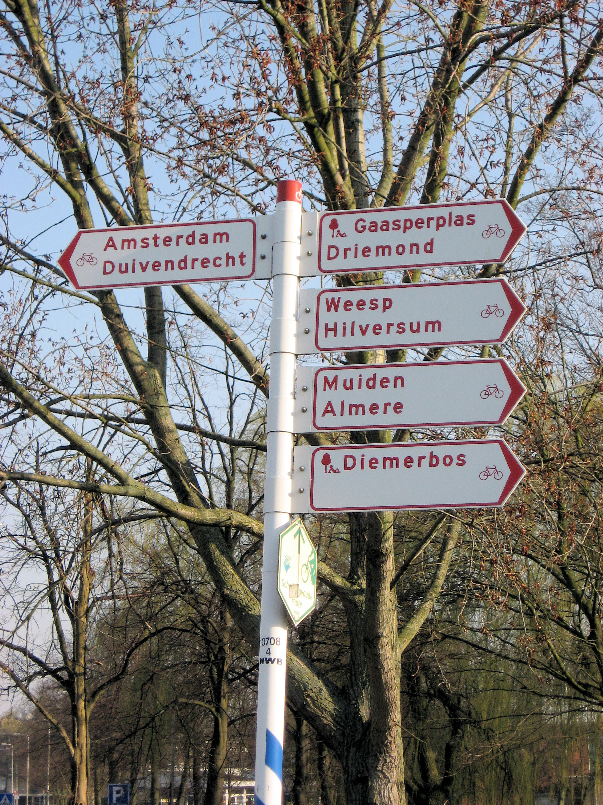
First day of cycling in Europe! Nice to finally be riding from Amsterdam on a trip titled “Amsterdam to Vladivostok”. My bike was visibly heavier than riding in Texas. I also noticed when the bike paths had square tiles, that the handling in the front was a bit bouncy. It was a little slower cycling today, despite absolutely flat terrain.
Left Amsterdam just past 9am. The first exercise was to find my way out of Amsterdam. I mostly tried different streets heading towards the east (into the sun) and also looked for signs to “Diemen” and “Weesp” since those towns were just east of the city. Cycling was still a little slow with the weight and occasional stops. At one point, I came past the “Amstel” train station and noticed I was a little too far to the south, so corrected to the north.
Outside Naarden, the bike path was suddenly closed due to construction. Just at this time a group of tourists came by on bikes with helmets and went on the road. So I followed. I took small roads to Laren and from here decided to take back roads through the countryside. The land was flat and open, but I also noticed the winds from the east. Weather forecast had called for winds of scale “4”, but I assume this beaufort scale. At noon, I had done just 45km and came to the Eems River. There was a ferry here and as you can see, the ferry was stopped until 13:00. Not much to do, but wait for an hour.

After the ferry was Eemdijk and then Spakenburg. More flat and sometimes windy terrain across to Nijkerk at 60km. From here, more trees and slightly faster cycling along smaller roads and bike paths to Harderwijk (82km). I was feeling the cycling already but came east to Nunspeet (98km) and then turned south through the Veluwe Forests. Some beautiful cycling here via Epe (110km). Here I accidentally got onto a larger road without a bike path. Despite the “caution bicycles” sign, several of the cars let me know with honks that they didn’t expect a bicycle.
From here a few small towns including Oene and then via Wilsum across another ferry. I wasn’t quite sure how long this one might be open so I kept going to reach it just before 6pm. Crossed the river and made my way to my Tante (Aunt) Gea. Nice end to the first day of cycling. I’ve decided to increase my estimated trip distance to 13000 km, since it may be a little further to St Petersburg than initial estimate. 123 km today. 1761 km total.
]]> Reached Amsterdam! An easy rest day today before starting the trip. Photo at left is an official “start” photo taken outside the train station in Amsterdam.
An uneventful flight that was delayed by 60 minutes by weather in Chicago. Other flights had been delayed before, so our flight was completely full. Sitting behind me were folks from a tour group. They were going to see Amsterdam, Brussels, Paris and London…all in one week! Now just six days because they had been delayed by a day.
Luggage was slow to arrive, but bike and all gear arrived in good condition. At Amsterdam I was met by Mickey. Mickey is planning to cycle across Eurasia as well. Leaving Amsterdam a little later and then joining together from St Petersburg. We left bike in the box, and took the train and metro to Mickey’s place.
In the afternoon I put the bike together and we bicycled to my Oom (Uncle) Gerard. Along the way we took an official start photo shown above left. A nice meal in Amsterdam before turning in early for the night.
]]>